QUICK-LOOK FORECAST:
- Quiet tonight into Monday
- Seasonably cool
- Multiple rounds of precipitation throughout this week
>> TRACK THE LATEST CONDITIONS: Live Doppler 7 Radar
DETAILED FORECAST:

SUNDAY: Cloudy and cold with temperatures below freezing. Break from rain and snow.

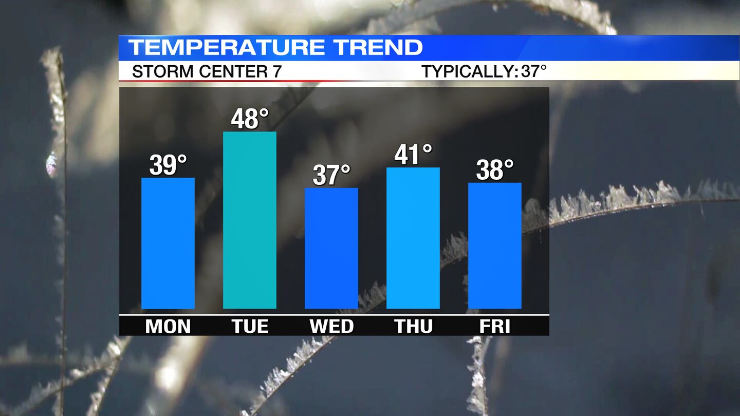
MONDAY: Mostly cloudy and seasonably mild with highs in the lower 40s.
TUESDAY: A rain/snow mix Tuesday morning before becoming all rain. Snow accumulations are looking rather light at this time due to the brief duration of mix, however, we will need to monitor for a sloppy morning commute with snow changing to rain.
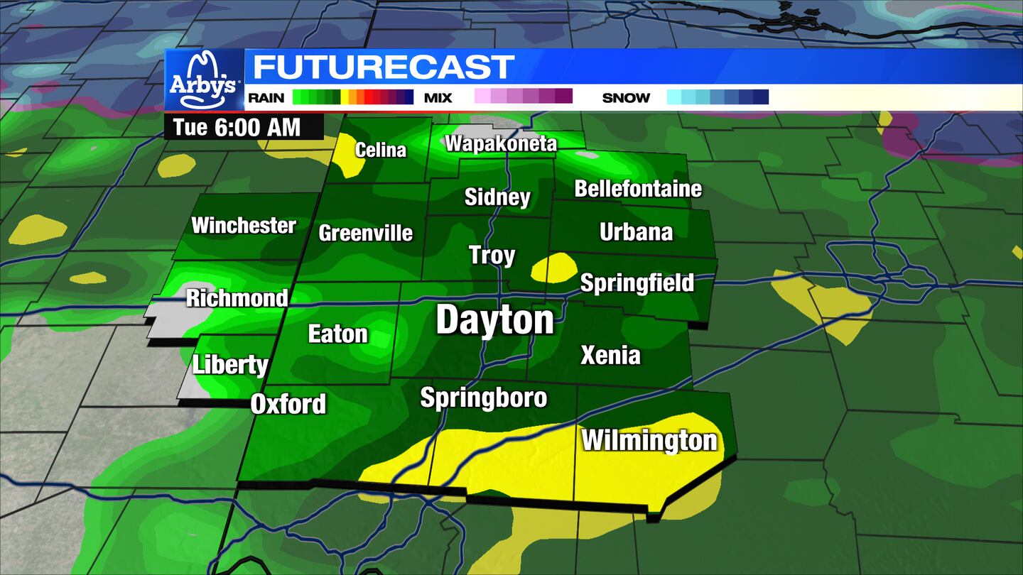
A good soaking of rain expected Tuesday afternoon, with rainfall potentially over 1″. Windy. Gusts to 30MPH. High temperatures in the upper 40s. Wind gusts could approach 40mph at times Tuesday night. Rain mixes with snow overnight into Wednesday morning.
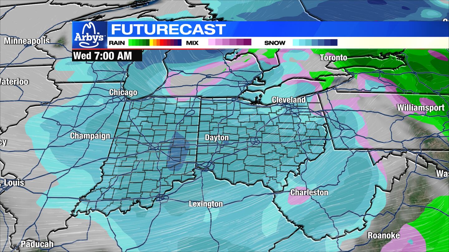
WEDNESDAY: Colder with a mix of rain and snow showers. Snow accumulations look rather minimal at this time if any were to occur. Highs in the upper 30s. Windy. Gusts over 40MPH are possible.
THURSDAY: Mostly cloudy. Chilly with highs near 40.
FRIDAY: Cloudy with another round of rain or snow arriving. Low confidence forecast given this is 6 days away. Cold with highs in the mid to upper 30s.
SATURDAY: Chance of snow depending on how Friday’s forecast turns out. Low confidence forecast at this stage. Highs in the middle 30s.
©2024 Cox Media Group


