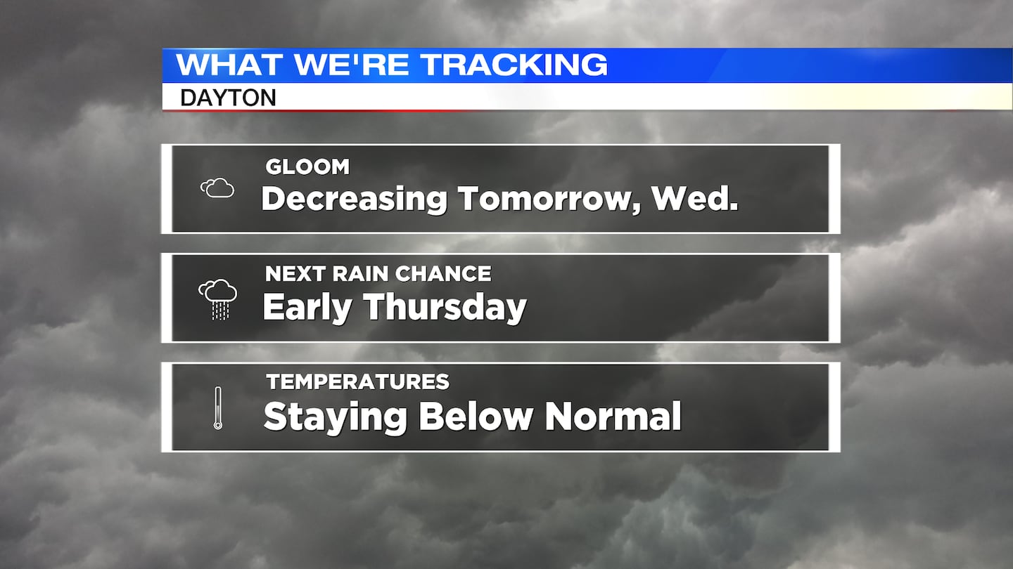
QUICK-LOOK FORECAST:
- Gradual clearing is expected tomorrow
- Tracking showers again early Thursday
- Temperatures remaining below normal
>>TRACK THE LATEST CONDITIONS: Live Doppler 7 Radar
DETAILED FORECAST:
MONDAY: Cloudy skies with some very patchy mist or drizzle possible and cool, according to Storm Center 7 Chief Meteorologist Austin Chaney. Low temperatures make it down to the mid-40s by morning.
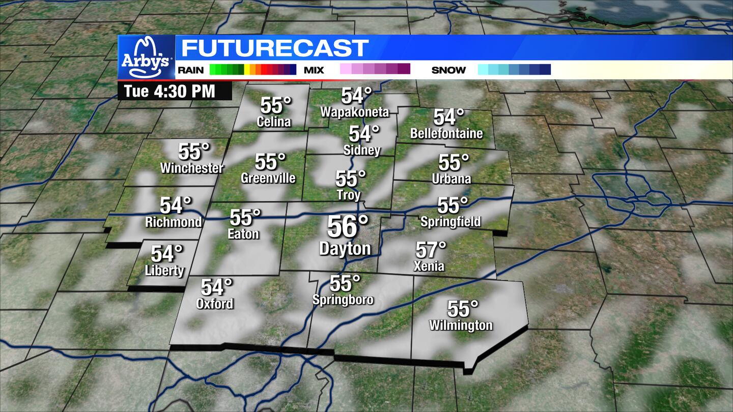
TUESDAY: Mostly cloudy skies turn partly cloudy occasionally throughout the day. Highs in the upper 50s.
WEDNESDAY: Gradual clearing becomes more prevalent with mostly sunny skies at times. High temperatures return into the middle 60s.
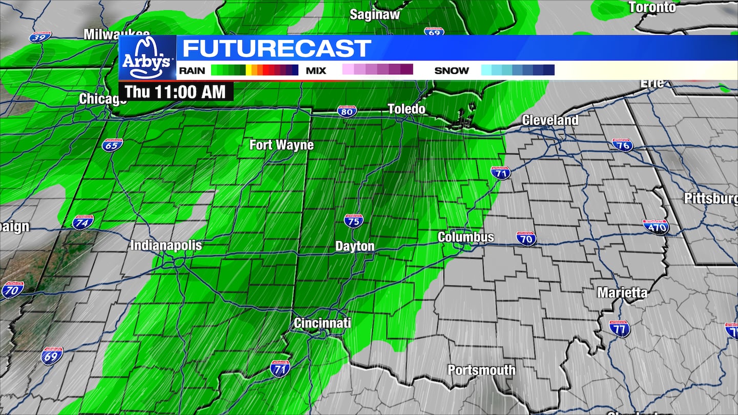
Wednesday evening into Wednesday night, clouds return with a chance for showers arriving during the predawn hours of Thursday.
THURSDAY: Cloudy skies with a chance for showers. A push of rain may work through really early Thursday, followed by some more scattered showers during the afternoon and evening. Highs in the low to mid-60s.
FRIDAY: Mostly cloudy with some on-and-off light rain showers. Highs in the lower 60s.
SATURDAY: Mostly cloudy skies with a few showers possible early. Then some slow clearing into the evening. Highs expected near 60.
SUNDAY: Partly cloudy and cool with highs on either side of 60.
MONDAY: A mix of sun and clouds with highs in the lower 60s.
©2023 Cox Media Group


