QUICK-LOOK FORECAST:
- Tracking rain showers tomorrow
- Coldest air of the season arrives Saturday
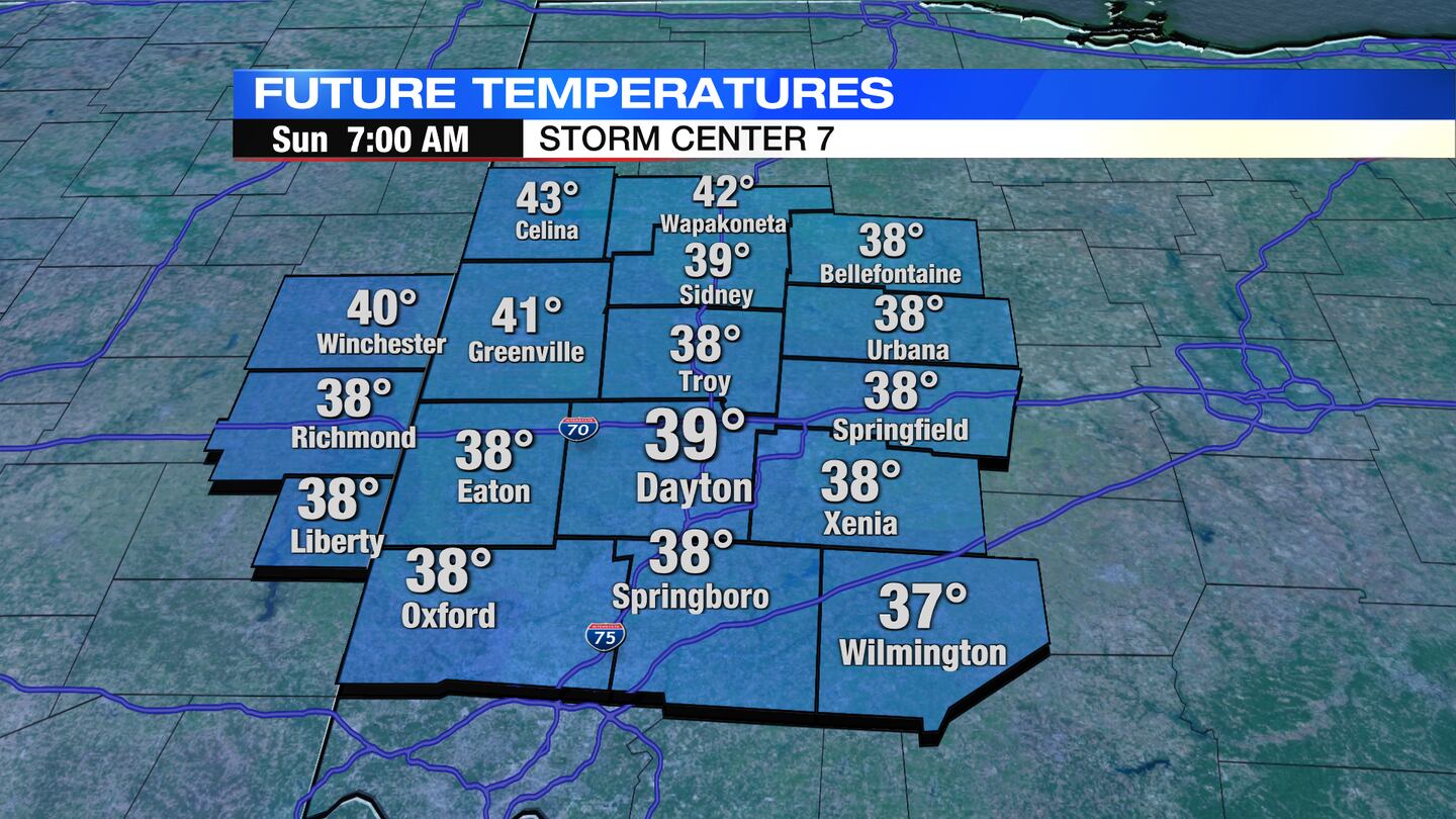
- Upper 30s / lower 40s Sunday morning
>> TRACK THE LATEST CONDITIONS: Live Doppler 7 Radar
DETAILED FORECAST:
WEDNESDAY: Clouds continue to stream in from the west this evening into tonight. We should stay dry overnight. Lows fall to the lower 60s by tomorrow morning.

THURSDAY: Cloudy with showers arriving on Thursday. While a stray shower can’t be ruled out before noon, the vast majority of the rain falls during the afternoon, evening, and overnight hours. A few tenths of an inch of rain possible, so totals won’t be overly high. High temperatures in the upper 70s. Breezy with some gusts 15-20MPH.
FRIDAY: A chance for showers early in the day, then mostly dry with just an isolated shower chance during the afternoon. Partial clearing with partly cloudy skies returning for the afternoon. Cooler with highs in the lower 70s. Clouds thicken back up with a chance for a few showers Friday night.
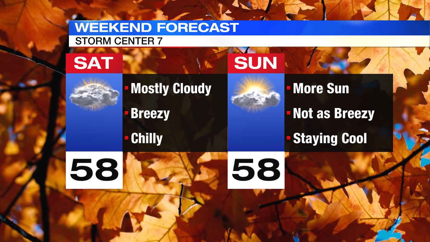
SATURDAY: Mostly cloudy, cool, and breezy for Saturday. A few light rain showers can’t be ruled out. Highs only get to the upper 50s making it the coolest day since early May. Winds gusting as high as 30MPH will make it feel even chillier.
SUNDAY: A cold start with morning lows in the upper 30s to lower 40s. As of now it looks like a light breezy Sunday morning should help us avoid any risk for frost. Partly cloudy during the day with high temperatures again in the upper 50s.
MONDAY: A mix of sun and clouds with cool highs in the low 60s.
TUESDAY: Partly cloudy, slightly warmer with highs in the mid 60s.
WEDNESDAY: Mostly sunny with highs in the mid 60s.
©2023 Cox Media Group


