QUICK-LOOK FORECAST:
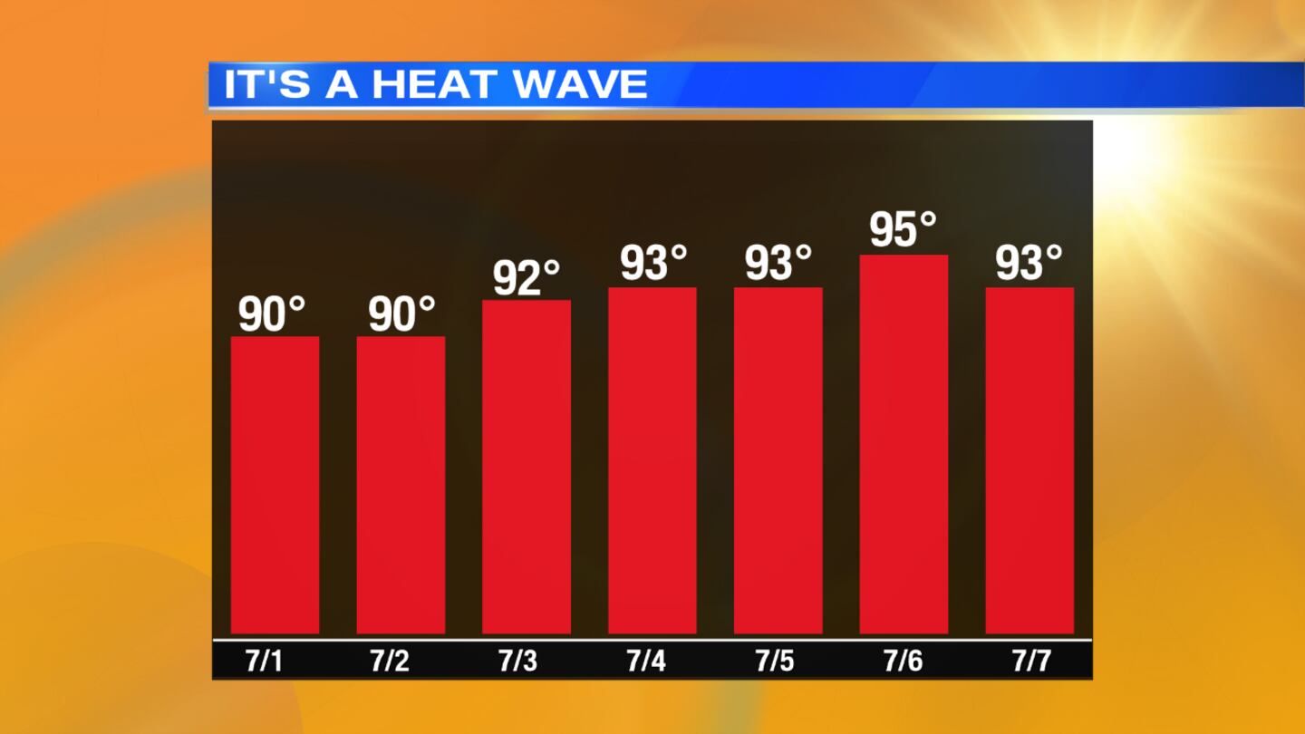
- Heat wave continues through the week
- More storms possible this afternoon
- Unsettled weather pattern through the weekend
>> TRACK THE CONDITIONS: Live Doppler 7 Radar
DETAILED FORECAST:
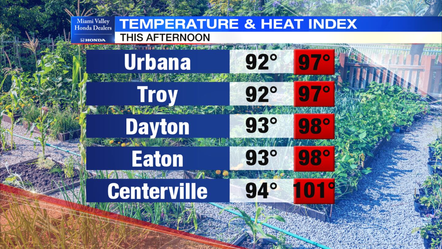
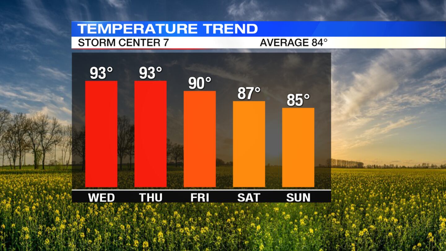
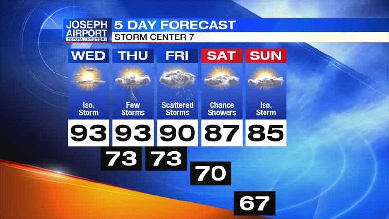
TODAY: The heat wave in the region will continue today and through the end of the week with high temperatures again expected in the lower 90s today, Storm Center 7 Meteorologist Dontae Jones said.
Heat index values for the day will range from 95 to 100 degrees.
Sunshine and clear skies are expected into the afternoon before some clouds develop. Storms will begin to fire up again during the heat of the day.
The threat for severe weather will be isolated, however any storms that develop could produce heavy rain and strong winds. Storms will come to an end at night.
>> STAY INFORMED: Download the WHIO Weather App
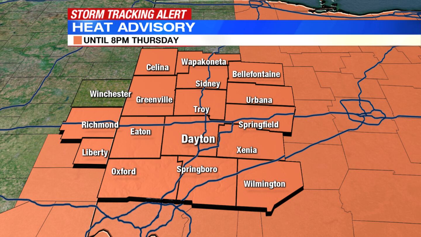
THURSDAY: Expect a warm and muggy day with more pop up storms in the afternoon. A few storms will again produce strong winds and heavy rain. Highs will be in the lower 90s with heat index values from 95 to 100 again.
A Heat Advisory has been issued for the Miami Valley from 12 p.m. to 9 p.m. Thursday.
FRIDAY: Scattered showers and storms will develop and be more widespread in the region. Highs should hit around 90 degrees but might stop in the upper 80s for some. A few storms could become severe again with wind and localized flooding the main threats. Storms will taper off into the evening.
SATURDAY: Warm and muggy conditions continue with highs in the middle to upper 80s. Sunny skies with some scattered clouds but a few showers or storms are again possible.
SUNDAY: We will continue to stay in the middle 80s through the weekend. Expect some sun with an isolated shower or storm in the afternoon.
© 2020 Cox Media Group


