QUICK-LOOK FORECAST:
- Increasing clouds tonight
- Scattered showers Sunday, may end as a few snowflakes
- Coldest air of the season so far next week
>>TRACK THE LATEST CONDITIONS: Live Doppler 7 Radar
DETAILED FORECAST:

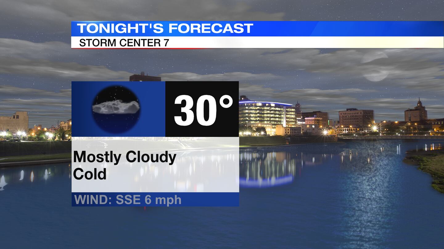
SATURDAY: Increasing clouds and cold with temperatures near 30.
SUNDAY: Cloudy, chilly, breezy, and wet. Scattered showers with highs in the low to middle 40s. A few snowflakes may fall as precipitation ends and colder air wraps in, but no accumulation is expected.

MONDAY: Clearing skies with much colder temperatures arriving. Afternoon highs in the lower to mid-30s. Coldest afternoon high since March 14th.
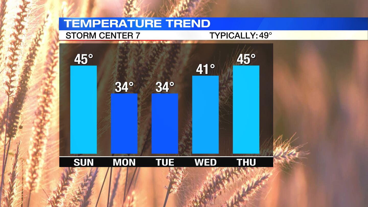
TUESDAY: Very cold start with lows around 20, and a few upper teens possible in outlying areas. Mainly sunny during the day and staying cold with highs only in the lower to middle 30s.
WEDNESDAY: Mostly sunny and milder with highs climbing back to around 40 degrees.
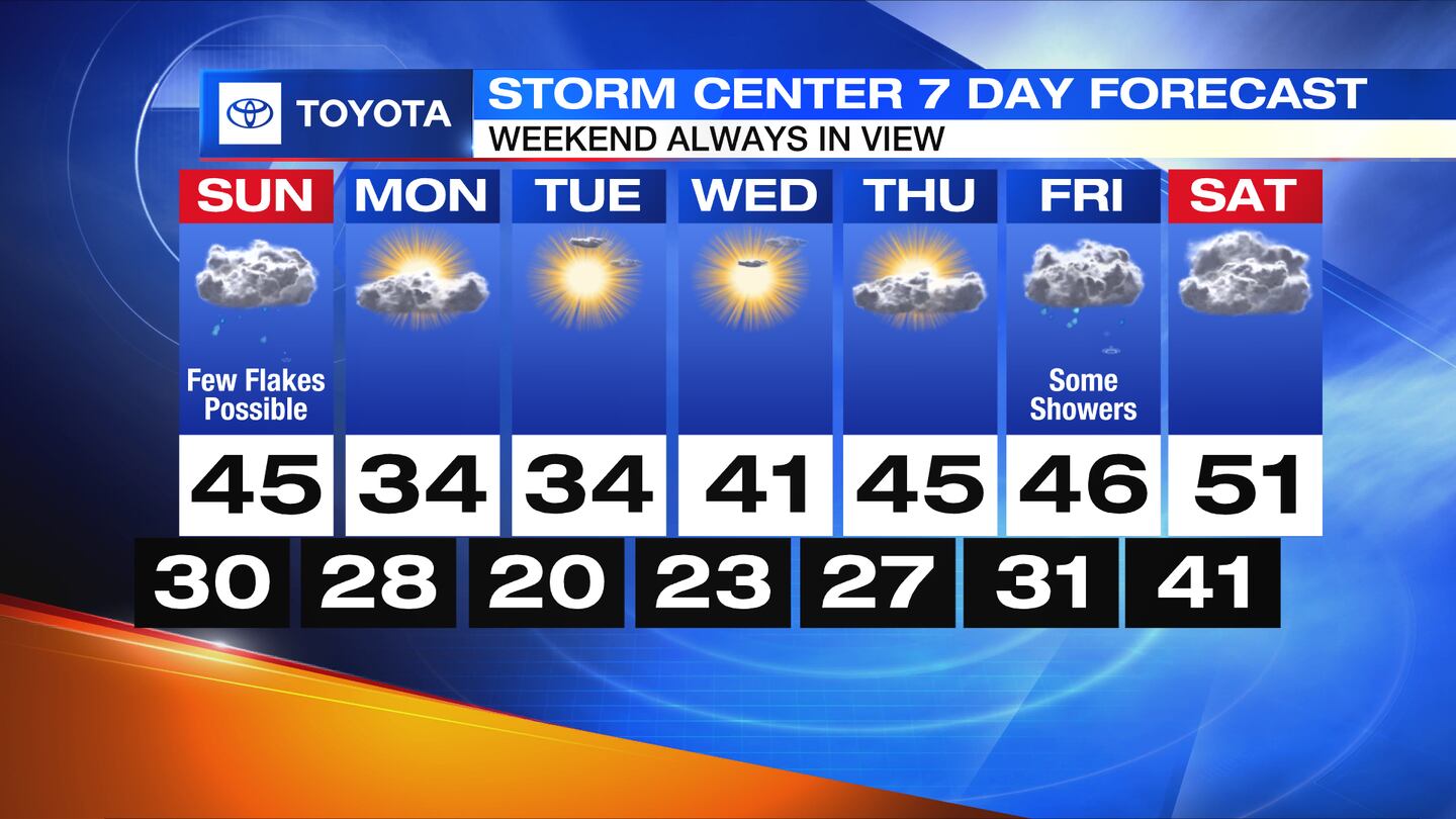
THURSDAY: Partly cloudy skies and seasonably cool with highs in the middle 40s.
FRIDAY: Chance of rain returns with highs in the middle 40s.
SATURDAY: Partly to mostly cloudy and mild with temps in the low 50s.
©2023 Cox Media Group


