Have you been dreaming of a White Christmas? If so, let’s take a look at all the ingredients that make a White Christmas and discuss our chances of seeing one this year.
By definition, a White Christmas occurs when there’s at least 1 inch of snow on the ground Christmas morning. While having it snow on Christmas Day may look nice, it doesn’t necessarily need to snow on the holiday for it to be considered a “White Christmas”.
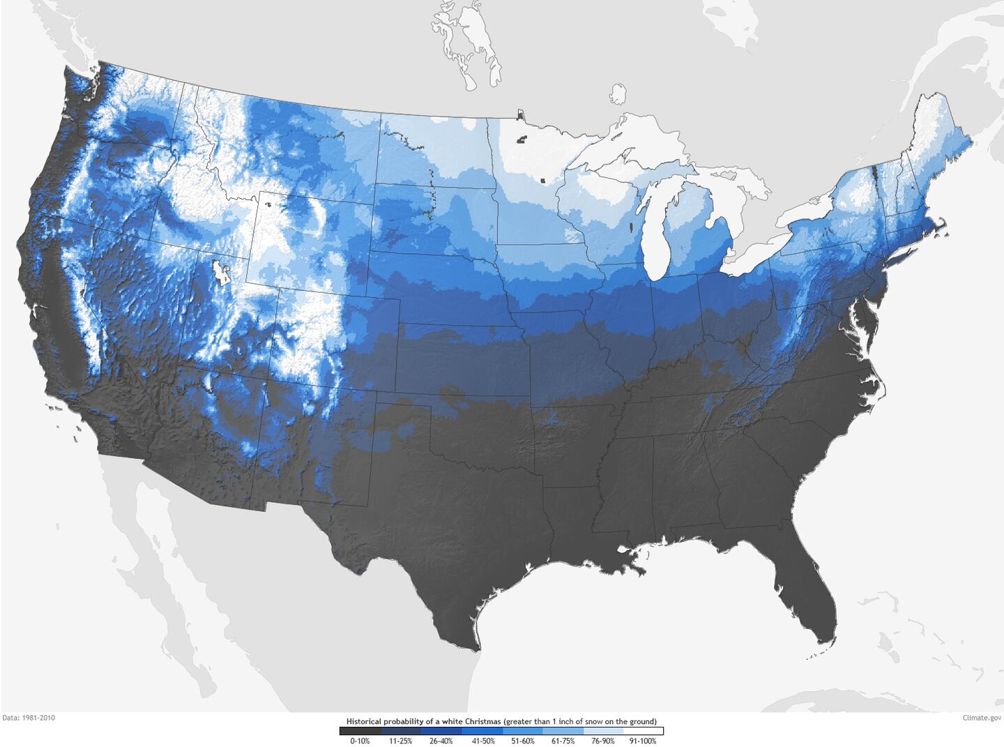
NOAA put together a map to show the historical probability of at least 1 inch of snow on the ground Christmas morning in the Lower 48 states. The data used to create this map was based on the latest (1981-2010) U.S. Climate Normals from NOAA’s National Centers for Environmental Information (NCEI). What it shows, and is no surprise based on location, is most of Idaho, Minnesota, Maine, Upstate New York, the Allegheny Mountains of Pennsylvania and West Virginia, the Rockies, and the Sierra Nevada Mountains all have a high probability of seeing a White Christmas.
In southwest Ohio, Dayton and Cincinnati statistically only experience a White Christmas about 20 to 30 percent of the time. Of these cities, Dayton tends to see them more frequently.
Are you dreaming of a white Christmas? Well, if you live in the southern OH Vly, we suggest you keep dreaming. Historical probabilities aren't in our favor, w/ only 2 of past 15 years qualifying as a white Christmas. With the warm pattern thru end of Dec, we may keep trend going. pic.twitter.com/9tGEc1rp8z
— NWS Wilmington OH (@NWSILN) December 8, 2020
The most recent White Christmas for both cities occurred in 2017. While the snow depth wasn’t that high, it was enough to be considered a White Christmas. As for the record highest snow depth on Christmas day, this occurred in 2004. Cincinnati had a snow depth of 9 inches and Dayton 16 inches.
As for this year, there is a low chance of a White Christmas, said Storm Center 7 Chief Meteorologist McCall Vrydaghs.
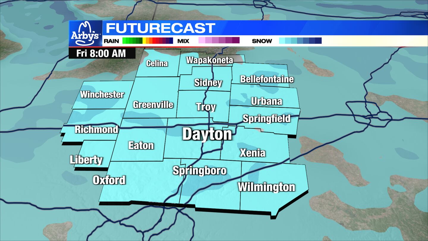
Wednesday night, a cold front will cross the Miami Valley bringing rain to the region. As colder air arrives overnight some precipitation may mix or change to light snow by daybreak Thursday.
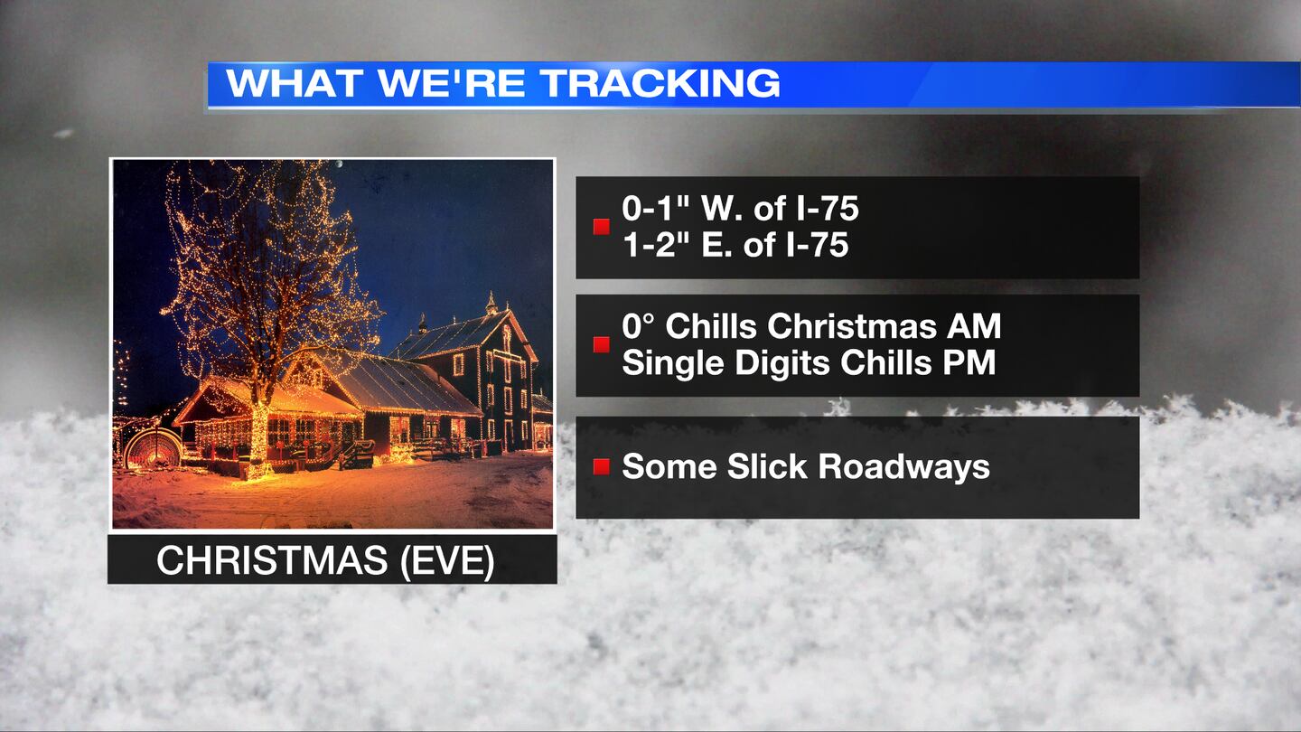
“A coating of snow, perhaps up to an inch east of Dayton is possible,” said Vrydaghs.
On Christmas Eve, any light snow showers in the morning will give way to mostly cloudy skies and perhaps a few flurries in the afternoon and into the overnight. No additional snow accumulation is expected.
Christmas morning will be very cold with some slick spots possible.
Temperatures will stay below freezing from Thursday morning through Christmas Day, so whatever snow has fallen will remain on the ground.
Cox Media Group


