QUICK-LOOK FORECAST:
- Dry, cool for Valentines plans tonight
- Passing showers, breezy Thursday
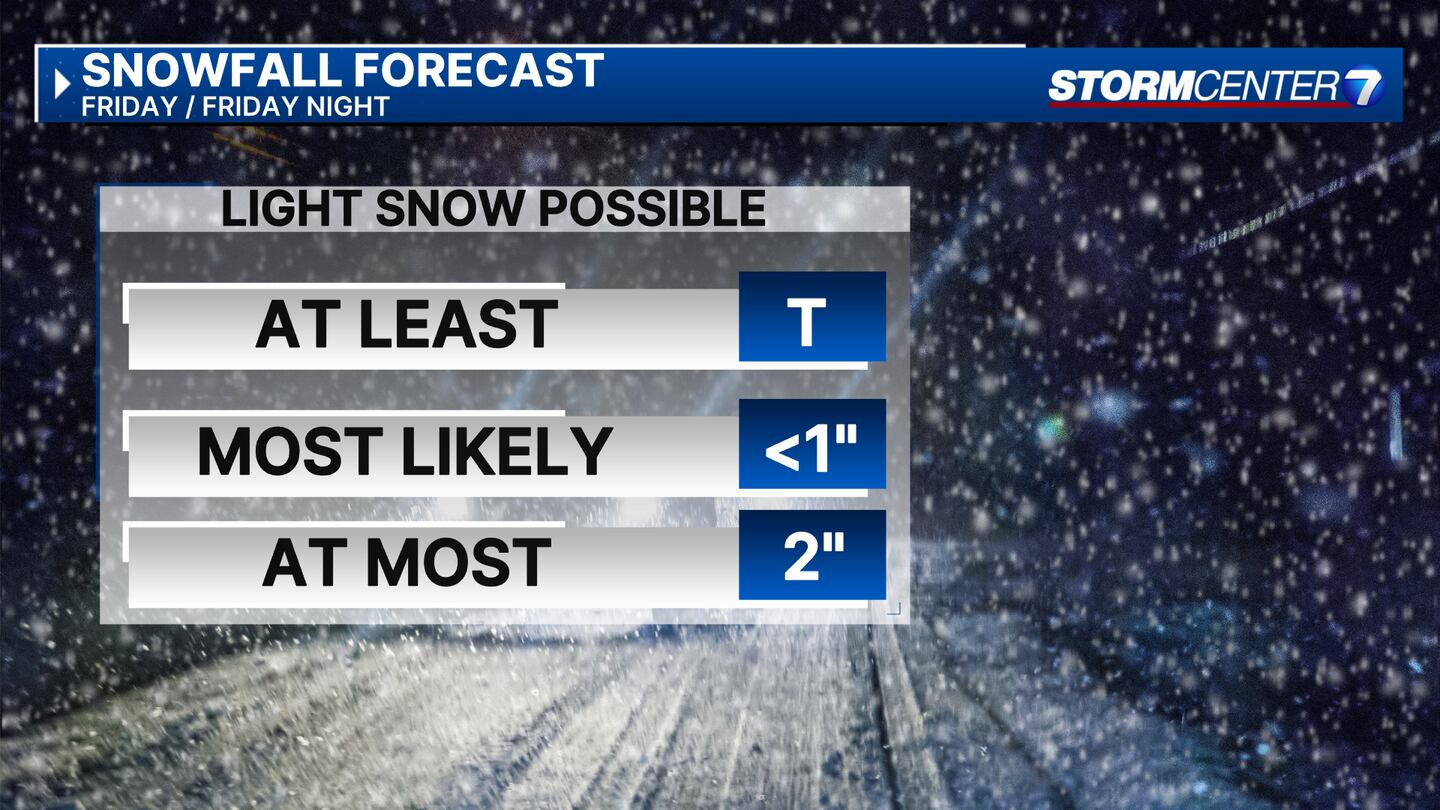
- A chance for snow Friday evening and Friday night
>> TRACK THE LATEST CONDITIONS: Live Doppler 7 Radar
DETAILED FORECAST:
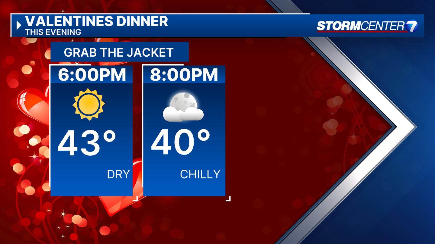
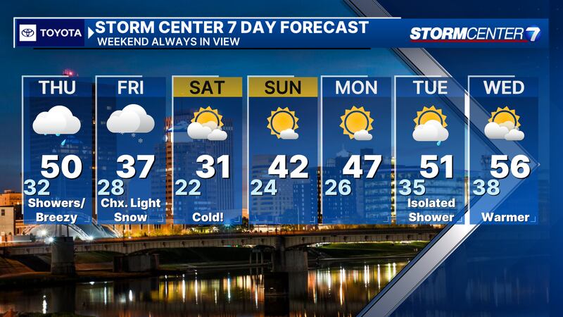
TONIGHT: Clear skies this evening eventually give way to more clouds overnight. Chilly tonight with lows around freezing.
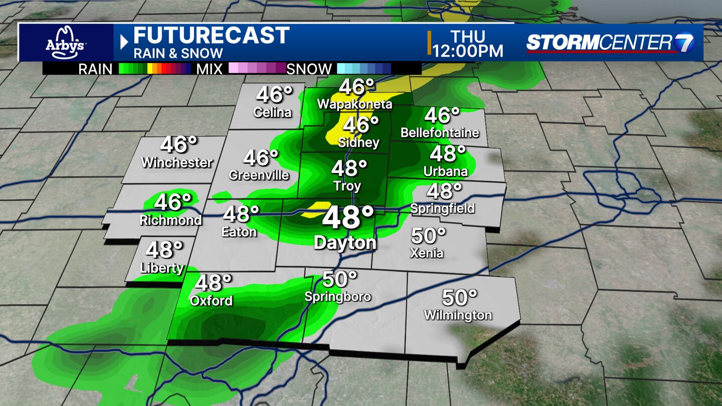
THURSDAY: Mostly cloudy early with a quick moving line of showers possible from late morning into early afternoon with a cold front. Breezy to go along with those showers.
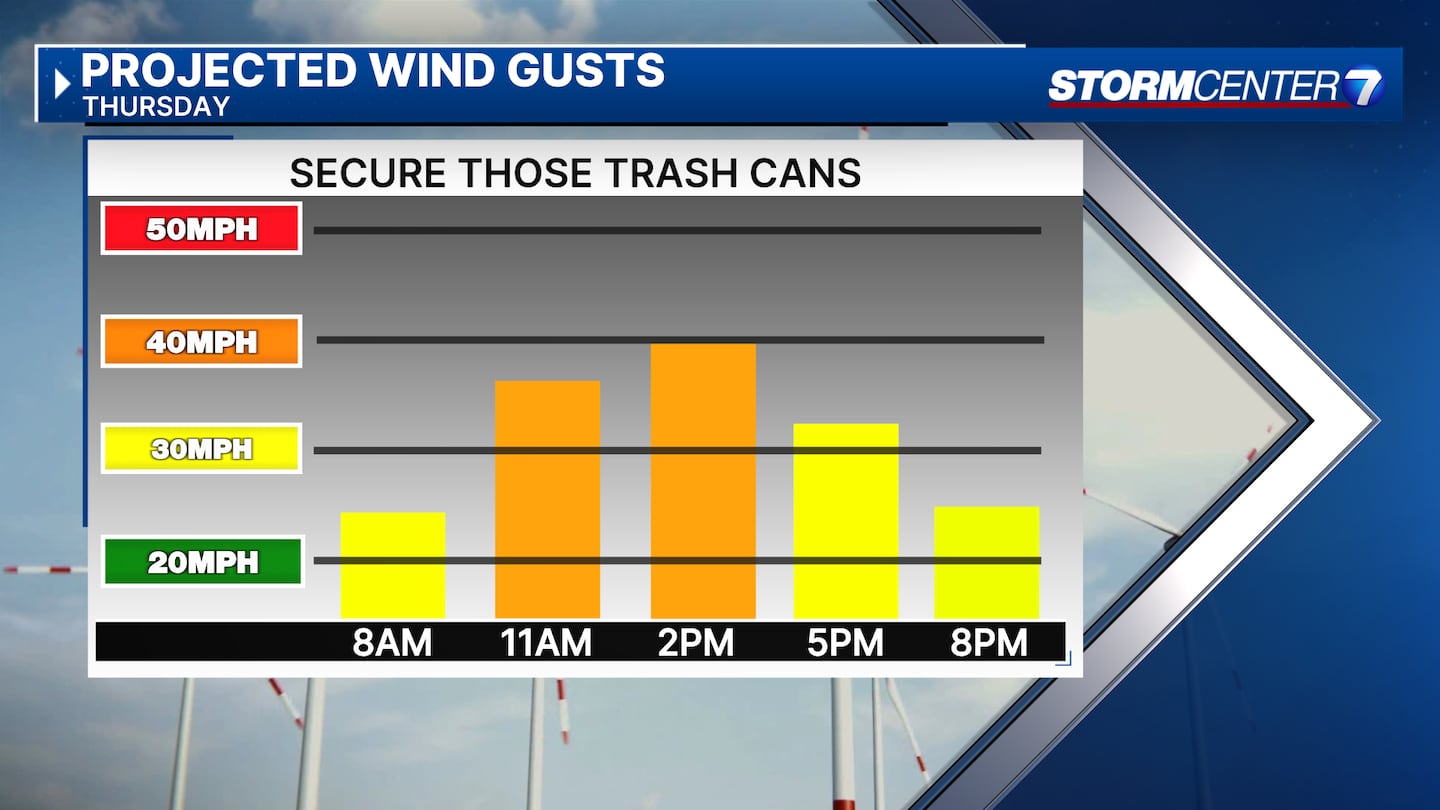
Gusts of 30+MPH possible. A gust or two may top 40MPH. Highs near 50 degrees. We’ll end the day with dry conditions and broken clouds.
FRIDAY: Mostly cloudy with a chance for light snow arriving during the afternoon and evening hours.
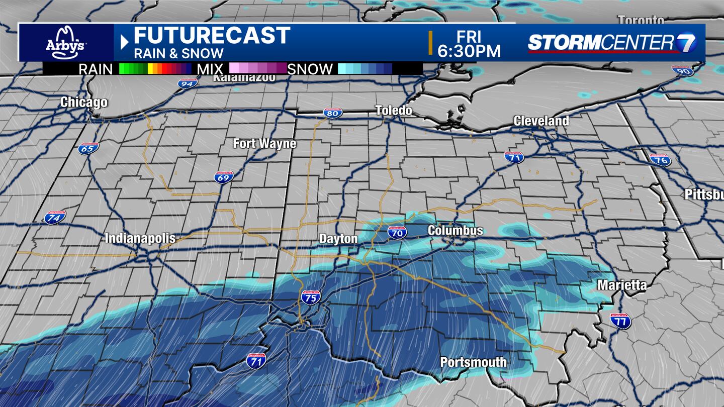
Some accumulation is possible, especially after sunset. With area of low pressure passing well to our south, only light snow is expected across the Miami Valley at this time with totals around an inch or less. Daytime highs in the mid 30s. Overnight lows falling to the low 20s.
SATURDAY: Some clouds early. Becoming mostly sunny. Cold with temperatures struggling to warm past the freezing mark
SUNDAY: Mostly sunny and chilly with highs in the upper 30s and lower 40s.
MONDAY: Partly cloudy. Warming it up with highs in the mid 40s.

TUESDAY: Mostly cloudy with a stray shower. Highs near 50 degrees
WEDNESDAY: Partly cloudy. Climbing to the mid 50s.
©2024 Cox Media Group


