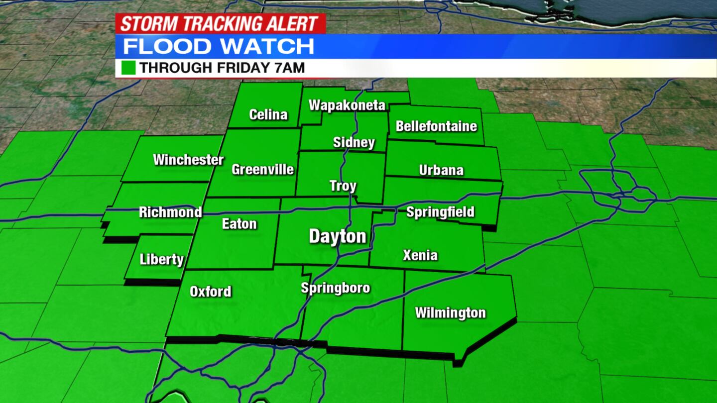
A Flood Watch has been issued for the region through Friday morning.
A Dense Fog Advisory has been issued for the region until 4 a.m. Thursday.
A Flood Warning has been issued for Great Miami River at Miamitown until Feb. 10 at 4:49 p.m., at Milford until 11:30 a.m. Thursday.
QUICK-LOOK FORECAST
- Flood Watch for region through Friday morning
- Rounds of rain likely Thursday
- Colder by weekend
>> Live Doppler 7 HD Interactive Radar
DETAILED FORECAST
OVERNIGHT: Expect areas of dense fog and drizzle, along with passing showers at times. Steadier, heavy rain returns Thursday. We'll not get a soaking Wednesday night, there remain areas where there is standing water and flooding. Never drive through standing water on roadways, Storm Center 7 Chief Meteorologist McCall Vrydaghs said. Temperatures fall into the upper 40s by morning.
>> How can snow melt cause flooding?
THURSDAY: Steady rain returns in the morning, with downpours that will cause limited visibility and will increase the threat for ponding on the roads. Several rounds of rain will work across the region during the day, with thunderstorms possible in the late afternoon and evening.
An additional 1 to 3 inches of rain is possible for the day with highs expected in the lower 60s.
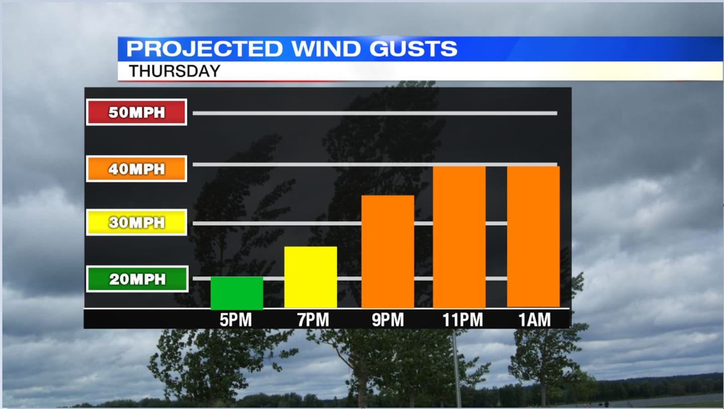
Gusty winds are also likely, with gusts between 30 and 40 mph possible from late afternoon through the night.
Temperatures will drop toward Friday morning, with some wet snowflakes mixing in overnight.
FRIDAY: Gusty winds between 30 and 35 mph are expected all day with temperatures turning colder through the day. Most will start with temps in the upper 20s and fall by the end of the afternoon/evening to the low 20s. Clouds will decrease during the day.
River levels might rise to action stage but most spots along the Great Miami won’t see big river flooding. There will be some minor flooding in the Dayton area along the bike path and Rip-Rap road. Cold at night dropping into the low teens.
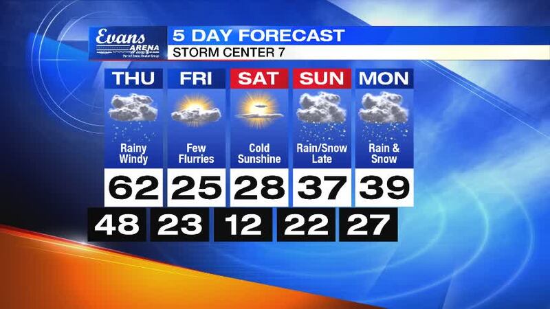
SATURDAY: A cold but quiet day with temperatures starting around 12 degrees and highs reaching the upper 20s. Expect some sunshine through the day.
SUNDAY: Dry start to the day. Clouds increase quickly and another storm system will approach. Highs in the upper 30s. Rain and snow will return.
>> YOU NEED THIS: Download the WHIO Weather App
MONDAY: A wintry mix of rain and snow arrives, but areas north of I-70 could start and end with all snow. Some light accumulation is expected. Highs will be in the upper 30s.


