Another system moves in today, this time bringing the potential for severe thunderstorms, said Storm Center 7 Meteorologist Kirstie Zontini.
>> Live Doppler 7 Interactive Radar
A Tornado Warning is issued until 4:30 p.m. for Montgomery and Preble counties.
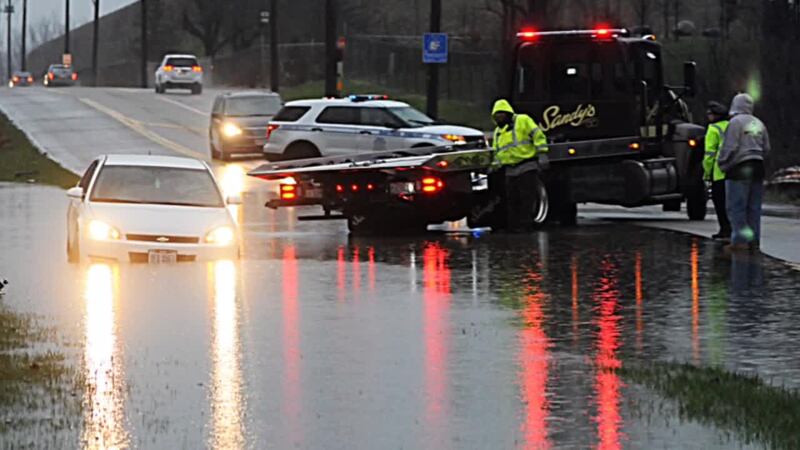
A Flash Flood Warning is in effect until 7 p.m. Shelby, Preble, Champaign, Logan, Darke, Montgomery and Miami counties.
The Storm Prediction Center has most of the Miami Valley under an Enhanced Risk for severe storms. The best ingredients for strong and severe storms looks to come together along and ahead of a cold front that approaches tonight. Impacts from this system will be felt from the morning and into Tuesday night.
>> Severe Weather: Slight vs Enhanced risk
COMMUTE IMPACTS
Tuesday evening: Storms are expected to redevelop late in the afternoon and through the evening mainly from 5 to 11 p.m.
These storms have a high chance of becoming severe. The main threat is damaging winds and flash flooding but there is the possibility of an isolated tornado or two to develop in a strong storm or line of storms.
Larger sized hail is a low threat for the day.
Check out this video from Shiloh Springs road in #HarrisonTownship @whiotv pic.twitter.com/XtkF6qem3h
— Gabrielle Enright (@GEnrightWHIO) April 3, 2018
>> Severe weather alerts sign-up
Drivers should check the forecast and Live Doppler 7 Radar for a look at the afternoon development. Storms will become more widespread toward the end of the drive.
Drivers should watch for flash flooding, reduced visibility and severe storms during the evening hours. The biggest impacts outside of flooding will be damaging winds. Some storms could also produce hail and an isolated tornado can't be ruled out.
>> Impacting your drive: Strong wind, heavy rain
Once the cold front passes at night, the rain will taper off. The Wednesday morning drive should be quiet, but a few flurries are possible if it gets cold enough.


