QUICK-LOOK FORECAST:
- Storms in the region tonight
- Main threats are hail, damaging winds, flooding
- Turning cooler and drier late into the week
UPDATE @ 11:47 p.m.: The Tornado Watch for all counties, except Clinton, has been canceled.
UPDATE @ 10:21 p.m.: A Severe Thunderstorm Warning adds Greene, Montgomery and Preble counties until 11 p.m.
UPDATE @ 10:03 p.m.: A Severe Thunderstorm Warning (60 mph winds and 1-inch hail) has been issued for Butler and Warren counties until 11 p.m.
UPDATE @ 9:44 p.m.: A Severe Thunderstorm Watch has been issued for Montgomery County, Butler and Preble counties until 10:45 p.m. Winds of 70 mph and 1-inch hail has been reported in Fayette, Franklin, Union and Wayne counties in Indiana until 10 p.m.
UPDATE @ 7:29 p.m.: A Tornado Watch has been issued for Butler, Clinton, Greene, Montgomery, Preble and Warren counties in Ohio, Wayne and Union in Indiana, until 2 a.m. Thursday.
>>Power outages across the Miami Valley
DETAILED FORECAST:
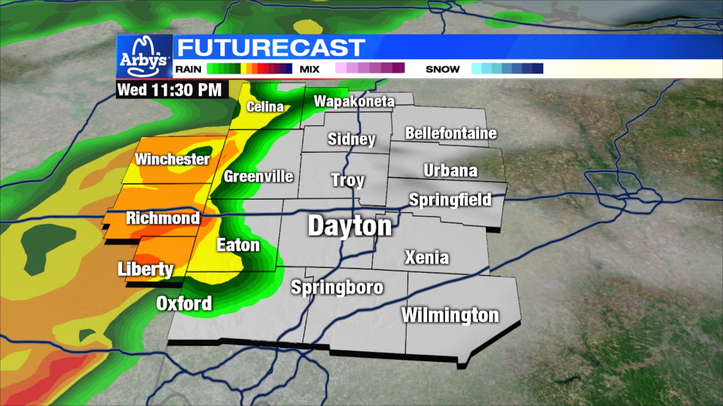
THIS EVENING - OVERNIGHT: There will be a few clouds around early this evening, with warm temperatures falling into the 60s.
Another round of showers and storms will cross the area between 10 p.m. to 1 a.m. Southwest of Dayton is in the best position to see stronger storms.
>> Track the conditions with Live Doppler 7 Radar
Damaging winds, hail and flooding are the primary threats. An isolated tornado cannot be ruled out.
Overnight lows drop to the middle 40s.
>>Stay up-to-date with the WHIO Weather App for your device
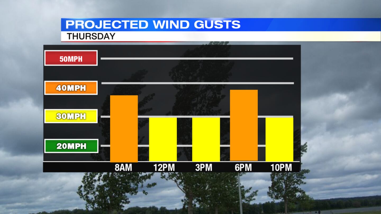
THURSDAY: It will be dry by sunrise with some broken clouds for the afternoon. A few passing rain or snow showers move through late afternoon into the first part of Thursday night.
Temperatures will be cooler with highs in the lower 50s. It will be pretty breezy, bordering on windy.
FRIDAY: We will see a cold morning in the low 30s. Expect the day to become mostly sunny with highs in the mid 40s.
SATURDAY: Some early morning frost is possible, with sun and clouds to come later on. Highs will be in the middle 50s.
SUNDAY: Cloud coverage will increase with showers arriving from the southwest. Highs will be around 60 degrees.
MONDAY: Some showers will linger early on, and then the day will turn mostly cloudy, windy and cool with highs in the mid 50s.
© 2020 Cox Media Group


