QUICK-LOOK FORECAST:
- Few showers overnight
- Cool Monday
- Warmer by the end of the week
>> TRACK THE CONDITIONS: Live Doppler 7 Radar
DETAILED FORECAST:

>> STAY INFORMED: Download the WHIO Weather App
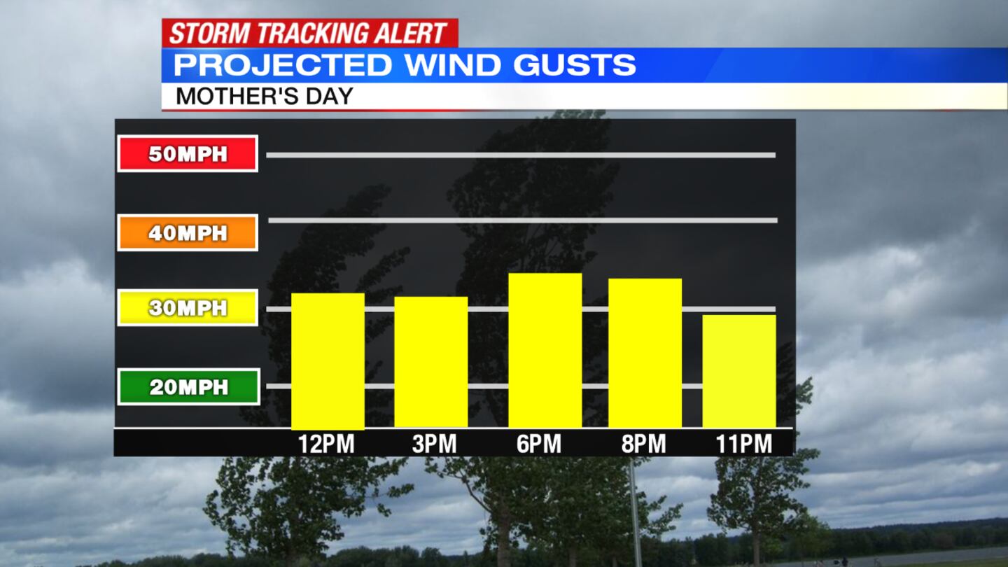
OVERNIGHT: There will be scattered showers overnight with mostly cloudy skies. It’ll be windy overnight with wind gusts as high as 30 mph. It will be cool with temperatures falling into the 30s.

MONDAY: There will partly to mostly cloudy skies. It will be cool with highs into the low 50s. There will be a very small chance to see a few afternoon/evening showers. Expect a breeze throughout the day.
TUESDAY: There will be patchy morning frost. Skies will be partly sunny and it will be breezy and cool with highs in the upper 50s.
WEDNESDAY: Increasing clouds for Wednesday. Breezy, and a bit milder with highs in the lower 60s. Some light showers develop late evening.

THURSDAY: It will be mostly cloudy with the chance for showers and storms. Warmer with highs into the middle 70s.

FRIDAY: It will be mostly cloudy with showers likely and an isolated thunderstorm possible. Warmer weather continues with highs into the middle 70s.
© 2020 Cox Media Group


