
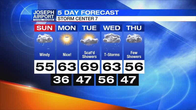
QUICK-LOOK FORECAST:
- Clear and cold overnight
- Sunshine returns Monday
- Rain and thunderstorms Tuesday and Wednesday
DETAILED FORECAST:
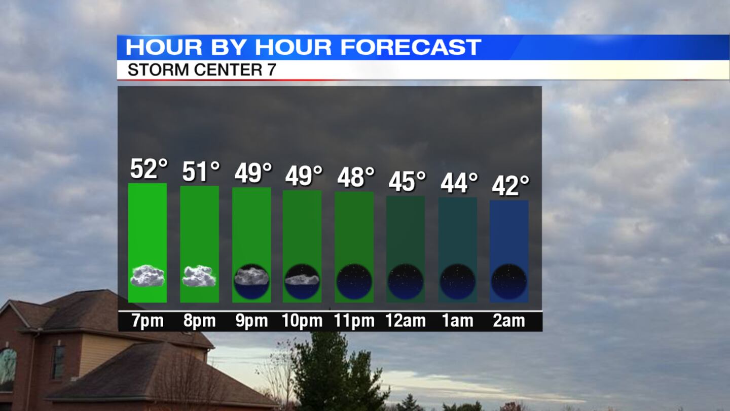
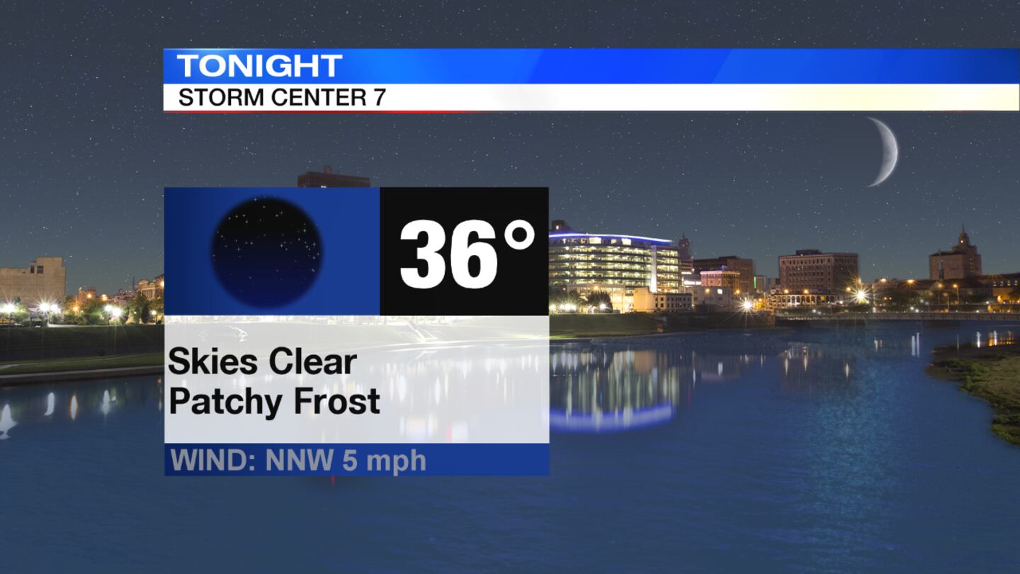
OVERNIGHT: Overnight, skies clear, winds calm and temperatures drop into the mid 30s. There may be some areas of patchy frost in the morning.
>> TRACK THE CONDITIONS: Live Doppler 7 Radar
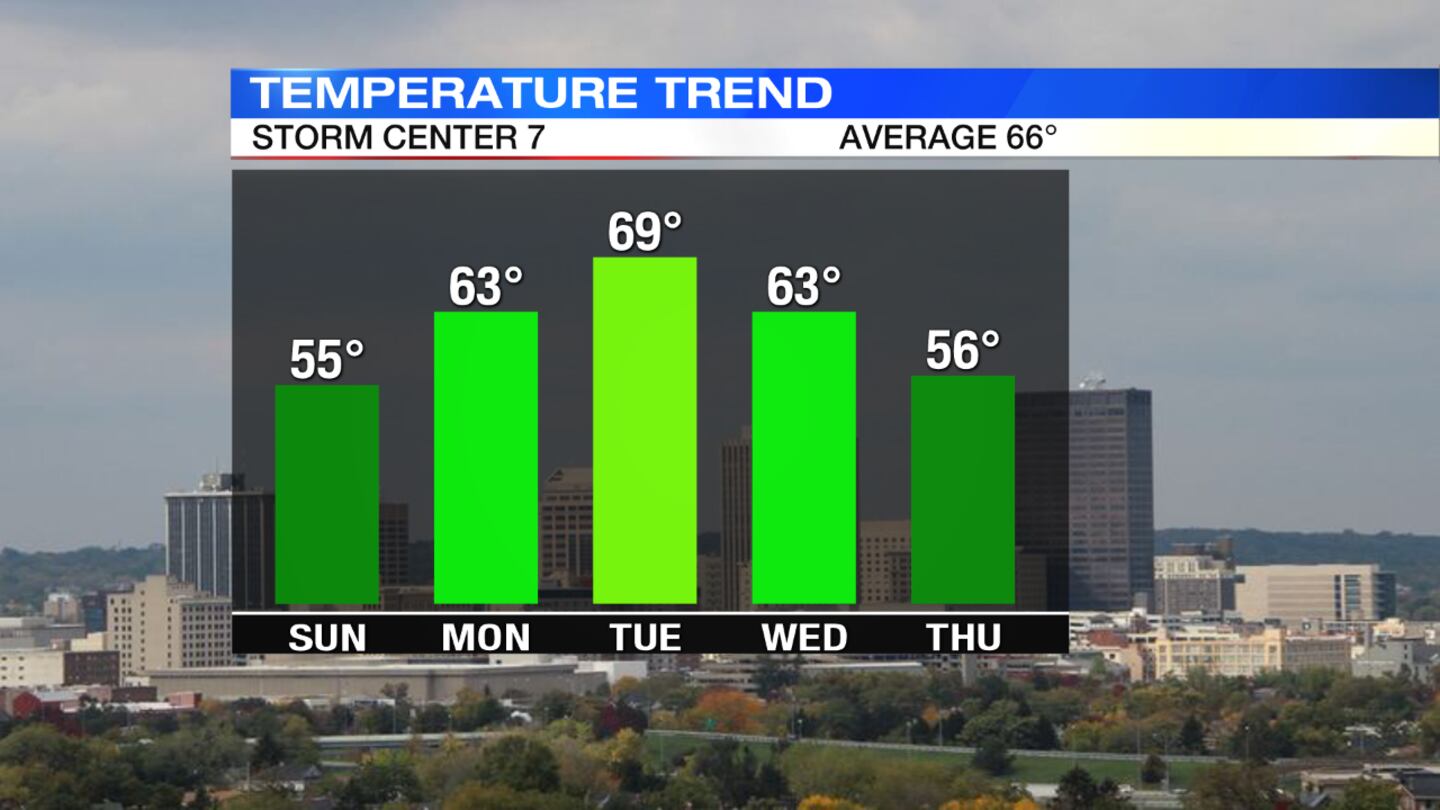
MONDAY: The day will start off with patchy frost on Monday morning. A beautiful day with mostly sunny skies and highs around 60 degrees. Clouds return into Monday night with the chance for showers.
TUESDAY: It will be mostly cloudy and breezy for Tuesday with a few more showers. An isolated thunderstorm is possible in the afternoon. Highs approach the upper 60s.
>> STAY INFORMED: Download WHIO Weather App
WEDNESDAY: Conditions will be cloudy with showers and storms likely on Wednesday. It will be breezy at times. Highs in the upper 60s
THURSDAY: It will be cloudy and breezy with scattered showers throughout the day. Highs only climb to the upper 50s.
FRIDAY: It will me mostly sunny and seasonably warm with temperatures in the mid 60s.
© 2020 Cox Media Group