It is the calm before the storm across the Miami Valley. A Winter Storm Warning will go into effect this evening. Accumulating snow, blowing and drifting snow, a flash freeze, and dangerous wind chills will all be present tonight into Friday
>> STAY INFORMED: Closings, delays announced ahead of this week’s winter storm
ALERTS:
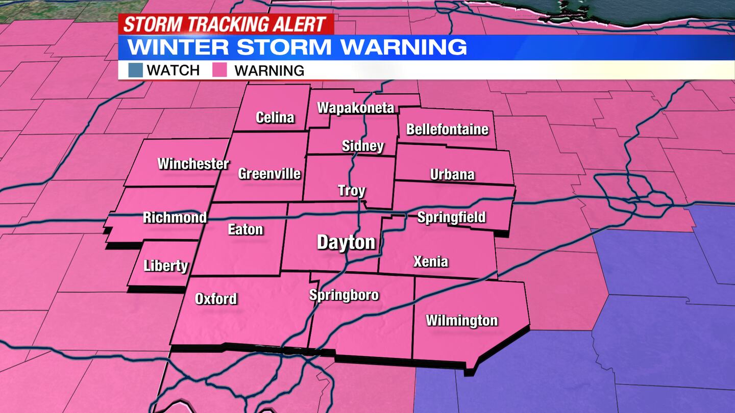
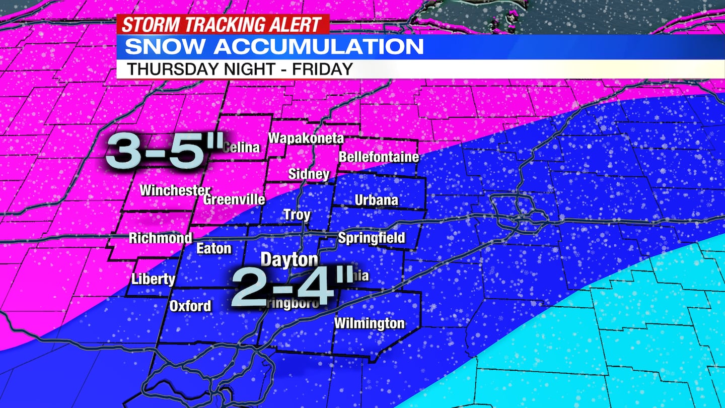
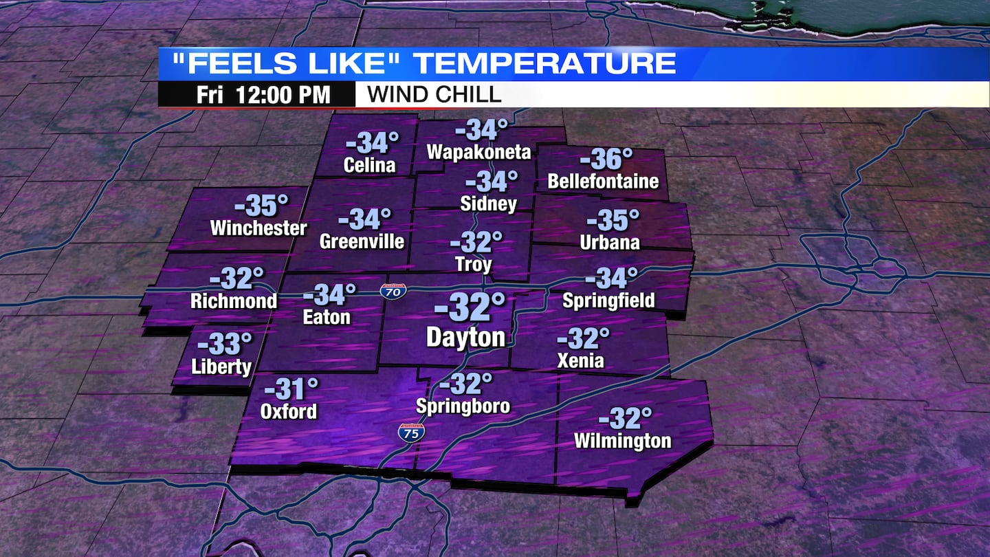
A Winter Storm Warning will be in effect for the entire Miami Valley from 7PM tonight through 5PM Friday. Snowfall amounts of 2-4 inches, with some areas reaching 5 inches will be possible tonight. A Wind Chill Warning will be in effect from 1AM Friday through 4AM Saturday. Wind chills may drop as cold as 35 below zero at their worst. Much of this time will be spent with wind chills in the -20 to -30 range.
TIMING:
The timeframe to watch is Thursday evening through Friday morning. Thursday evening, temperatures will be in the upper 30s and lower 40s, and rain showers will be possible. As colder air quickly crashes in, precipitation will go from rain to snow. Snow will remain possible through Friday morning. The changeover will first occur near the Ohio / Indiana line around 7 or 8PM, the I-75 corridor around 10PM, and the eastern part of the channel 7 news area by 11PM or midnight. Snow will remain possible through around daybreak Friday.
SNOW:
Widespread snow totals of 2-4 inches are expected. Some areas further north could see as much as 5 inches. This snow will be powdery making clearing roads difficult. Wind will easily blow this snow right back onto area roadways. The snow may come down heavy at first. This combined with strong winds may reduce visibility to ¼ mile for a short period of time right after the changeover.
WIND:
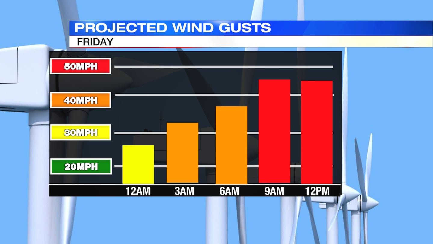
Winds may gust as high as 50MPH on Friday. This could lead to isolated power outages. It may be a good idea to bump the heat up in your house a bit Thursday night, just in case you lose power for some time Thursday night into Friday.
WIND CHILLS:
Wind chill values will drop well below zero on Friday. The National Weather Service is suggesting these could be as low as -35. That is dangerous cold, and can lead to frost bite in as little as 30 minutes. You’ll want to limit your time outside on Friday.
FLASH FREEZE:
The combination of rapidly dropping temperatures along with moisture on the roads from rain and snow will lead to flash freeze potential. Road conditions may quickly change from wet to slick in a short period of time Thursday night into early Friday. Be aware of this if you must travel during this time.
©2022 Cox Media Group


