Montgomery, Clark, Darke, and Preble Counties are under a LEVEL 1 SNOW EMERGENCY
>>Snow Emergencies: What does it mean?
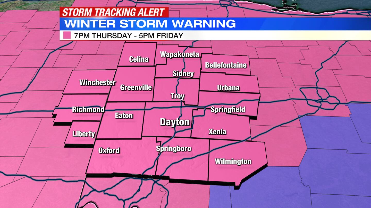
A Winter Storm Warning continues through 5 p.m. Friday for all counties in the Miami Valley plus Wayne and Randolph counties in Indiana.
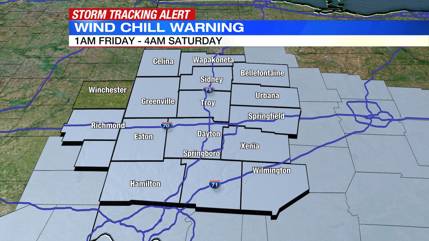
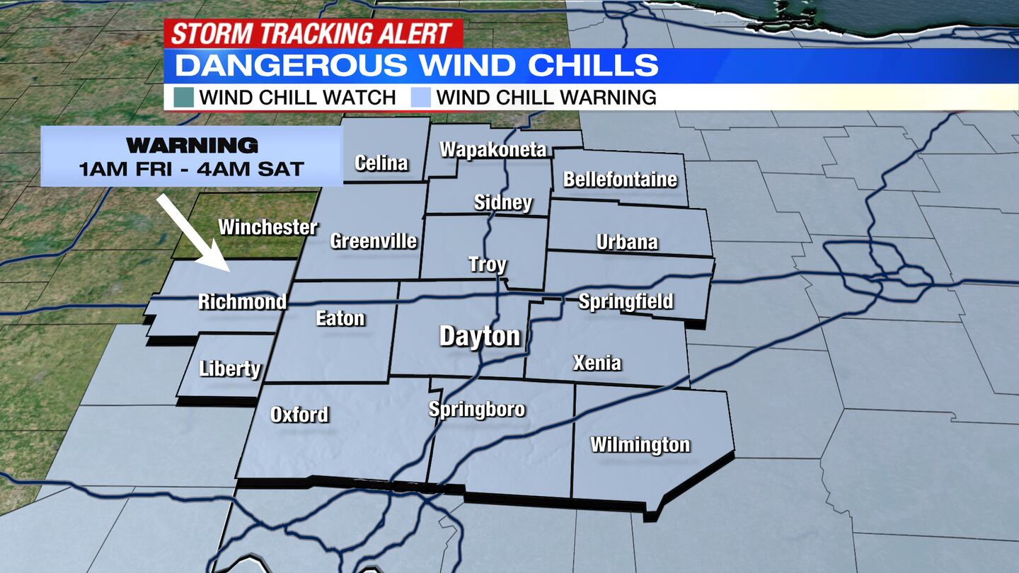
A Wind Chill Watch goes into effect at 1 a.m. Friday through 4 a.m. Saturday for the entire Miami Valley.
>> TRACK THE CONDITIONS WITH LIVE DOPPLER 7
QUICK-LOOK FORECAST:
- Rapid changeover from rain to snow tonight; Flash freeze likely
- Winds at 40 mph to 50 mph Friday and Saturday morning
- One of the coldest Christmas Days on record
>>Winter Storm Warning, Watch issued for Miami Valley; What to expect from holiday storm
DETAILED FORECAST:
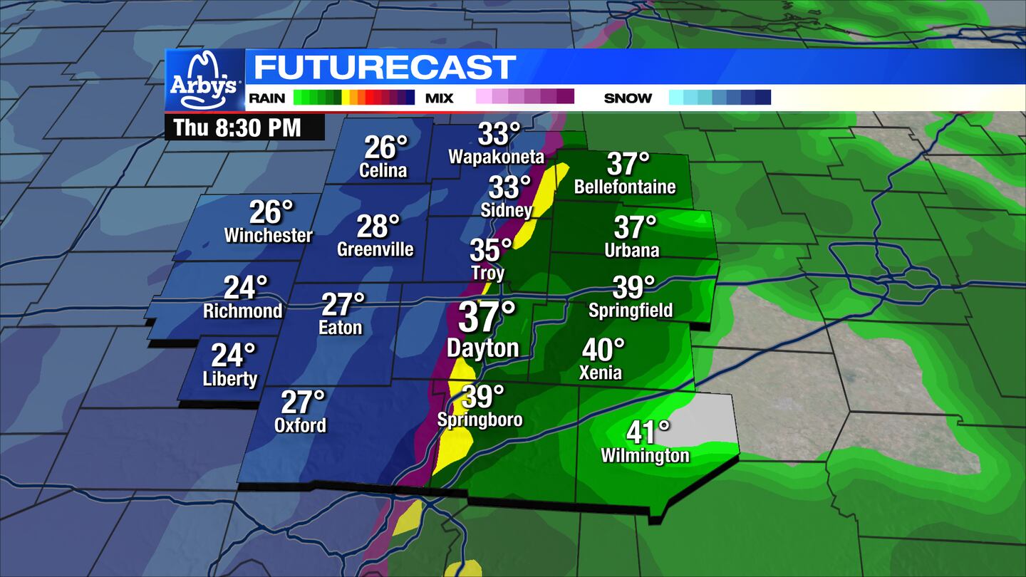
TONIGHT: Cloudy, cool, with rain showers early this evening. Breezy with temperatures in the 40s. As cold air arrives with this storm, there will be a RAPID transition from rain to snow. The timing for the transition NOW looks like 9 p.m. to 2 a.m. Snow showers may continue until around 6 a.m. Friday, Storm Center Chief Meteorologist McCall Vrydaghs said. Temperatures will drop 30 to 40 degrees overnight. Wet roads may flash freeze. Winds will gust from 40 to 50 mph with stronger winds in the northern Miami Valley.
>>Wright-Patterson Air Force Base to close Thursday evening for inclement weather
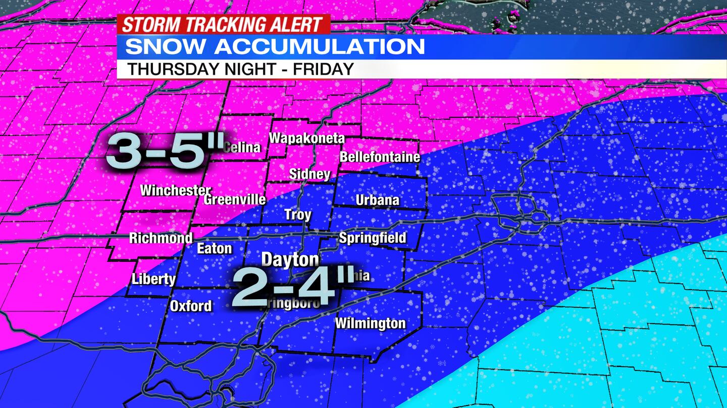
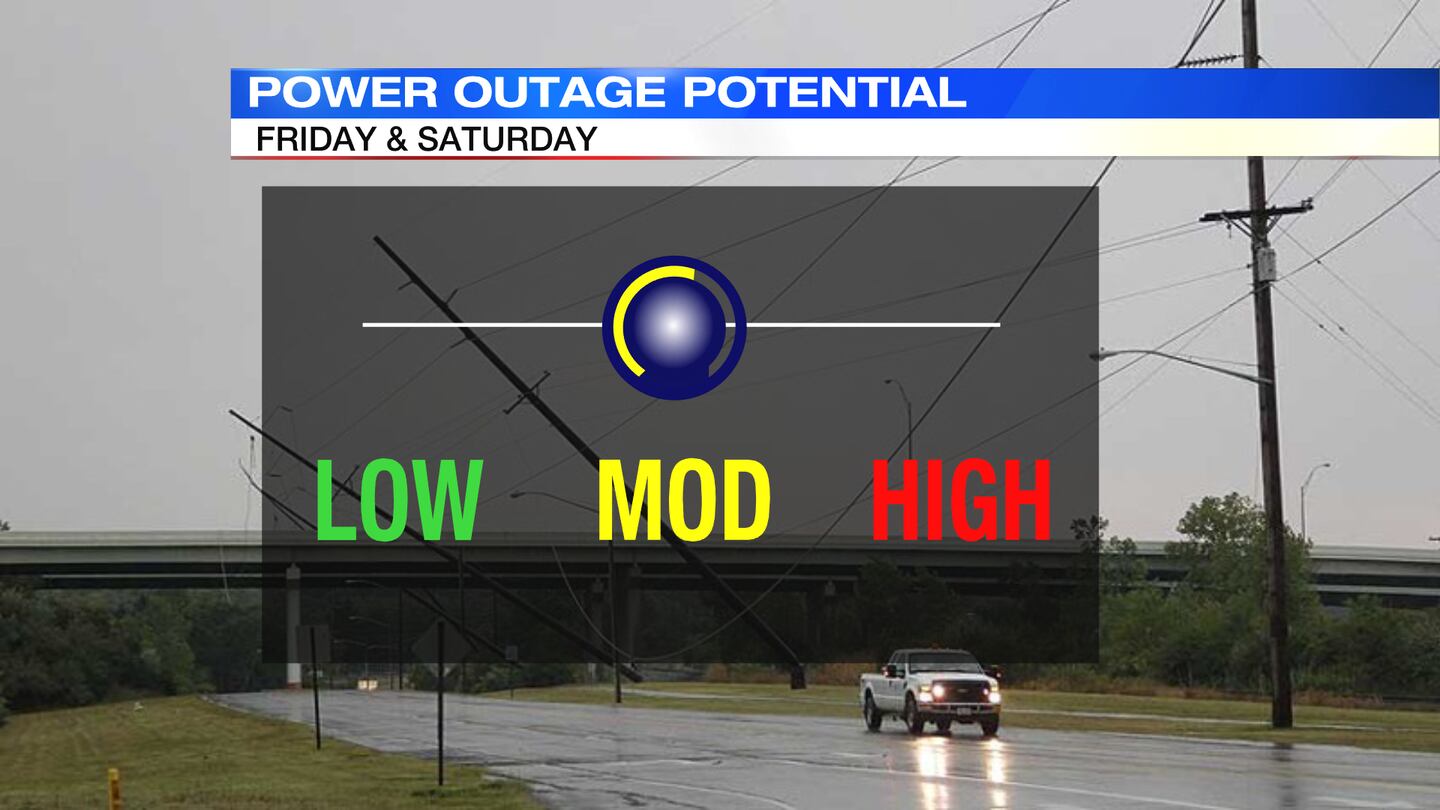
FRIDAY: Slick and snow-covered roads by morning. Accumulation of 2 to 4 inches, but it will be BLOWING as winds are the strongest through the first half of the day. Snow showers end, so the rest of the day is just dealing with bitter cold. We wake up around -minus 3 degrees and strong winds that could lead to isolated power outages. Wind chills will range from minus 20 to minus 30, perhaps slightly colder.
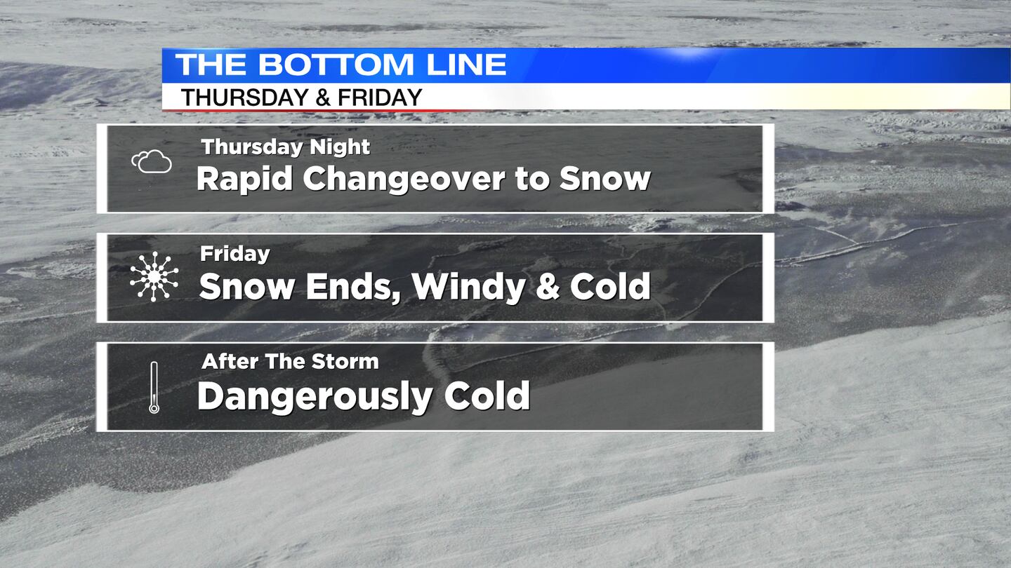
THE MOST DIFFICULT TRAVEL TIME PERIOD WILL BE THURSDAY NIGHT INTO FRIDAY MORNING. Accumulations will only reach 2 to 4 inches in most places.
SATURDAY: Bitter cold with dangerous wind chills but dry day. Highs only reach single digits. Wind chills will remain from minus 10 to minus 25. Roads may remain slick in spots. A passing flurry cannot be ruled out.
SUNDAY: One of the coldest Christmas days on record. We wake up around 2 with a high of only 12. Wind chills will still range from minus 10 to minus 20 during the morning. We stay dry at least with some sunshine returning.
MONDAY: Scattered clouds. Cold again in the middle 20s. Slight chance for flurries, especially at night.
TUESDAY: Still cold. A mix of sun and clouds with highs in the upper 20s.
WEDNESDAY: Partly cloudy and chilly. Highs in the mid-30s.
THURSDAY: Mostly cloudy with a rain shower possible. It will be a milder day with a high in the mid-40s.
©2022 Cox Media Group


