A Winter Storm is on the way to the Miami Valley.
>>TRACK THE CONDITIONS: Live Doppler 7 Radar
Although the snow isn’t currently anticipated to amount to more than a few inches, travel will be impacted, and dangerous cold will move in as the storm pulls away, according to Storm Center 7 Meteorologist Austin Chaney.
>>Wind chills explained: How they are calculated, advisories, and tips to stay safe
A Winter Storm Warning goes into effect Thursday at 7 p.m. through Friday at 5 p.m. for Auglaize, Champaign, Darke, Logan, Mercer, Miami and Shelby counties in Ohio, and Wayne and Randolph counties in Indiana
A Winter Storm Watch is in effect from 7 p.m. Thursday until Friday at 5 p.m. for Butler, Clark, Clinton, Greene, Montgomery, Preble and Warren counties, as well as Union County, Indiana.
A Wind Chill Watch goes into effect Friday at 1 a.m. through Saturday at 4 a.m. for Butler, Clark, Clinton, Greene, Montgomery, Preble and Warren counties
Expected aspects of the storm
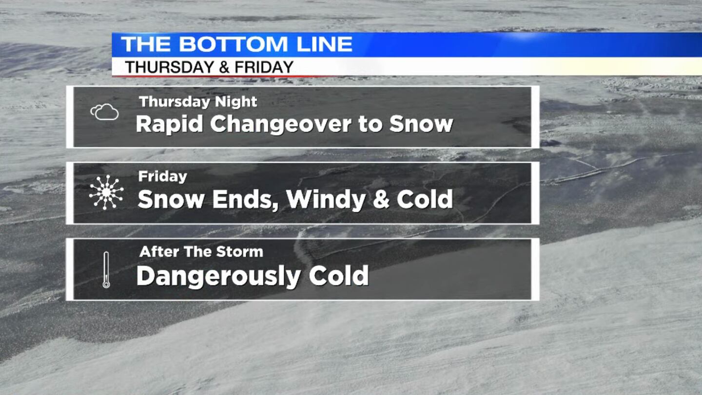
Timing: The timeframe to watch is Thursday evening through Friday morning. Thursday evening, temperatures will be in the upper 30s and lower 40s, and rain showers will be possible. As colder air quickly crashes in, precipitation will go from rain to snow. Snow will remain possible through Friday morning.
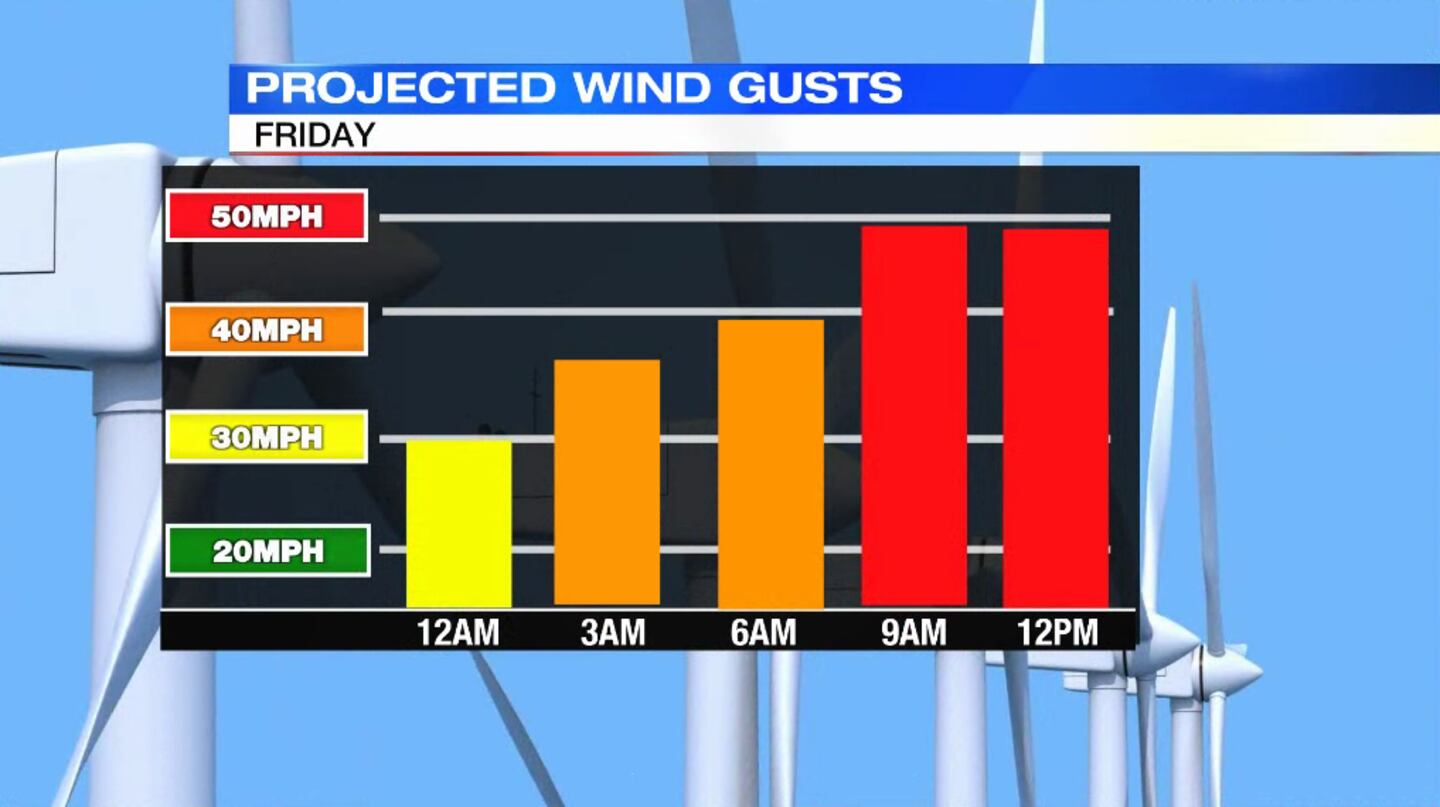
Wind: Winds may gust as high as 50 mph on Friday. This could lead to isolated power outages. It may be a good idea to bump the heat up in your house a bit Thursday night, just in case you lose power for some time Thursday night into Friday.
>>Lose power in the cold? Here’s what to do
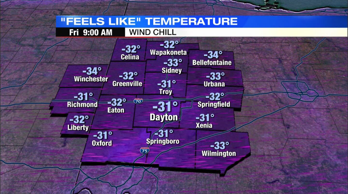
Wind Chills: Wind chill values will drop well below zero on Friday. The National Weather Service is suggesting these could be as low as -30. That is dangerous cold, and can lead to frost bite in as little as 30 minutes. You’ll want to limit your time outside on Friday.
Flash Freeze: The combination of rapidly dropping temperatures along with moisture on the roads from rain and snow will lead to flash freeze potential. Road conditions may quickly change from wet to slick in a short period of time Thursday night into early Friday. Be aware of this if you must travel during this time.
Precipitation Type: Rain, wintry mix, and and flurries are expected, then all snow.
Cold: Temperatures will be in the teens and single digits Friday through Sunday night.
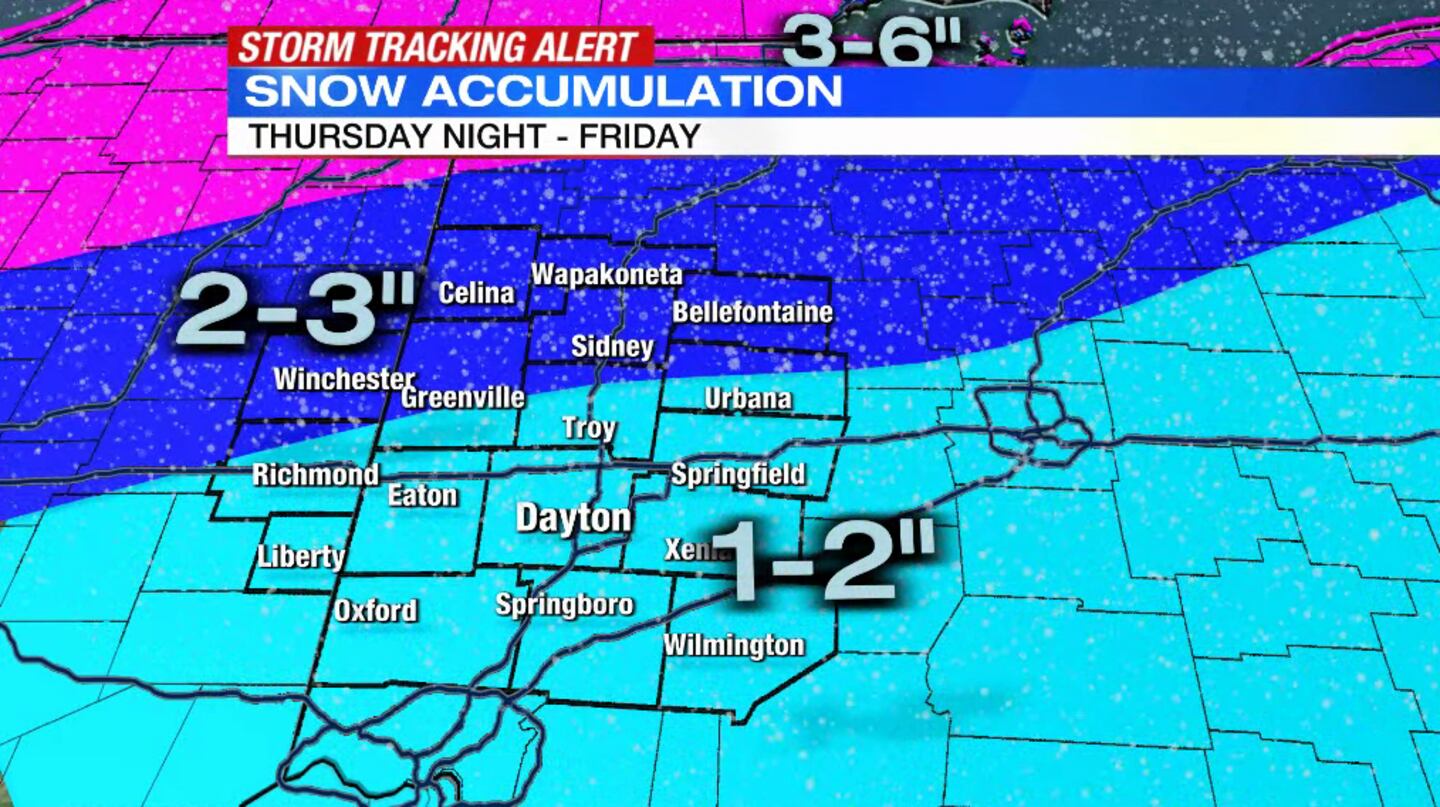
Snow Totals: Snow will amount to 1-3″ with isolated 4″ across the Miami Valley. This will not be a huge snow producer for us in terms of amounts, but this snow will still be impactful to travel. It will be of the powdery variety. That combined with wind will lead to roads remaining snow covered, Chaney said.
>>Winter Weather Awareness: Driving dangers
Storm Center 7 will have more model trends, the type of precipitation expected, and the impact a few days before the storm.
>>Winter Safety Awareness: How does salt help icy roads?
Impacts to you
Be ready for a windy and cold Christmas weekend, Storm Center 7 Meteorologist Kirstie Zontini said.
The roads will be tough to travel on Friday and Saturday when there is active rain and snow falling.
>>Winter weather: Tips for driving on snow and ice
It is expected to get extremely cold this weekend. Any moisture or snow will likely freeze Christmas morning.
Strong winds up to 50 mph may also create isolated power outages Friday night and Saturday morning.
Be ready to leave extra time to travel and check flights, Zontini said.
Stay tuned as Storm Center 7 tracks the first winter storm.
©2022 Cox Media Group


