
DAYTON — Good Sunday evening to you. Have you enjoyed the snow showers out there today? Meteorologist Nick Dunn here with you to close out the weekend. So far, as of 4:00 PM Today, Dayton has received 1.1 inches of fresh snow to bring the season total to 36 inches.
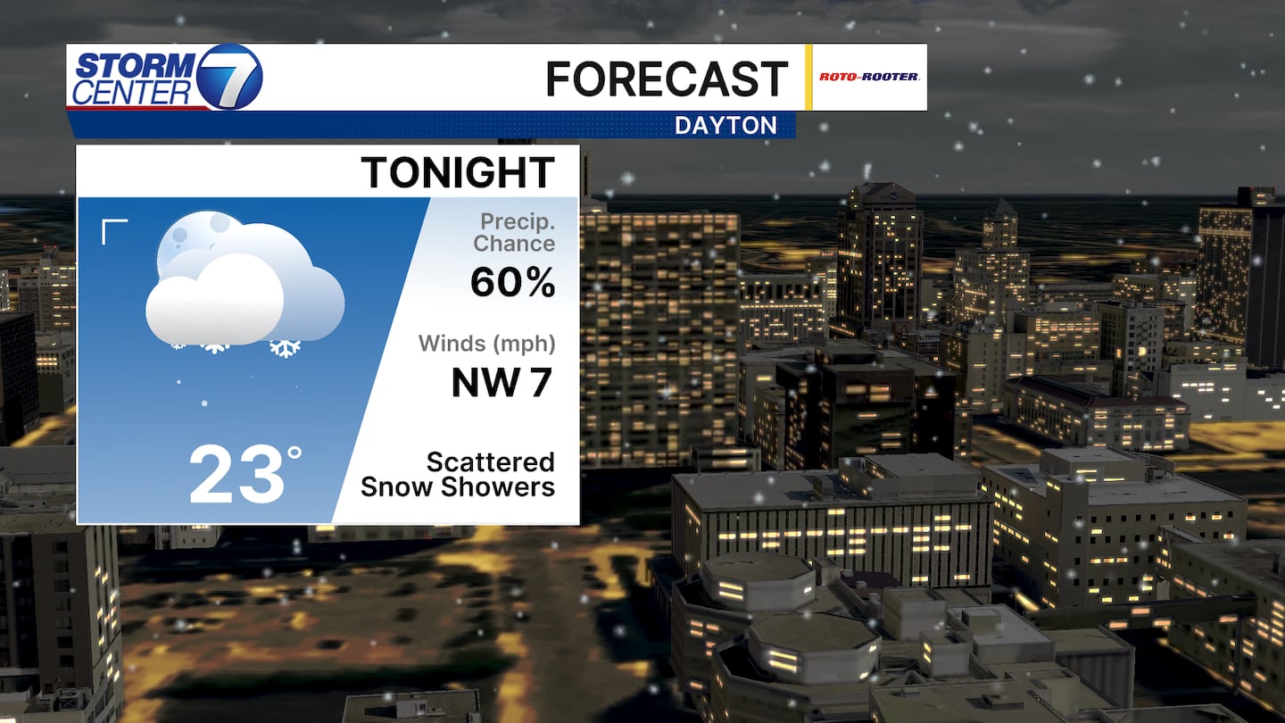
Tonight features additional scattered snow showers with cold temperatures in the lower 20s. Watch for a few slick spots on untreated, secondary, or elevated surfaces into early Monday morning.
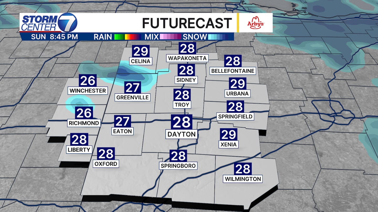
Futurecast shows the coverage of snow showers slowly tapering off after dark. A few streamer bands off Lake Michigan could bring additional localized accumulations to some spots, so be mindful if traveling.
[DOWNLOAD: Free Storm Center 7 Weather app for alerts as news breaks]
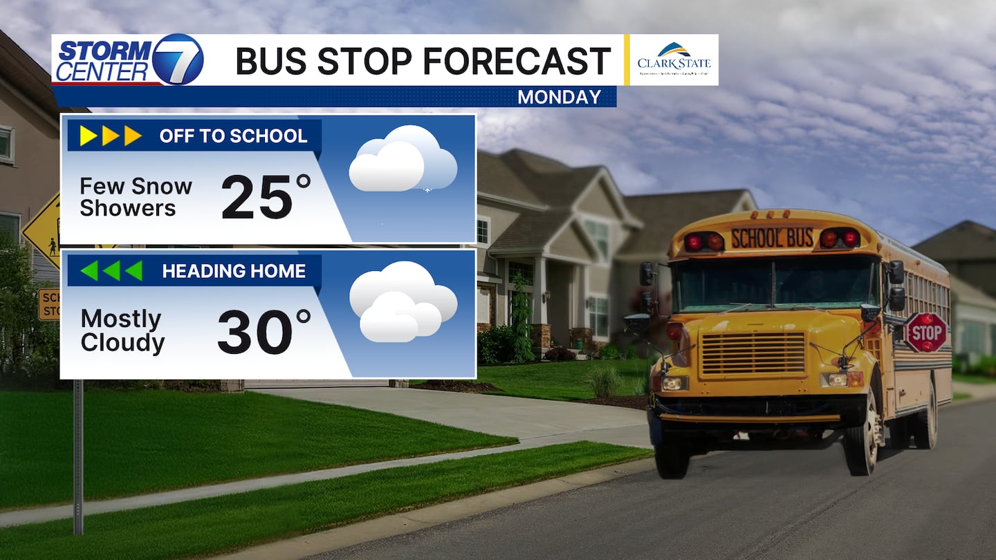
Tomorrow will be a cold day overall with highs more than ten degrees below average. The winter coats will be a necessary item stepping out the door to work or school.
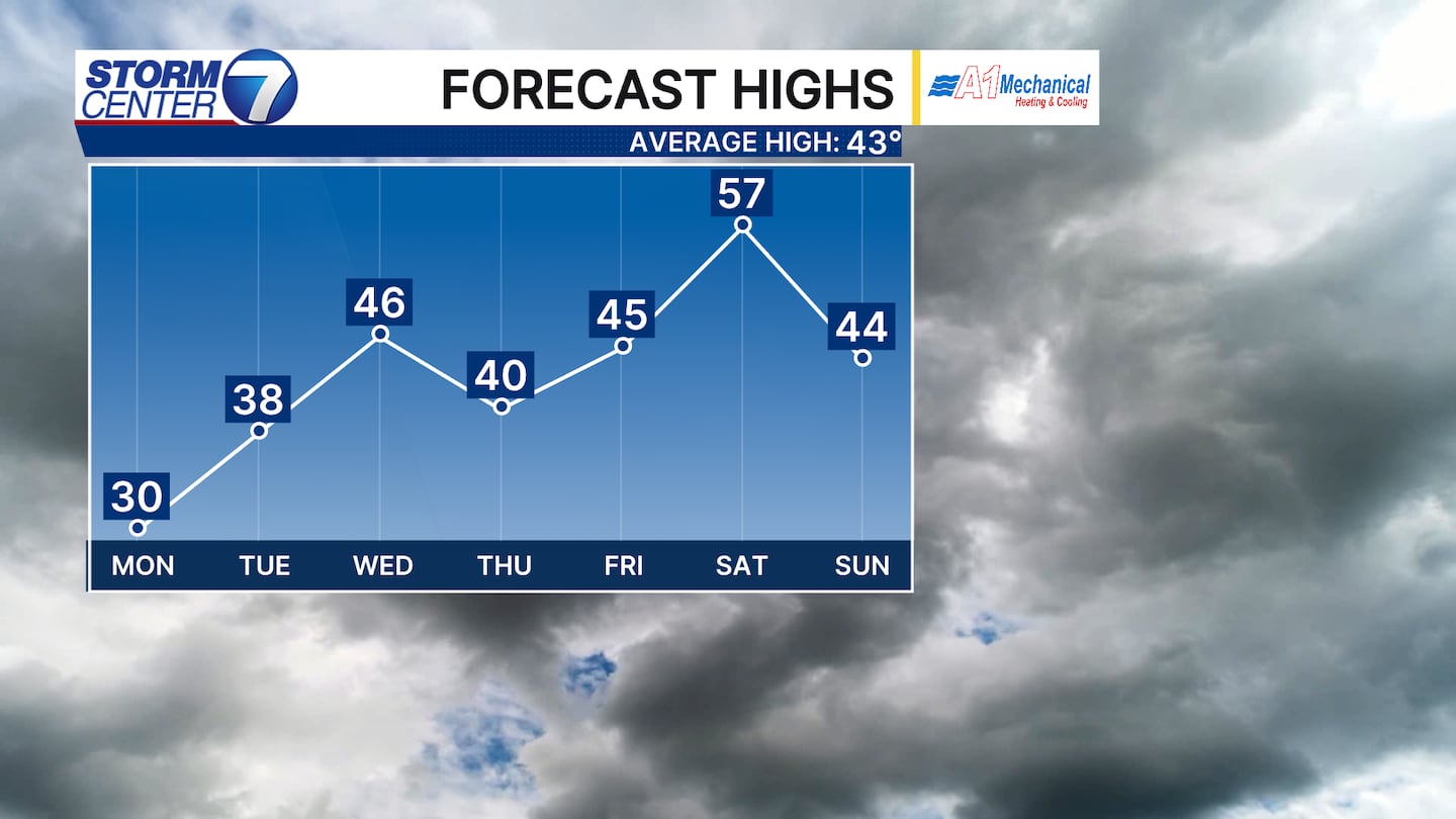
The ups and downs are noticed on the temperature trends this week for sure. Highs climb to the middle 40s for Wednesday before we see the arrival of our next system on Thursday.
[WATCH Storm Center 7 Weather on the following devices]
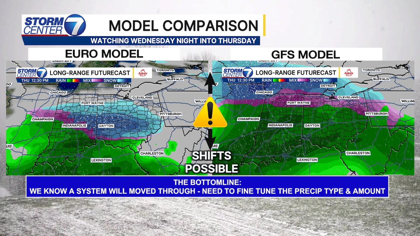
We have some model madness if you will for late Wednesday into Thursday. We know a system will be moving through, but the specifics will need ironed out as we draw a bit closer.
Warmer temperatures and a north track would mean more rain or a mix. On the opposite side, colder temperatures and a south track would mean more rain. The forecast is written in pencil right now!
©2026 Cox Media Group


