
DAYTON — Good afternoon, everyone. We are in the middle of one of the warmest March days on record for Dayton as highs have soared into the middle 80s. Right now, the air is “capped” and there is a lack of storm development. What exactly is the “cap” you ask?
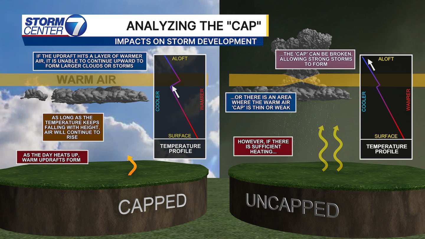
Think of the “cap” like you are boiling water on a stove. The lid on that pot prevents steam from rising. In the atmosphere, a “cap” prevents vertical cloud development. We hope this holds to prevent surface-based storms with the cold front tonight. This is a conditional threat and far from guaranteed. If a storm broke through the cap, we could see an isolated tornado and large hail.
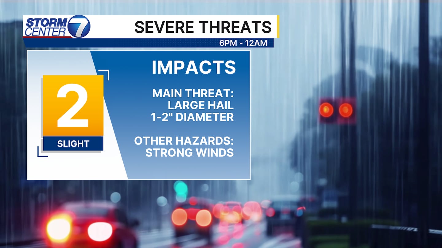
After the cold front passes, we expect thunderstorms to develop behind the front. This threat remains unchanged and confidence is higher in this happening between 6PM and Midnight. The main threat is large hail, with some hailstones of 1 to 2 inches in diameter possible.
[DOWNLOAD: Free Storm Center 7 Weather app for alerts as news breaks]
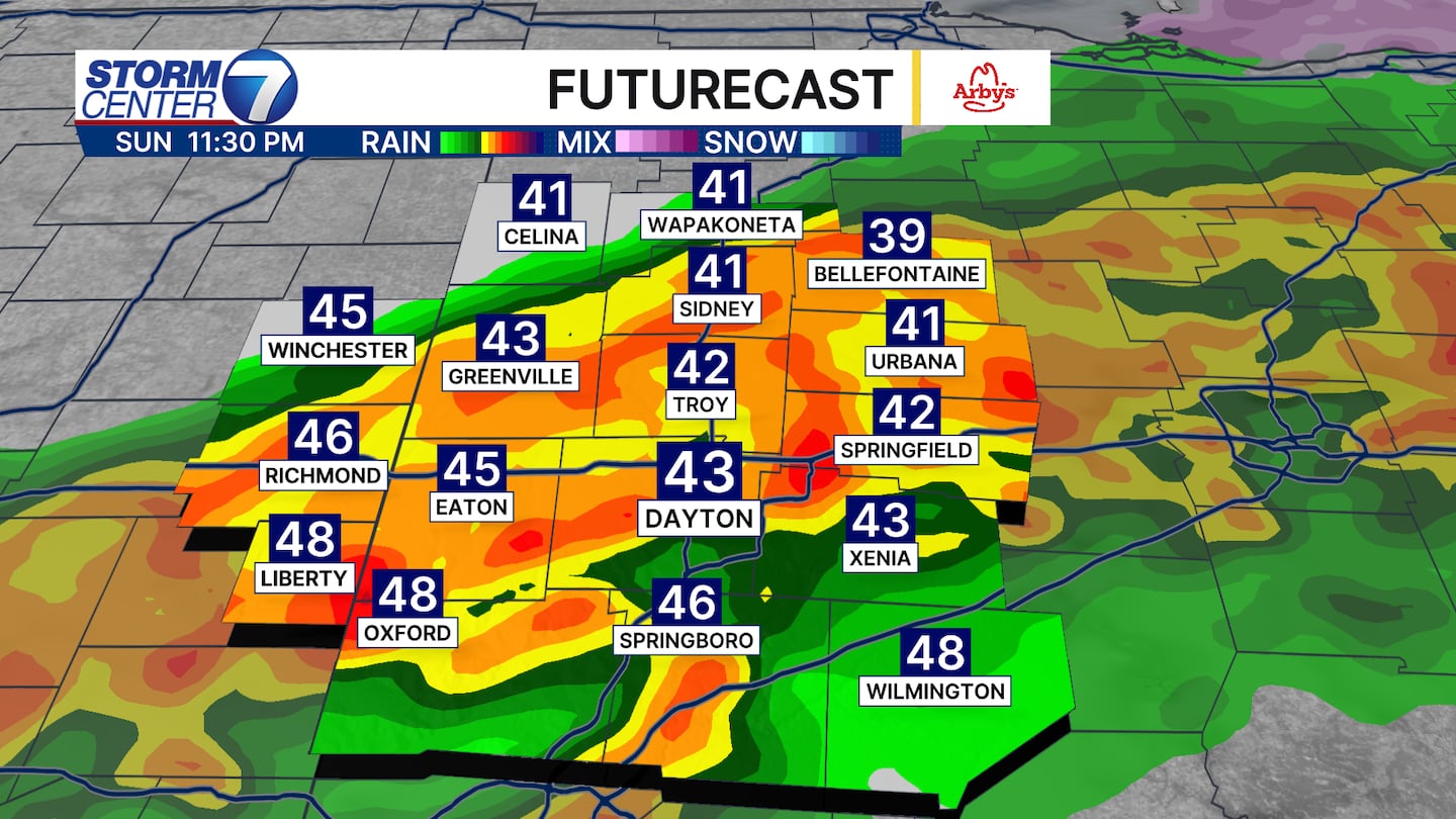
Despite temperatures falling tonight down into the 40s and 50s with thunderstorms moving through, large hail remains possible due to elevated instability behind the front. That means updrafts are elevated and those provide a favorable environment for large hail to become a hazard. Storms exit by Midnight or so as temperatures continue to fall.
[WATCH Storm Center 7 Weather on the following devices]
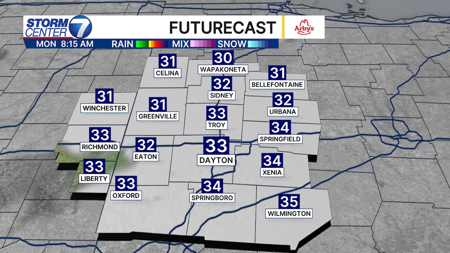
By tomorrow morning, we are digging the sweatshirts out with temperatures near the freezing mark. We are dry to start the work week, just much cooler than where we are today.
©2026 Cox Media Group


