QUICK-LOOK FORECAST:
- Showers taper tonight
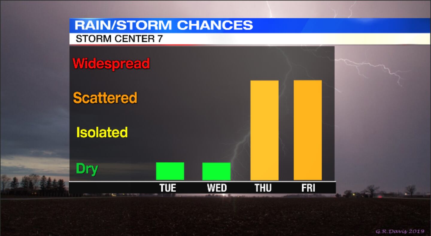
- Cooling off this week
- More rain Thursday and Friday
>>TRACK THE CONDITIONS: Live Doppler 7 Radar
DETAILED FORECAST:
TODAY: Cloudy and cool through the evening with temperatures falling through the 50s with a few passing light showers still possible. Clouds will linger through the night, but the showers will taper. Winds diminish a bit, too. Overnight lows fall to the middle 40s.

TUESDAY: A cool and breezy day expected for Tuesday. Mostly cloudy early with a stray sprinkle possible then skies clear into the afternoon.
Temperatures will be cooler than normal with highs only reaching the middle 50s.
A few clouds around for Tuesday night, but with enough clearing and lighter winds, temperatures will fall into the upper 30s. Some patchy frost may develop because of the colder temperatures.
WEDNESDAY: A cold morning with some spotty frost early. Sun and scattered clouds through the day. Cool again with highs around 60.
THURSDAY: Clouds increase quickly for Thursday with scattered showers arriving in the afternoon. Highs in the lower 60. Winds pick back up.
FRIDAY: Scattered showers and a few rumbles of thunder possible. Highs around 60. Cloudy and breezy.

SATURDAY: Cloudy with a few scattered showers early Saturday then drying out with decreasing clouds. Highs in the upper 50s.
SUNDAY: Sun and a few clouds around for Sunday. It will be a typical fall day with highs around 60 degrees.
©2021 Cox Media Group