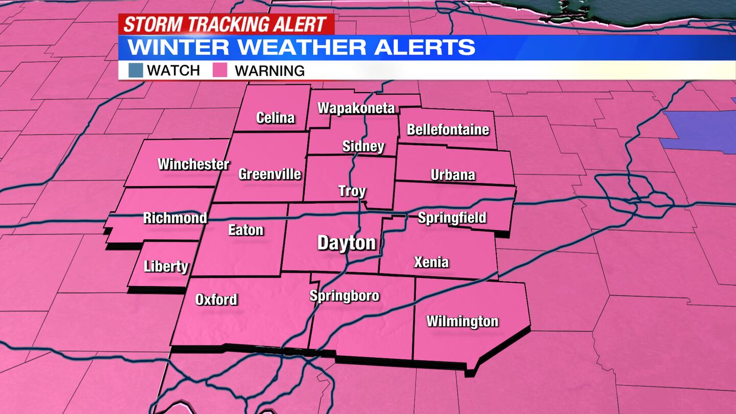
A Winter Storm Warning is now in effect for Auglaize, Darke, Logan, Mercer and Shelby counties until 7 a.m. Friday.
A Winter Storm Warning goes into effect for Champaign, Miami, Preble, Clark, Montgomery and Greene counties and Wayne and Union counties in Indiana at 5 p.m. The Warning is in effect until 7 a.m. Friday.
A Winter Storm Warning goes into effect for Butler, Clinton and Warren counties at 7 p.m. and lasts until 7 a.m. Friday.
>>What We Know: Winter Storm warning, watch issued for region; Accumulating ice, snow expected
QUICK-LOOK FORECAST:
- Winter Storm Warning through Friday AM
- Wintry mix to snow tonight into Thursday
- Very cold to end the week
>>TRACK THE CONDITIONS: Live Doppler 7 Radar
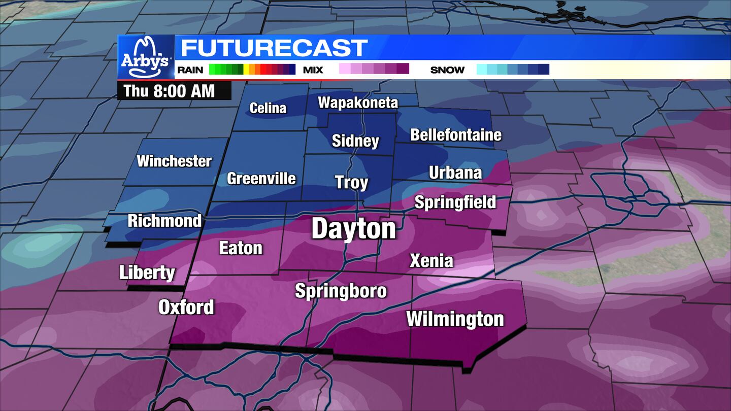
TONIGHT: Steady rain showers have started to transition to a wintry mix and even snow across northwestern portions of the Miami Valley.
I-70 may become a good dividing line between the wintry mix and all snow.
This divide looks to persist through the night leading to icing south of I-70, and heavy snow accumulation north of I-70.
>>AES Ohio preparing for winter storm, offering tips if outages occur

THURSDAY: Steady sleet and freezing rain expected through the southern Miami Valley during the day with snow across the northern Miami Valley. Eventually, the entire area transitions to snow.
Heavy wet snow on top of ice will cause significant travel problems and the potential for power outages. Temperatures will start near 30 degrees in the Dayton area, colder north, and drop as a cold front moves through. It will also be quite windy at times.
Blowing and drifting snow Thursday evening will keep roads snow covered.
>> ODOT says anticipated rain will impact road preparations ahead of midweek storm
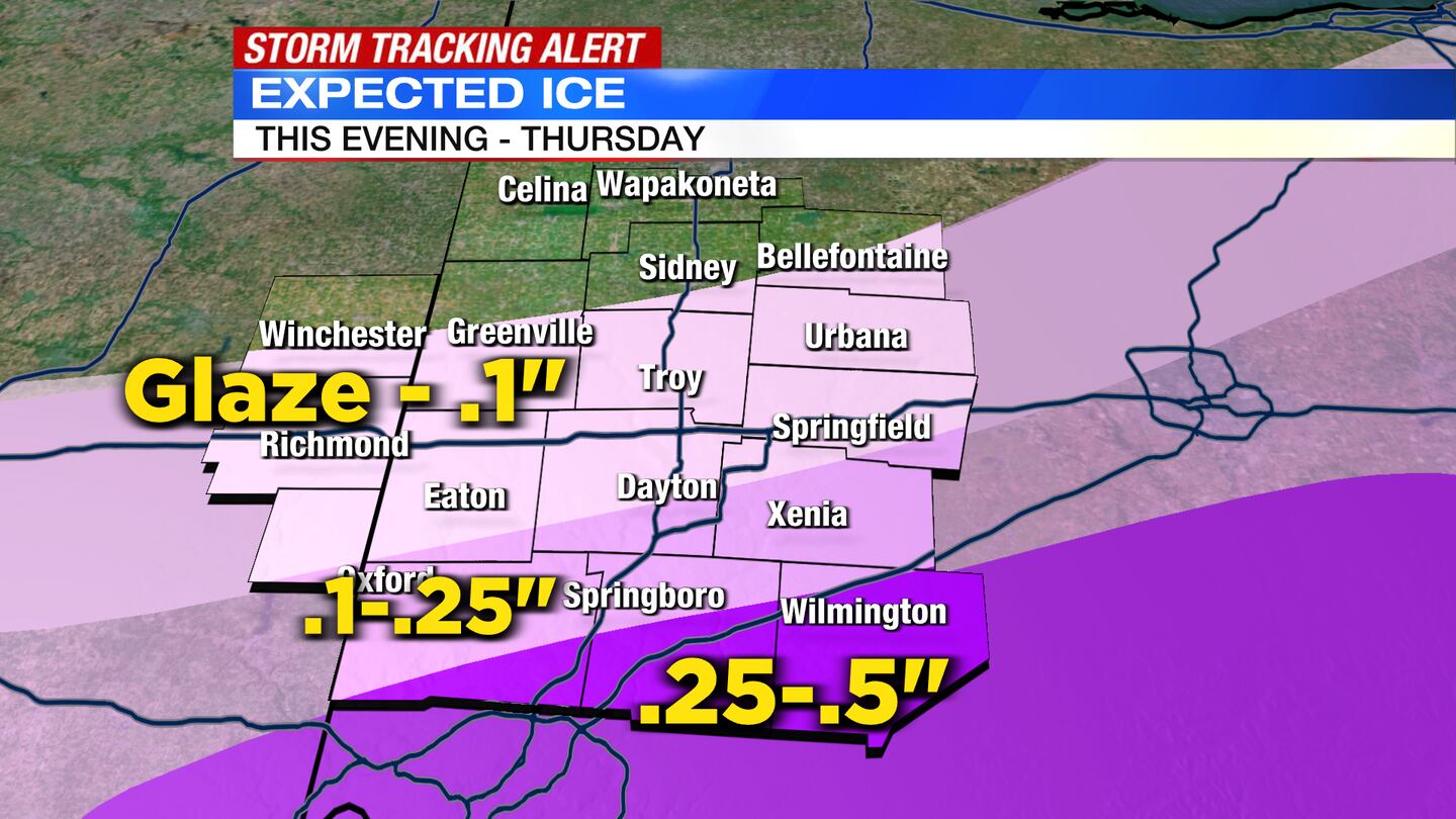
Expected Ice accumulations:
- Up to .25″ south of Eaton, to Dayton, to Springfield
- Up to .5″ south of Hamilton, to Springboro, to Wilmington
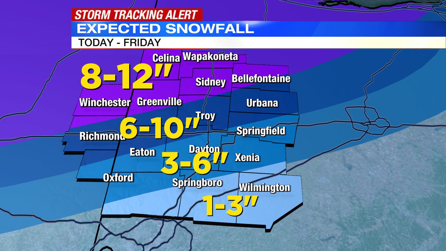
Expected Snow totals:
- Winchester to Bellefontaine northward: 8-12″ Eaton to Urbana: 6-10″
- Hamilton to Xenia: 3-6″
- Springboro to Wilmington: 1-3″
FRIDAY: There may be passing snow flurries or light snow showers early to the southeast, otherwise dry conditions expected.
Cloudy skies Friday morning, gradually clearing as the winter storm pulls away. Cold with high temperatures only warming to the upper teens in many places.
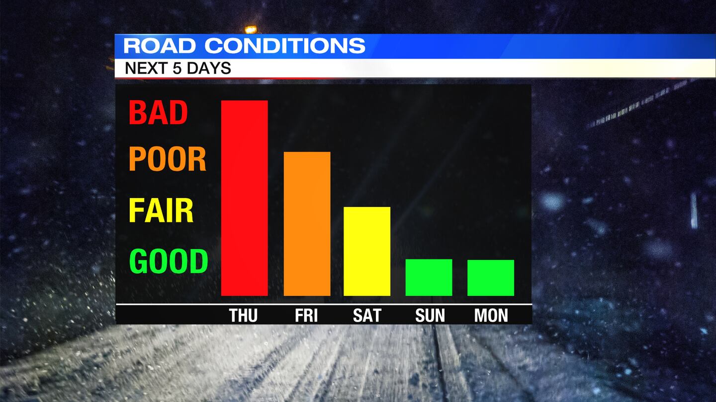
SATURDAY: A very cold morning, with temperatures near or below zero to start. Even with sunny skies, temperatures will top out in upper teens to lower 20s.
SUNDAY: Sun and a few clouds around on Sunday. A chilly day, but not as cold with highs in the lower 30s.
MONDAY: Partly sunny and cold. Highs in the upper 20s.
TUESDAY: A chilly day, but mostly sunny with highs in the lower 30s.
WEDNESDAY: Sun and a few clouds for Wednesday. Highs closer to normal in the upper 30s.
©2022 Cox Media Group


