
DAYTON — An area of low pressure is developing near the Four Corners region in the SW parts of the lower 48.
Currently, the low is disorganized, but it will get its act together over the next 24 hours and bring the Miami Valley a chance for rain and storms this weekend.
[DOWNLOAD: Free Storm Center 7 Weather app for alerts as news breaks]
Saturday, a weak wave will pass by early in the morning.
This will bring a slight chance of a shower around 6 to 8 AM. Most will stay dry.
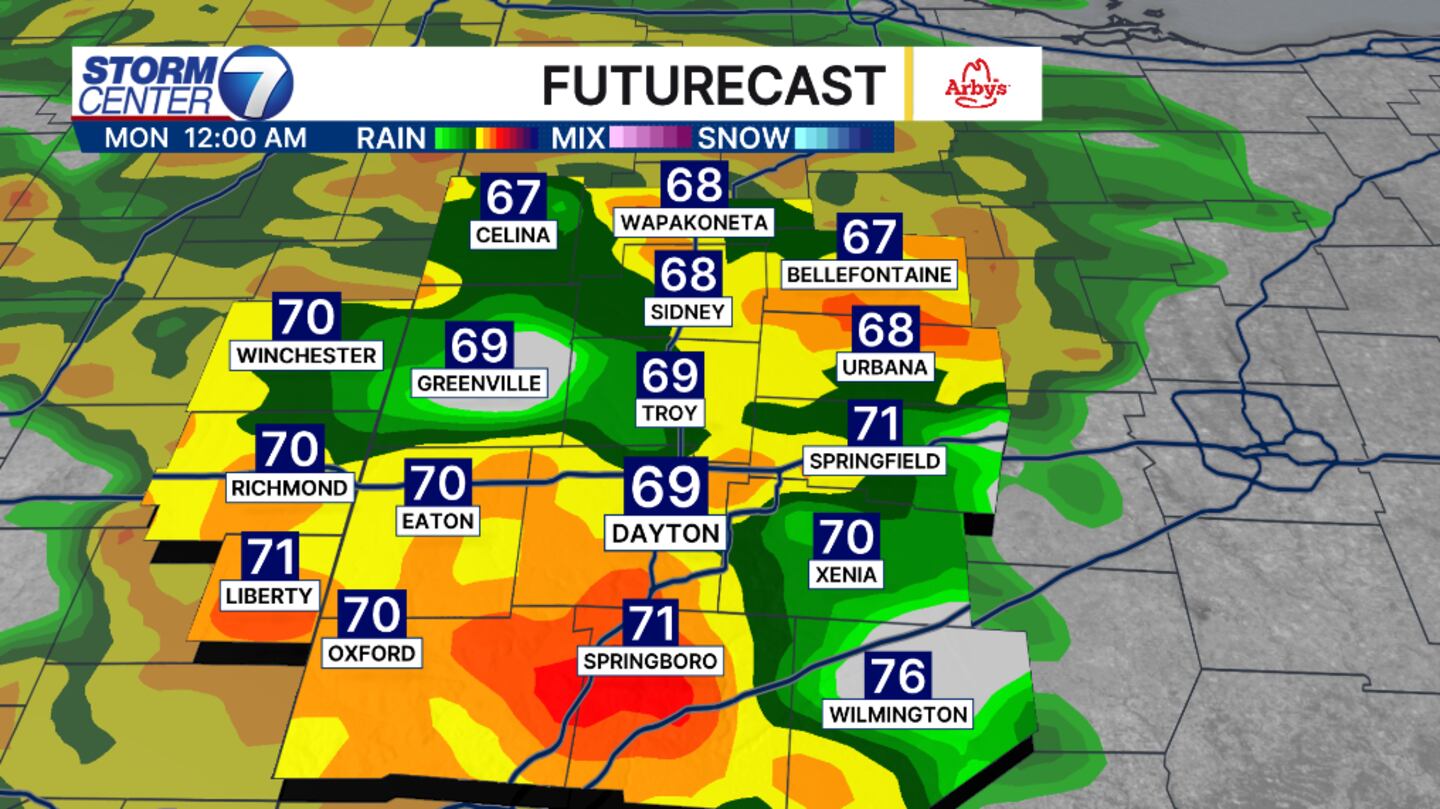
The main event will come late Sunday and into Monday morning.
Because the low hasn’t fully developed, there is still some uncertainty on the timing.
[WATCH Storm Center 7 Weather on the following devices]
The severe weather threats are low, but a few stronger storms can’t be ruled out overnight Sunday.
Wind would be the biggest threat. However, higher rain totals from the last system have allowed for rivers and creek beds to rise.
An additional 2 inches of rain with isolated higher amounts are forecast through Monday.
There is currently a slight risk for flooding during that time frame. This is a level 2 of 4.
Please remember to turn around and find a different route if you come across a roadway in water.
This will impact your Monday morning commute next week.
©2026 Cox Media Group


