QUICK-LOOK FORECAST:
- Cold and quiet end to the week
- More snow and frigid this weekend
- Snow storm possible late Monday
>>TRACK THE CONDITIONS: Live Doppler 7 Radar
DETAILED FORECAST:
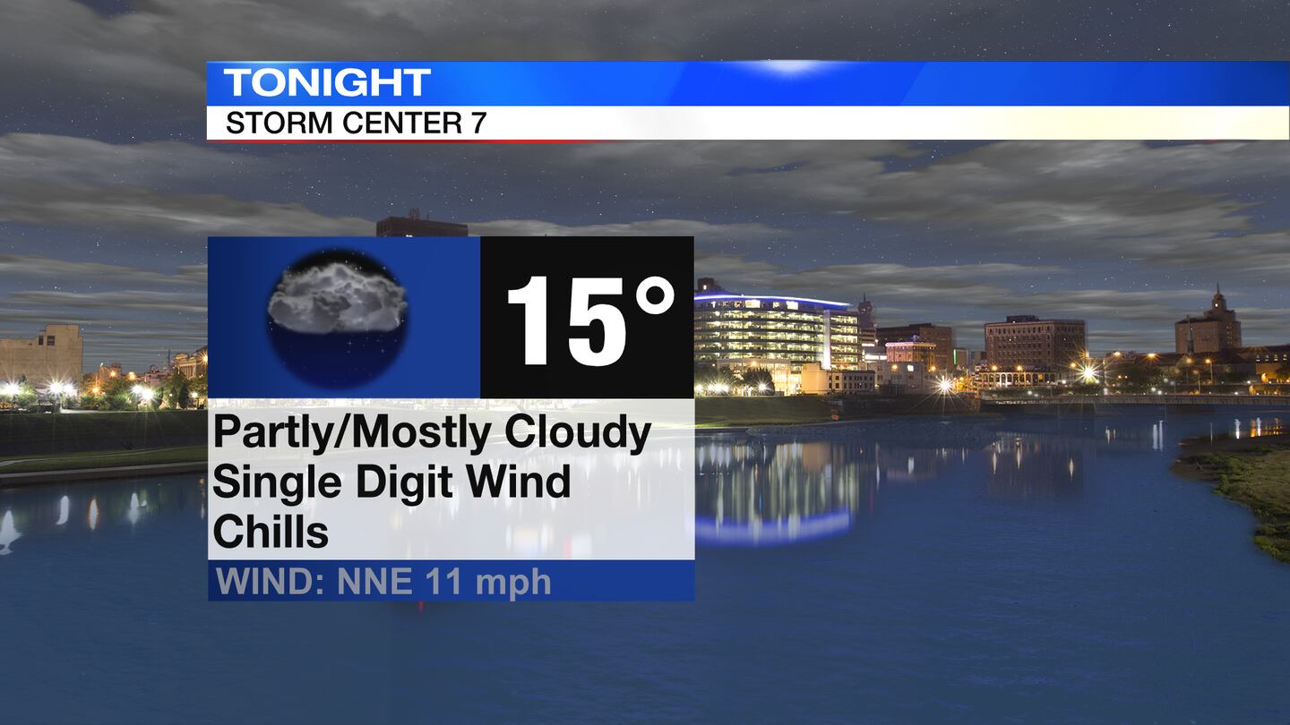
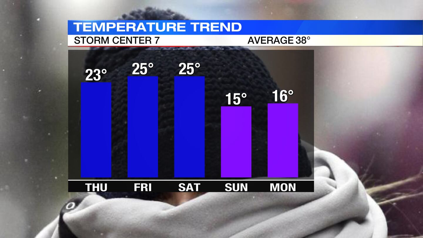
THURSDAY: Cloudy, breezy, and cold tonight with temperatures falling into the middle teens. Wind chills will dip into the single digits. Isolated slick spots may be leftover in areas from snow last night into this morning.
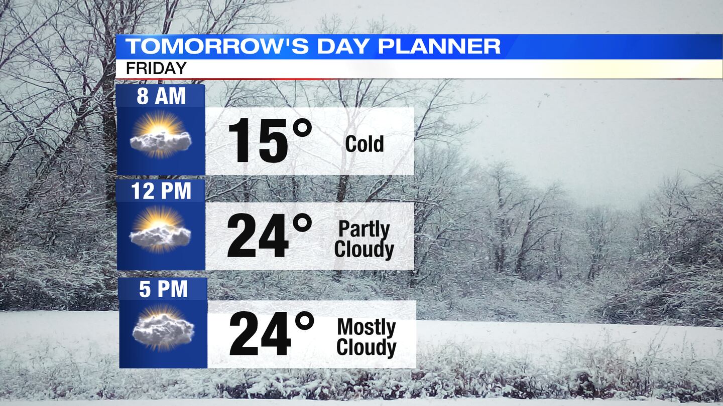
FRIDAY: Partly sunny and very cold to end the week. Temperatures on Friday will climb to the lower to middle 20s then fall to the lower teens Friday night.
SATURDAY: Clouds thicken for Saturday with a few passing light snow showers in the afternoon and evening. It will be a breezy and cold day with highs in the middle 20s. A coating up to an inch of snow is possible. This may cause icy spots around the Miami Valley.
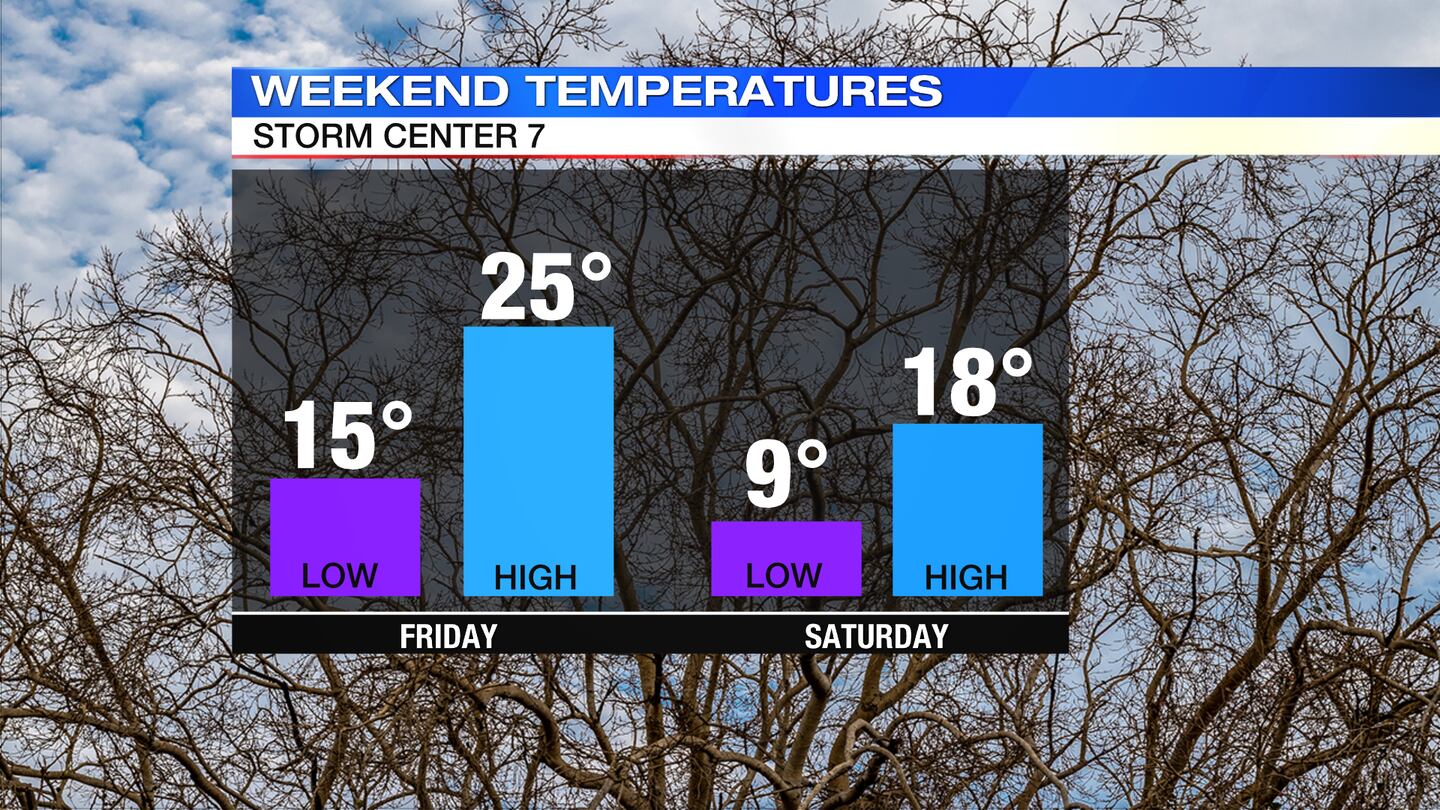
SUNDAY: Partly sunny and very cold for Sunday. Highs for the day in the middle to upper teens. Wind chills dropping below zero at times. Arctic air continues to push in through the overnight and into Monday.
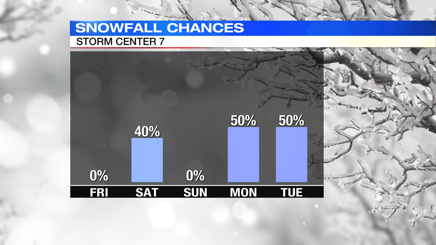
MONDAY: Frigid to start Monday with single digit temperatures and wind chills below zero. Highs only in the middle teens. Snow showers will arrive later in the day into Monday night. Some ice mixing in across the south is possible. This is an evolving storm, but indications show there could be high impacts based on snow and ice accumulations.
Cox Media Group


