
MIAMI VALLEY — The majority of watches and warnings have expired for the region as storms move out.
[DOWNLOAD: Free WHIO-TV News app for alerts as news breaks]
TRENDING STORIES:
- Anne Burrell, TV chef who coached the ‘Worst Cooks in America,’ dies at 55
- Do you drive to Wright-Patt? This change could impact you next week
- Moving road closures expected as over 400K pound ‘superload’ moves through area
The Storm Prediction Center (SPC) has parts of the region under an Enhanced Risk for storms, Level 3 of 5. This includes most of Montgomery County.
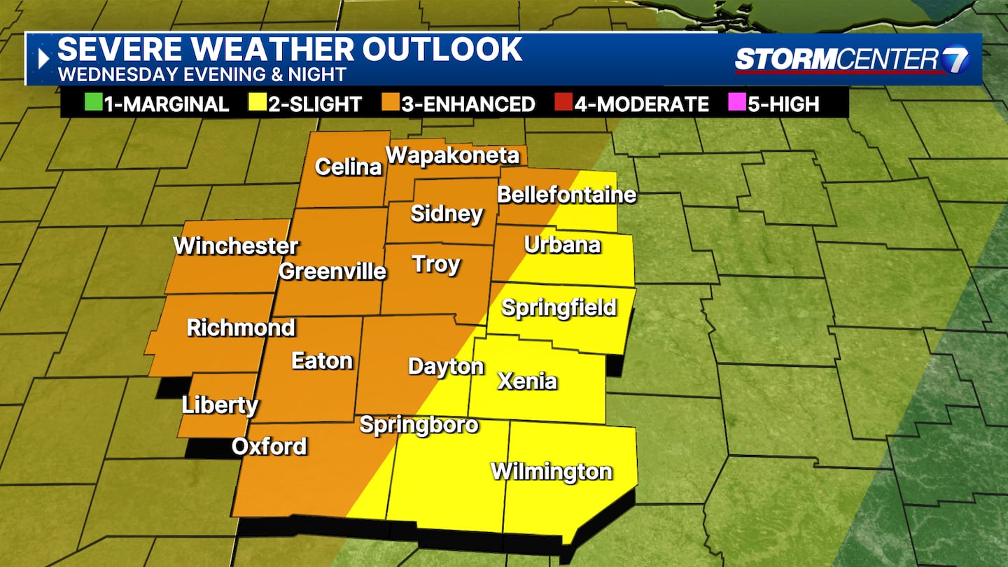
Marnado says this is increasing confidence that most of us could see a severe storm.
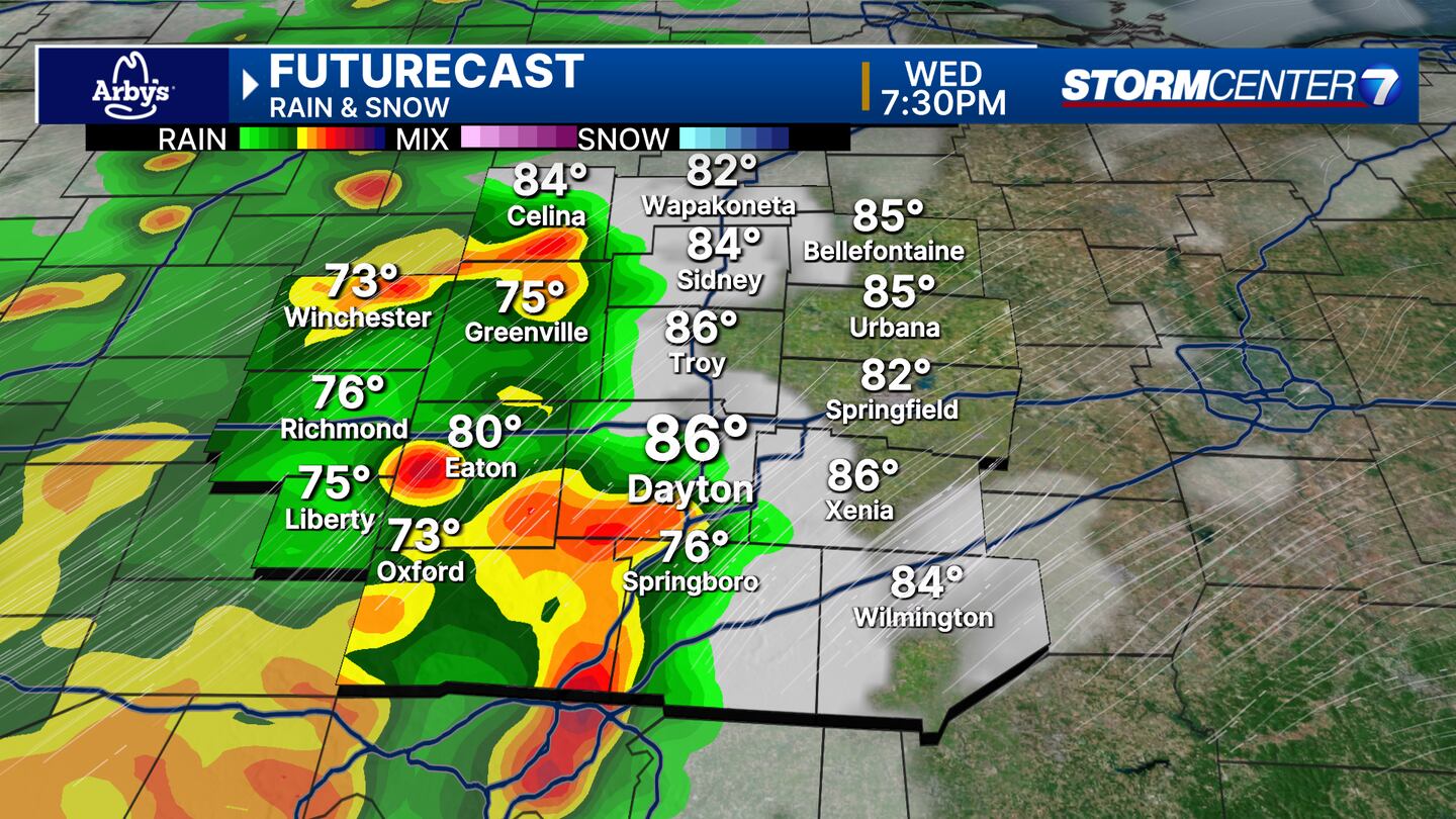
Storm Center 7 is tracking a Mesoscale Convective System (MCS). What is an MCS?
It is a line of strong storms that brings mainly a damaging wind threat. An MCS can occasionally include hail or brief tornadoes.
Recognizing the pattern that causes MCS is easy, according to Marando.
It says specifically what time and where they’ll hit is more difficult.
TIMING
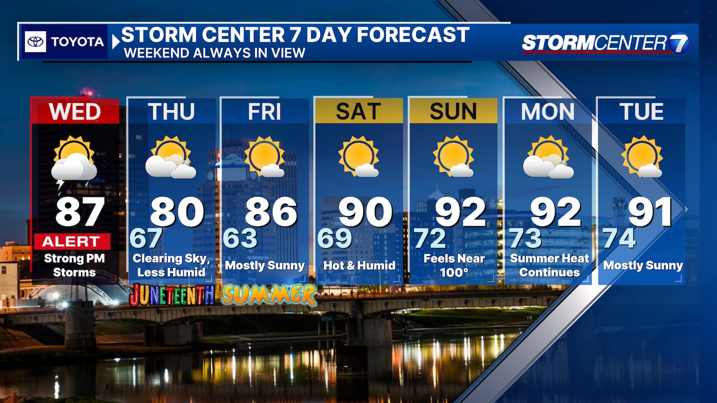
We will see partly cloudy skies Wednesday morning through the early afternoon hours. An isolated storm is possible during that timeframe, Marando says.
The best timeline is Wednesday night from 5 p.m.-10 p.m.
IMPACTS
Storm threats include mainly damaging winds, but also a lower, but not zero, risk of large hail and/or isolated tornadoes.
SPC indicates a level 3/5 risk for part of the DMA, 2/5 risk elsewhere.
Storm Center 7 will continue to update this story.
[SIGN UP: WHIO-TV Daily Headlines Newsletter]
©2025 Cox Media Group


