DAYTON — Good morning, and happy Friday to all of you! Meteorologist Nick Dunn here with you.
The calendar reads January 9th, but the thermometer is reading more April-like than January this morning.
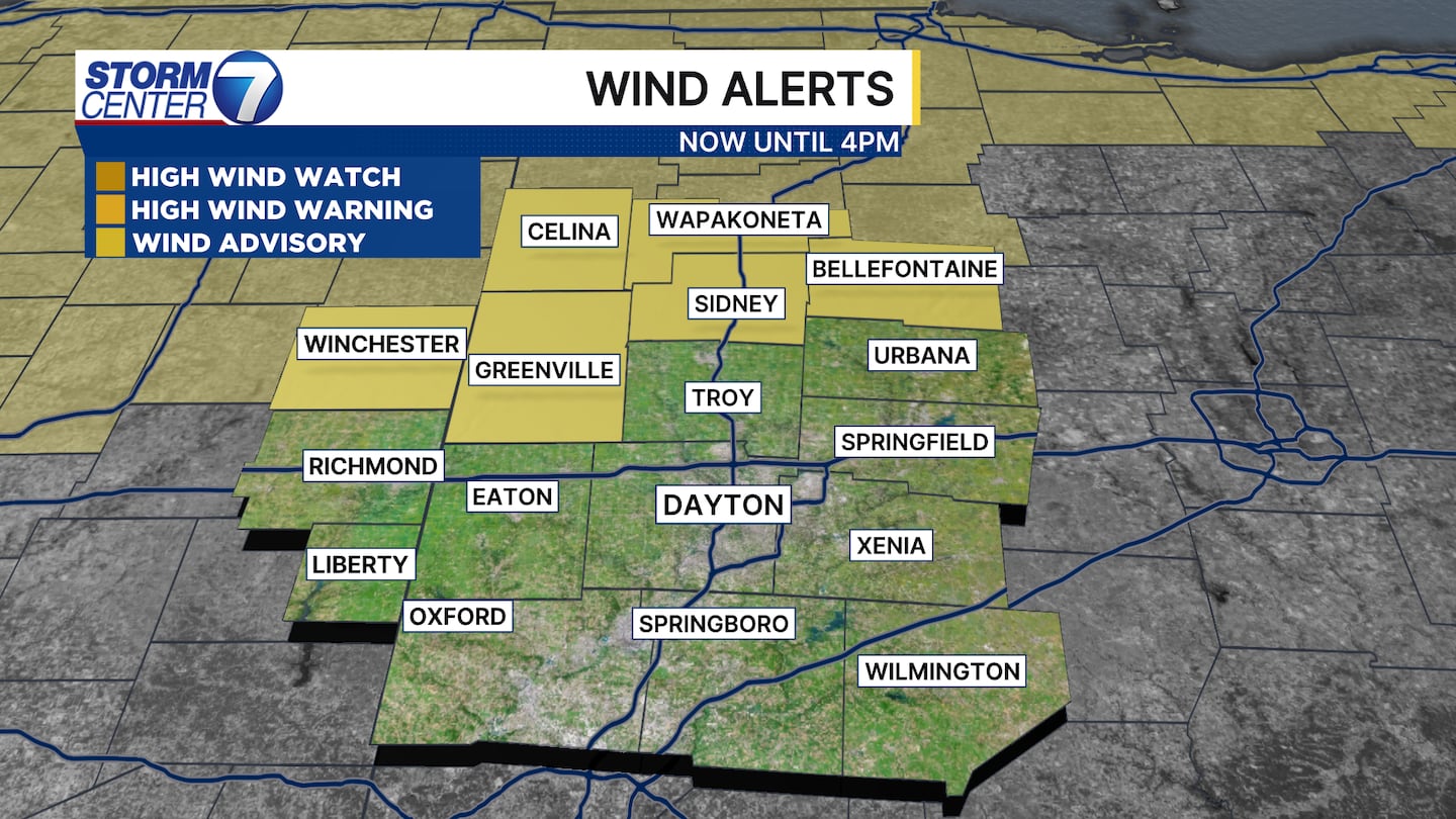
A Wind Advisory has been issued for Auglaize, Darke, Logan, Mercer, and Shelby counties in Ohio until 4 p.m. today. It has also been issued for Randolph County in Indiana until 11 a.m.
[DOWNLOAD: Free WHIO-TV News app for alerts as news breaks]
We already broke the record high for January 9th! We had been talking about this chance all week long.
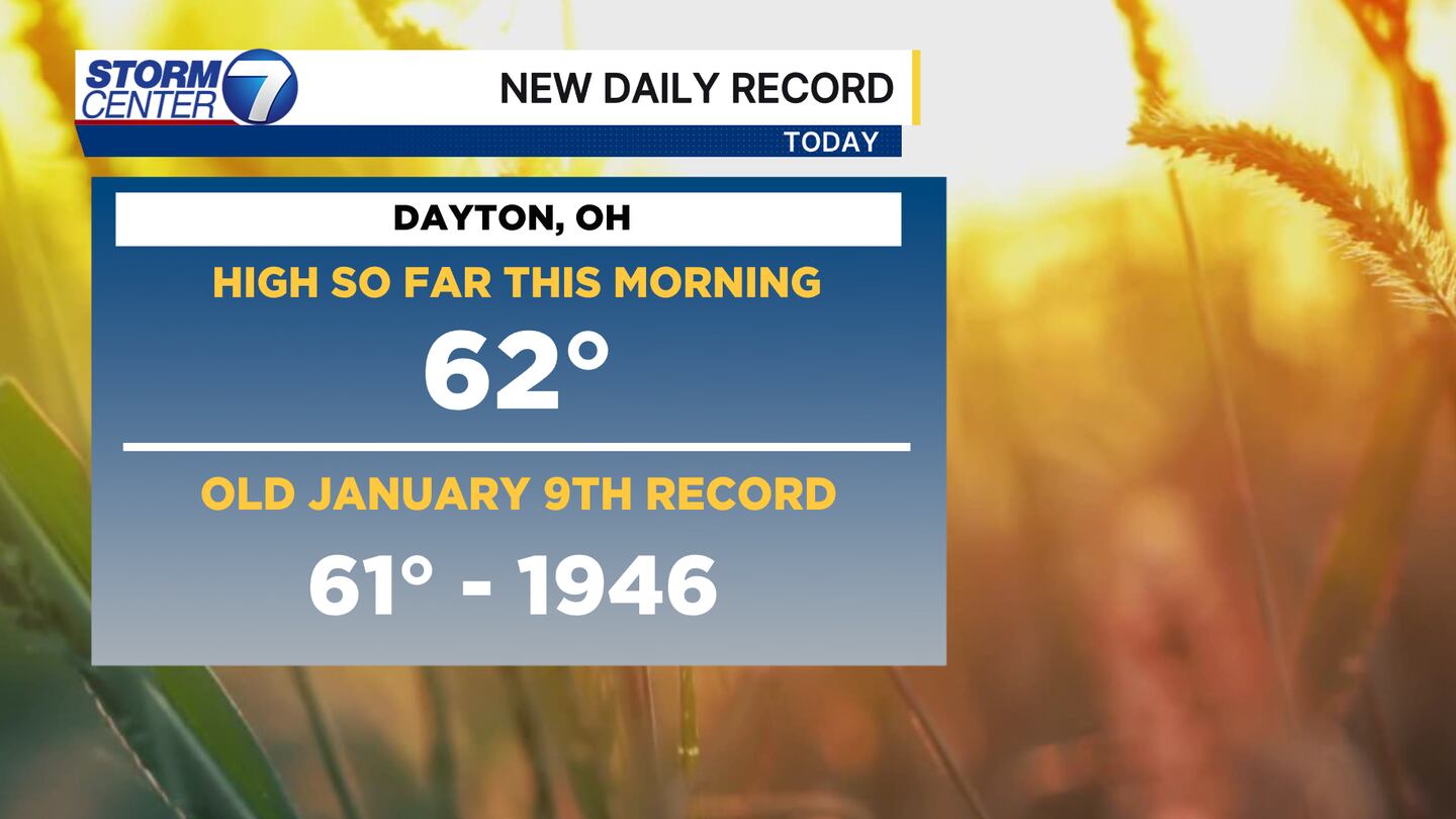
The record high took place around 2:30 AM this morning at the Dayton international Airport. For reference, these are highs we generally see in April! However, this does not break the all-time warmest January day ever, or even close to it. That took place on January 21, 1906 (75 degrees).
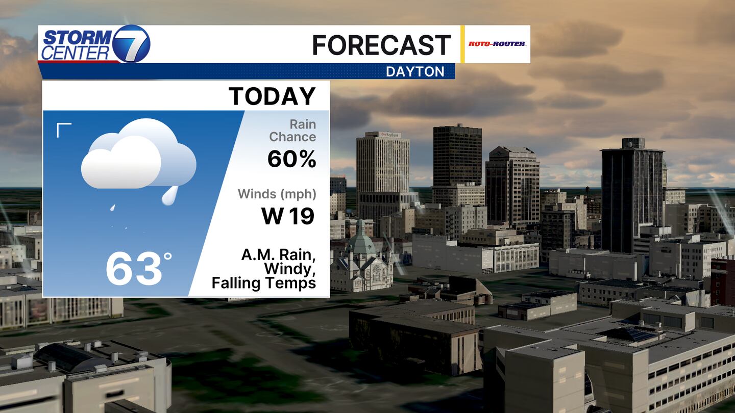
We may warm up another degree or so this morning as rain moves through. Eventually, temperatures will fall to near 50 degrees by the time you come home from work.
[DOWNLOAD: Free Storm Center 7 Weather app for alerts as news breaks]
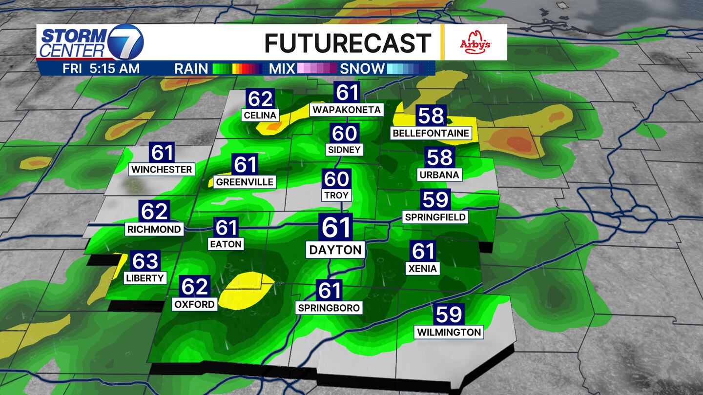
It has been a dry month so far, so it is nice to see some rain moving through this morning. Most of this ends before 11:00 AM this morning, but after that is when temperatures fall.
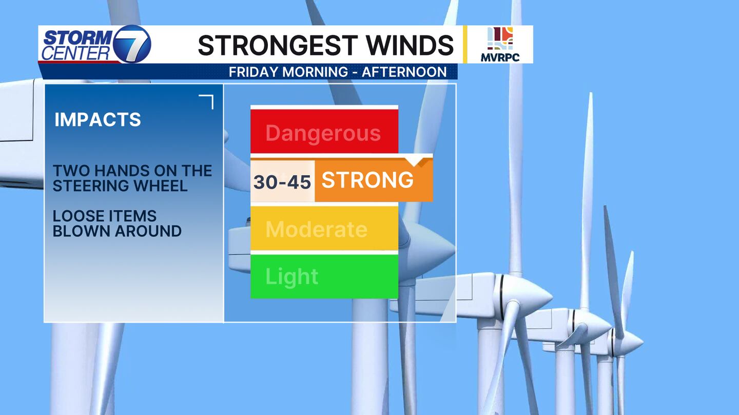
Expect windy conditions to continue through much of the day. You will find an abrupt decrease win winds after sunset this evening. Any loose items can be blown around. Winds will be south for now before changing to westly this afternoon.
[WATCH Storm Center 7 Weather on the following devices]
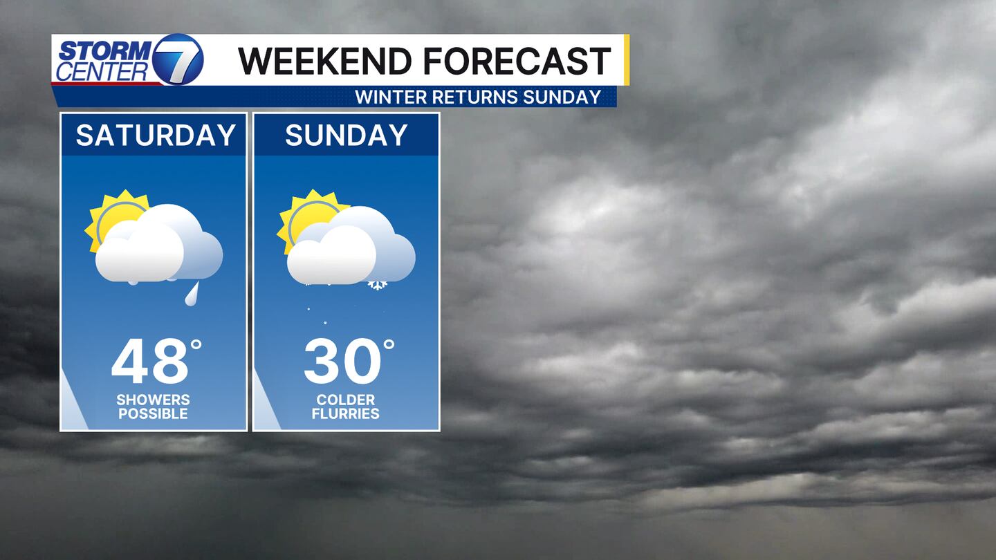
More rain showers are likely on Saturday before we turn sharply cooler with highs near 30 on Sunday! There may also be a few flurries flying around!
Additionally, wind chills make a sharp return as well by Sunday morning! So, those Winter coats that have been in the closet this week can be taken out and ready to go by Sunday morning. Have a great day!
©2026 Cox Media Group


