Areas of fog and drizzle remain possible through the night, Storm Center 7 Chief Meteorologist Eric Elwell said. Temperatures hold near 50 before rising toward morning.
QUICK-LOOK FORECAST
- Showers, patchy fog tonight
- Rain, heavy at times, Thursday
- Chance of wintry mix this weekend
>> Solar Storm: Could hit parts of Earth Thursday morning
DETAILED FORECAST
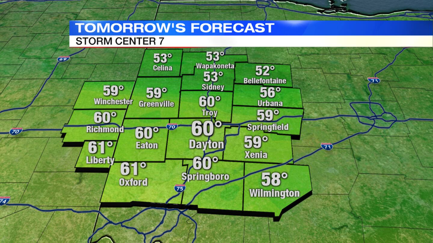
Thursday: Showers will be likely and could be heavy at times with rumbles of thunder possible. Temperatures will soar to near 60 degrees.
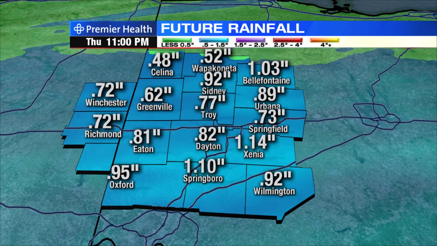
>> Heavy rains could cause minor flooding this week
>> SkyWitness7
Friday: Showers may mix with snow before ending in the morning. Clouds will break a little bit into the afternoon. A high temperature around 40 will occur early in the day with temperatures dropping throughout the day.
Saturday: Clouds will increase with a wintry mix or straight snow developing. Snow accumulation will be possible at night. Highs will be in the upper 30s.
Sunday: Mostly sunny skies and highs in the lower 40s.
Monday: Rain will return to the area with highs in the lower 50s.


