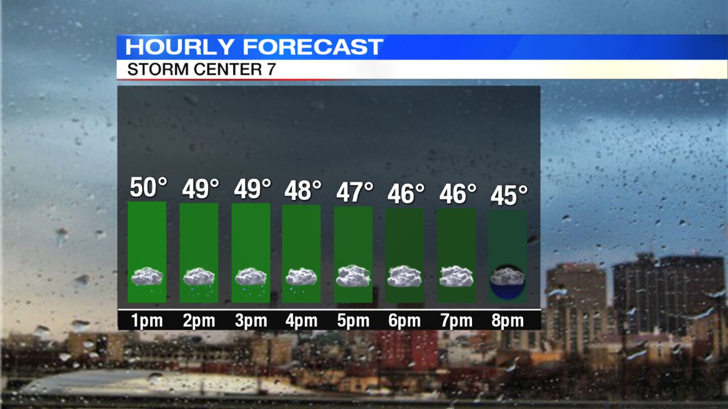
Rain is likely through the early afternoon before tapering off, Storm Center 7 Chief Meteorologist Eric Elwell said. Temperatures will fall through the 50s into the 40s during the afternoon with gusty west winds.
QUICK-LOOK FORECAST:
- Rain, gusty winds lingering today
- Colder air moves in tonight and Monday
- Passing snow showers to start the workweek
Live Doppler 7 Interactive Radar

DETAILED FORECAST:
Tonight: Occasional light showers or drizzle will be possible. There is a chance for some flurries toward morning as temperatures drop into the 30s overnight.
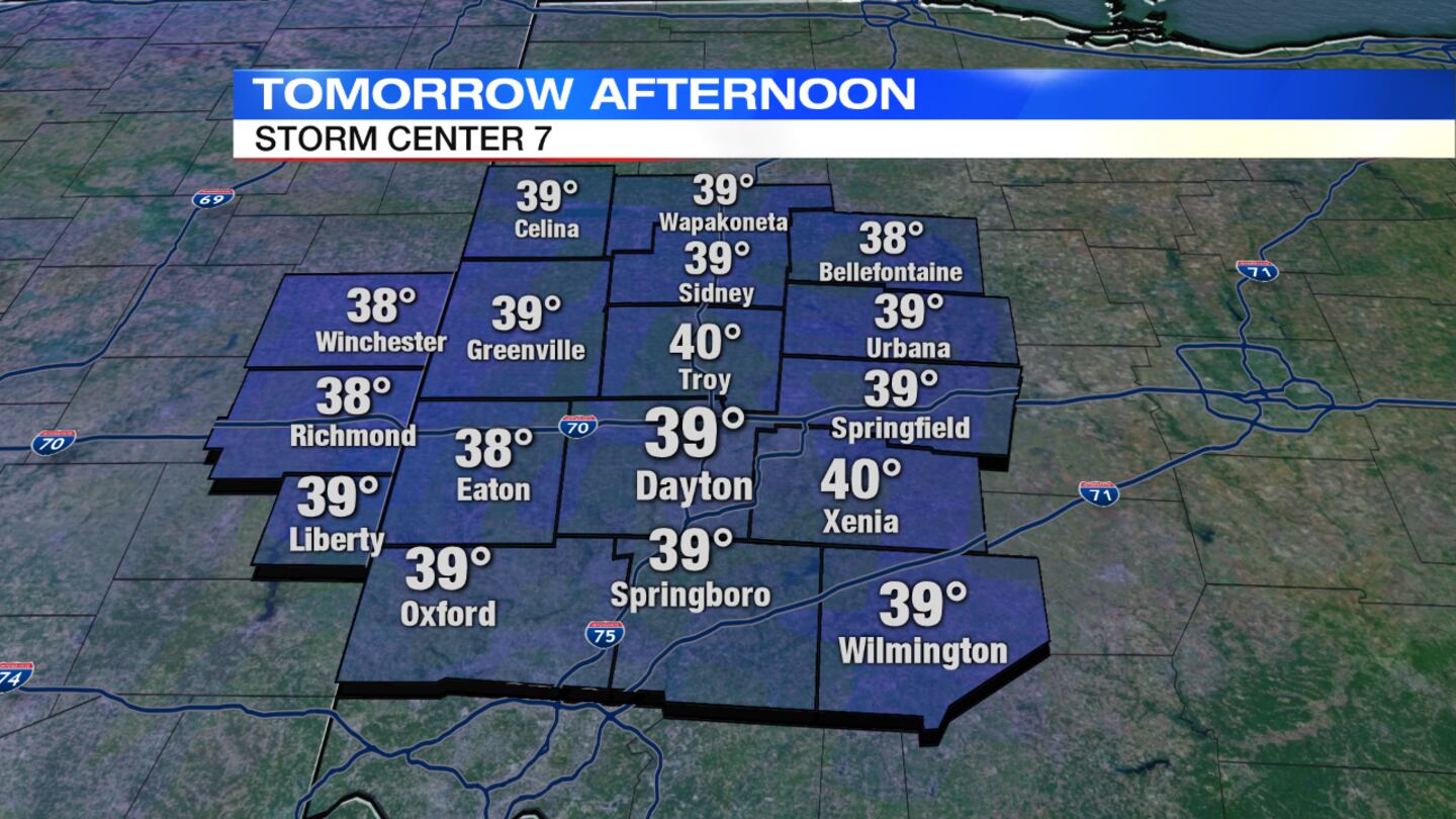
Monday: It will be mostly cloudy, blustery and much colder with highs holding in the upper 30s. Gusty winds will make it feel colder. There will be passing flurries or snow showers from time to time. Little if any snow accumulation is expected.
>> Sign up for Storm Center 7 Weather Alerts
Tuesday: Clouds will break some with temperatures rebounding back to near 50 degrees.
Wednesday: Clouds will increase with a chance for a passing shower and perhaps a thunderstorm. It will be breezy and mild with highs in the lower 60s.
Thursday: There is a chance for a passing shower in the morning before clouds begin to break. It will be a bit cooler and blustery with highs near 50 degrees.