QUICK-LOOK FORECAST:
- Showers arrive overnight
- Few storms Saturday night
- Strong storms possible on Tuesday
>> TRACK THE CONDITIONS: Live Doppler 7 Radar
DETAILED FORECAST:
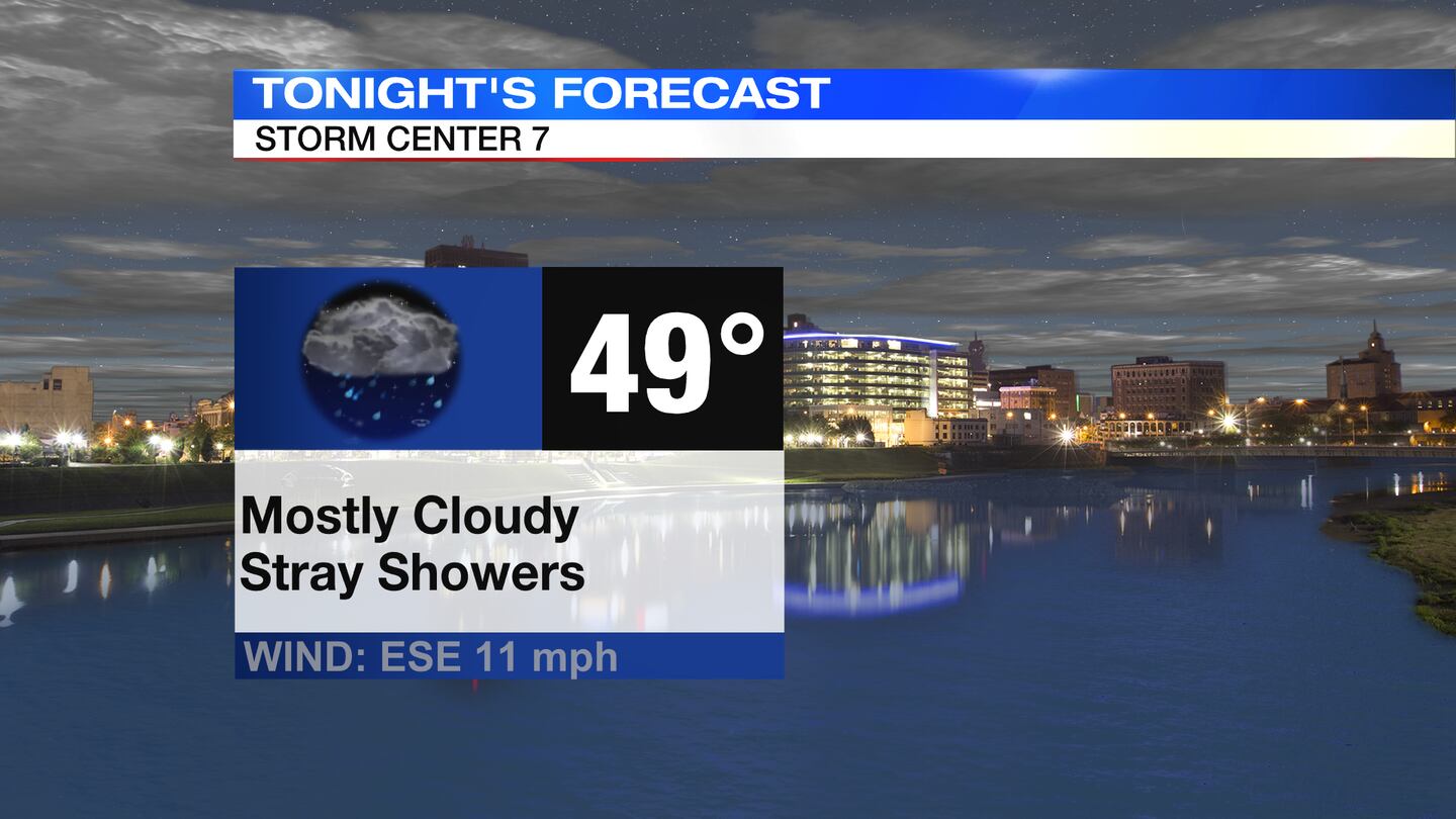
TODAY: Cloudy and cool this evening with temperatures falling into the 50s. A few showers arrive southwest late evening. Rain becomes more likely into the night with lows around 50 degrees.
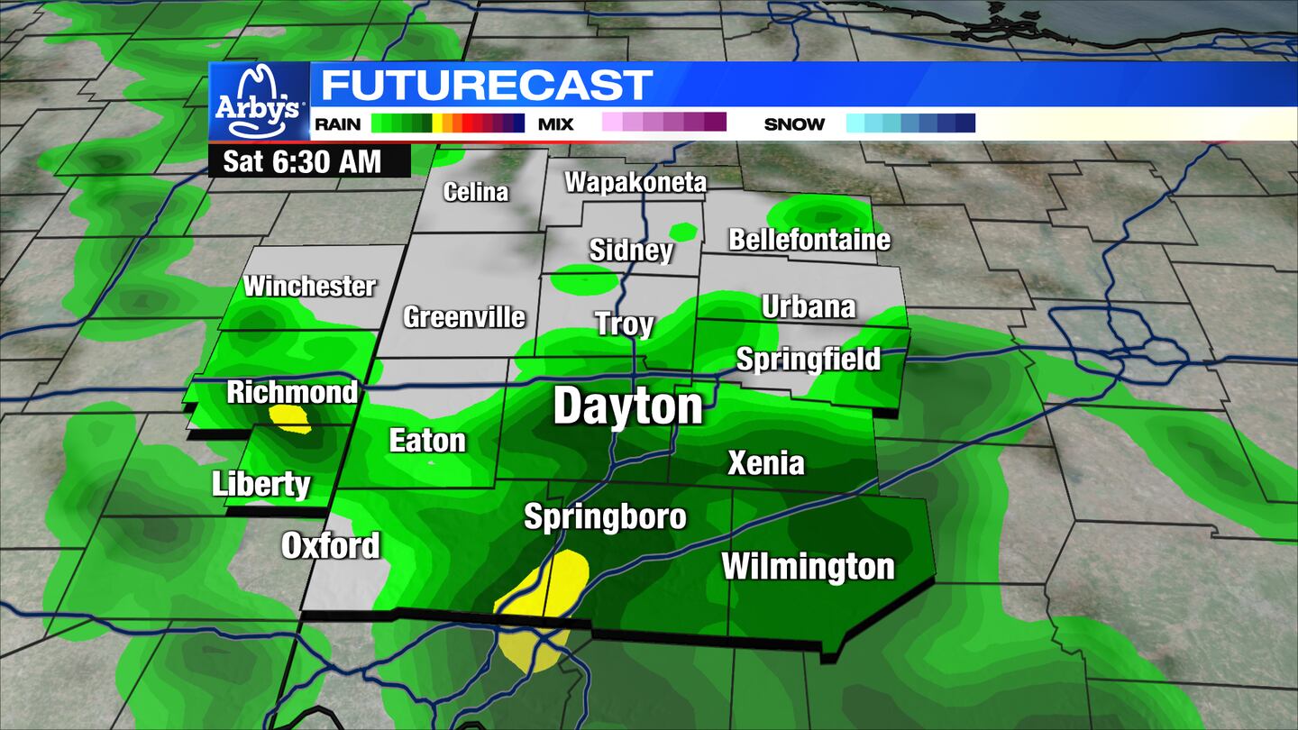
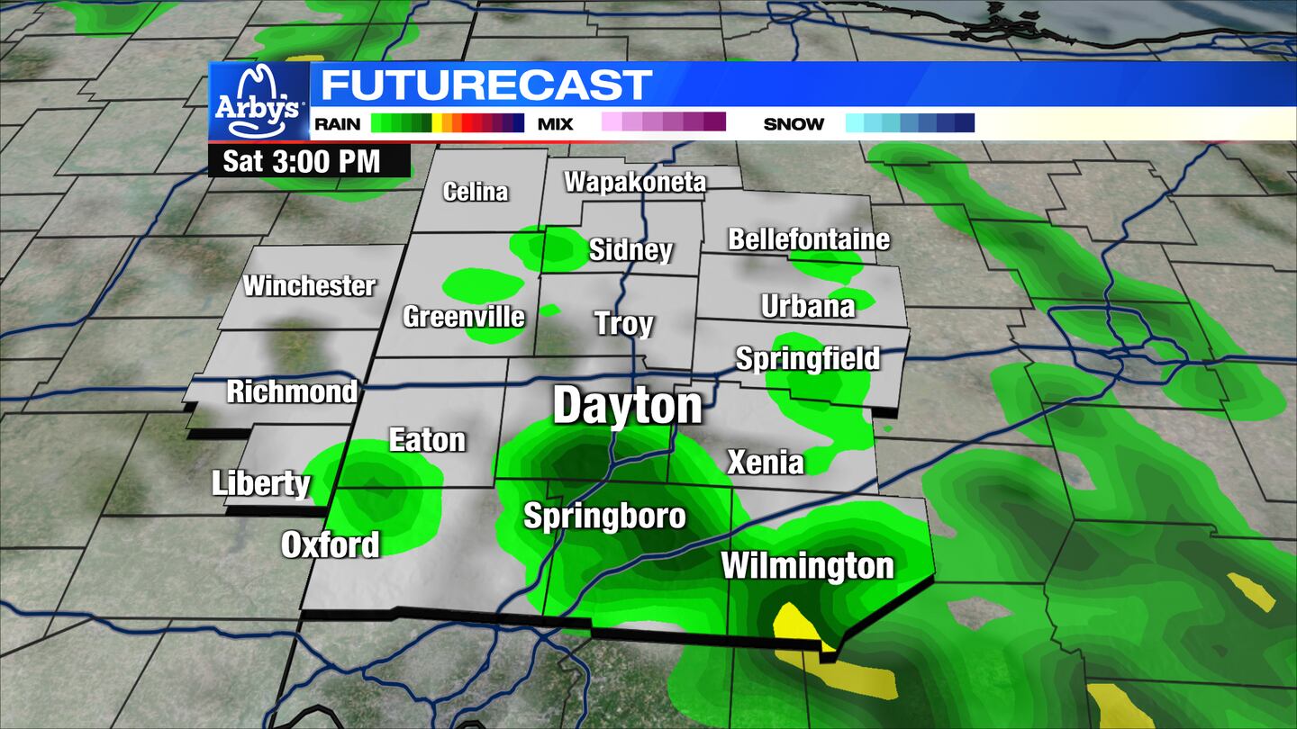
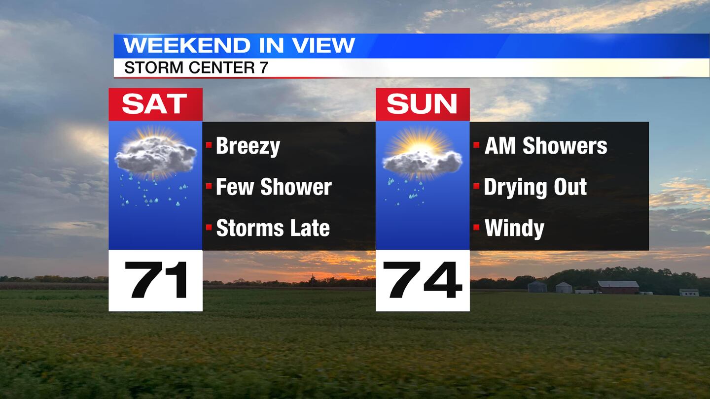
SATURDAY: Waking up to lingering showers/downpours on Saturday that will last into the early afternoon otherwise mostly cloudy. It will be breezy and warmer with highs in the lower 70s. Rain returns for Saturday night with a few storms possible, too. An isolated strong to severe storm is possible as storms arrive.
SUNDAY: Some showers around to start Sunday with a few isolated storms possible. Drying out by Sunday afternoon. Temperatures on Sunday will rise into the middle 70. It will also be a breezy day.
MONDAY: Partly cloudy and mild for Monday with high temperatures in the lower 70s. A chance for showers and a few storms arrives late Monday evening.
TUESDAY: Mostly cloudy with scattered showers and thunderstorms. One or two storms could become strong. It will be a seasonably warm day with highs in the middle 70s.
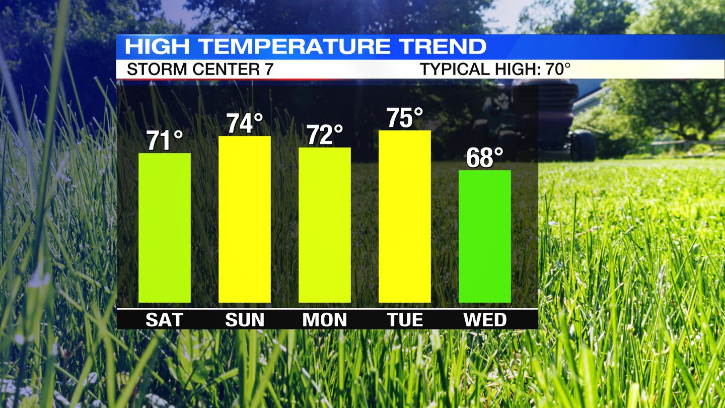
WEDNESDAY: Partly cloudy, breezy, and mild with highs in the upper 60s.
THURSDAY: Increasing clouds for Thursday with a few showers developing by the afternoon. Highs in the upper 60s.
FRIDAY: Mostly cloudy with the chance of showers. Highs in the lower 60s.
©2022 Cox Media Group


