NATIONAL — While we certainly don’t want to rush the seasons, there is something important you should know about the coming winter.
RELATED: Dayton Interactive Radar - WHIO Doppler 7
Beginning on October 2nd, the National Weather Service will change out winter weather watches and warnings are issued. The reason? To try to simplify - and make the alerts easier to understand. It is all part of the Hazard Simplification Process.
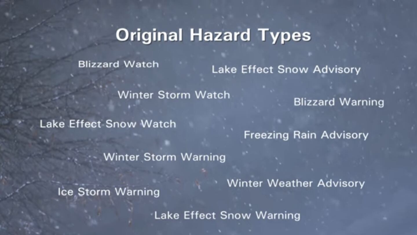
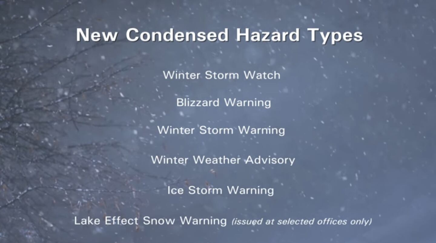
The Lake Effect Snow Watch and Blizzard Watch products will now fall under the umbrella of Winter Storm Watch. However, the warning types will still be separated (i.e. Winter Storm Warning or Blizzard Warning).
RELATED: County-by-County Weather
All other winter precipitation advisories will just be issued as a Winter Weather Advisory. This means the freezing rain and blowing snow advisories are gone. There will be no Ice Storm Warnings, only Winter Storm Warnings.
The NWS will also make messages shorter and they’ll have a standard format that highlights “What, Where and When” the given Watch/Warning/Advisory will impact the area of concern.
Additional details and precautionary actions will follow. Again this will make things simpler as future products will be more direct and to the point.
RELATED: WHIO WEATHER APP
The National Weather Service is not stopping with winter products. In the coming year it will make similar changes to flood, wind, marine and extreme temperature products.
For more on the “HazSimp” program go to weather.gov/hazardsimplification.


