
DAYTON — I’m digging through some of the long range data, and it shows a promising trend. Hey it’s Storm Center 7 Meteorologist Ryan Marando.
It’s no surprise that as winter closes, temperatures will begin to warm again. It looks like we will get a small warm up through the middle of the month. Temperatures have equal chances of being above or below average, as indicated by the gray, but many models are showing above average highs briefly returning through the middle of February.

[DOWNLOAD: Free Storm Center 7 Weather app for alerts as news breaks]
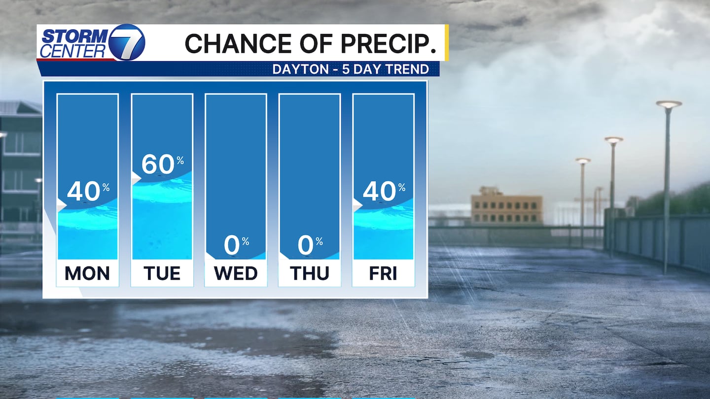
For the next week, it’s still going to feel and look like winter. Highs will continue to be well below our average high of 38 degrees with three chances of snow this week.
[WATCH Storm Center 7 Weather on the following devices]
Through Monday, there will be a few isolated flurries or light snow showers with not much accumulating. Tuesday morning will have a bit more snow with it, meaning around an inch of accumulation may be possible along and south of I-70. Areas north of Dayton, probably won’t see much accumulation from both days. This means some of the roads could be slippery Tuesday morning.

©2026 Cox Media Group


