>> LISTEN: Cloudy with a Chance of Podcast: A podcast for weather fans
UPDATE @ 9:50 p.m.: The Flash Flood warning issued for southwestern Butler County until 10:15 p.m. has been canceled, according to National Weather Service forecasters in Wilmington.
QUICK-LOOK FORECAST
- Scattered storms through Thursday
- Heat wave ends
- Remnants of Gordon to affect area over weekend
>> Storm damage: Tree falls at Miami Twp. government center
DETAILED FORECAST
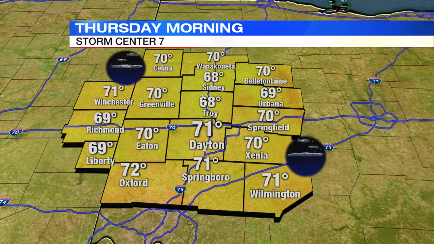
Overnight: Storms end with partly cloudy skies expected, Storm Center 7 Chief Meteorologist Eric Elwell said. It will remain muggy with lows holding in the lower 70s.
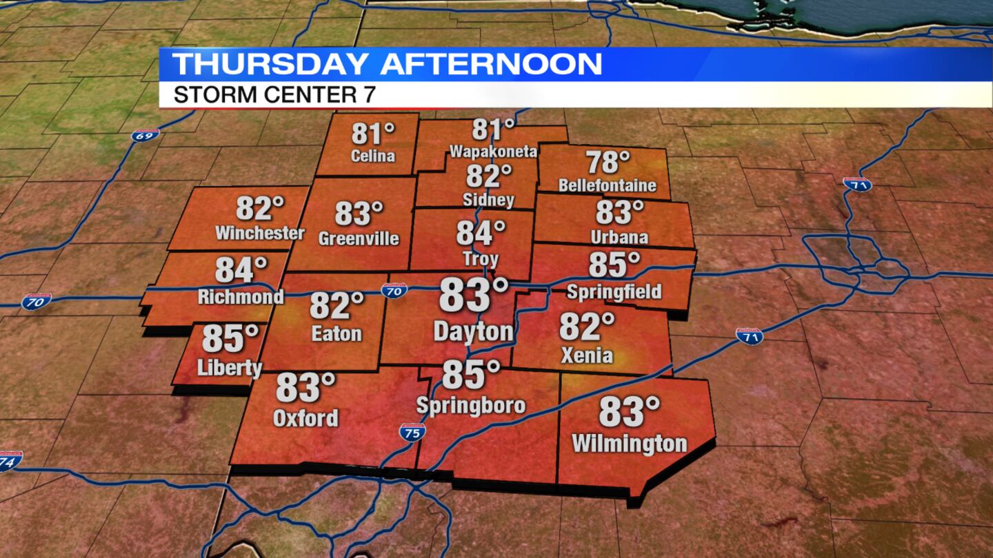
Thursday: Expect a mix of sun and clouds with numerous afternoon showers and storms. One or two storms could become quite intense with locally heavy rain and gusty winds. Highs will hold in the lower 80s.
>> Live Doppler 7 HD Interactive Radar
Friday: Clouds will increase through the day with a threat for rain and a few thunderstorms, mainly south of Interstate 70. It will be noticeably cooler, with temperatures holding in the upper 70s.
Saturday: Expect a chance for showers, mainly across the southern Miami Valley. Temperatures will be seasonably cool, holding in the lower to middle 70s.
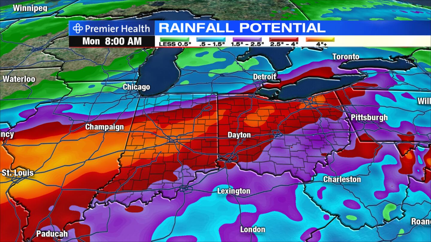
Sunday: A soaking, steady rain is likely under mostly cloudy skies as the remnants of Tropical Storm Gordon cross the region. The rain may be heavy at times and could lead to some flooding issues. High temperatures will hold in the middle 70s.
Monday: Any leftover showers will end early with clearing skies. Temperatures will be comfortable, holding in the upper 70s.


