
Good snowy Friday afternoon to you! Meteorologist Nick Dunn here to look at what has been yet another snowy day. We definitely had a good thumping of snowfall. So far, reports I have seen generally have ranged between 2 and 5 inches of snow.
Going into today, Dayton was at 31.7 inches of snow this season. That is well above average and one of our snowier periods since 2014.
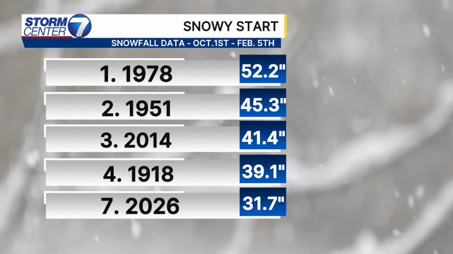
This is the 7th snowiest start to Winter when we look at October 1st to February 5th. Today’s snowfall likely put us in the top 5 once the official data comes out.
[DOWNLOAD: Free Storm Center 7 Weather app for alerts as news breaks]
So, how much snow fell in some of these prior years with well above average snowfall? History says that we still have a decent amount ahead!
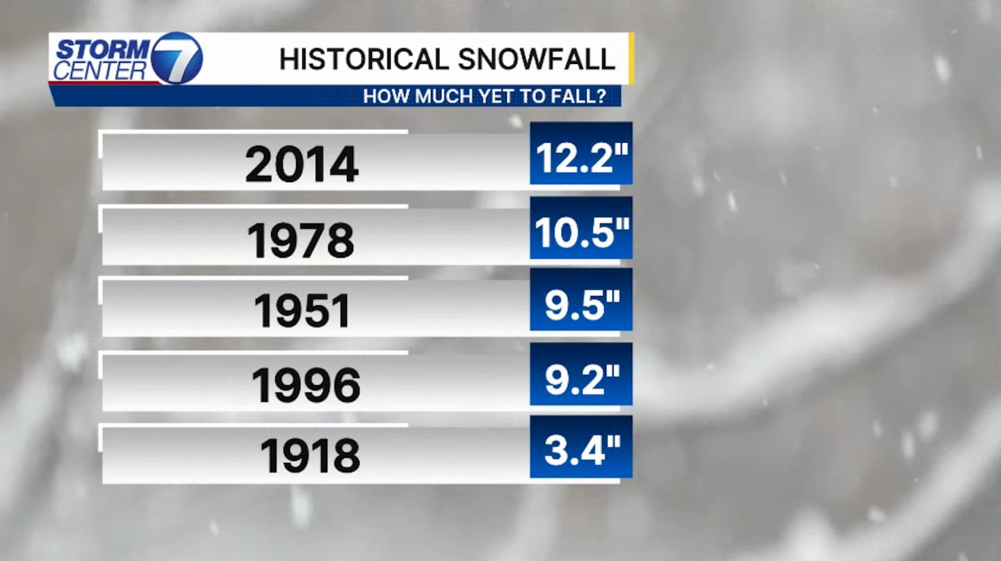
As you see, 4 of the past 5 times produced an additional 9″ or more of snowfall before the end of the season. This tells us that generally when we start snowy, we end that way.
[WATCH Storm Center 7 Weather on the following devices]
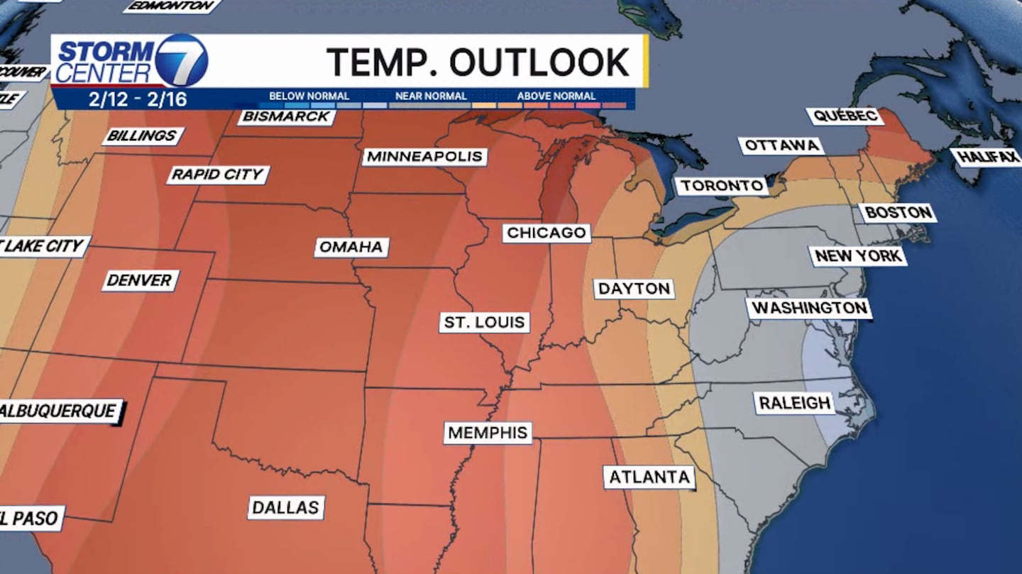
While we do see temperatures moderating into next week, we should not write off impactful snowfall chances just yet for the season base don past data. Have a great weekend!
©2026 Cox Media Group


