DAYTON — Good morning, everyone, and happy Thursday to you. Meteorologist Nick Dunn here on what is a rather cold Thursday morning compared to where we had been.
Temperatures are 30 degrees or more colder this morning compared to just 24 hours ago. What a change!
The next big thing we are watching is a round of high winds on Friday.
What exactly is driving it?
Strong pressure gradients.
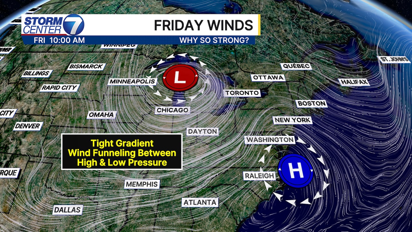
A strong low-pressure system with rain and snow passing well north of us will get close to a nearby area of high-pressure systems to our south.
That will allow for wind to be “funneled” into a tight gradient between the two systems, thanks to their opposite flows.
[DOWNLOAD: Free Storm Center 7 Weather app for alerts as news breaks]

We have some wind alerts issued out in advance of Friday to give you a heads up!
A High Wind Watch is in effect for Miami, Darke, Mercer, Auglaize, Shelby, Logan, and Champaign Counties from 5 AM to 8 PM Friday.
Some gusts to 60 miles per hour are possible in this area. An upgrade to a High Wind Warning is possible.
A Wind Advisory is in effect for Randolph, Wayne, Union, Preble, Butler, Montgomery, Warren, Clark, Greene, Clinton, from 7 AM to 8 PM Friday. Gusts of 50 miles per hour are possible here.
If any shifts in the track move south, an upgrade to a High Wind Warning cannot be ruled out.
[WATCH Storm Center 7 Weather on the following devices]
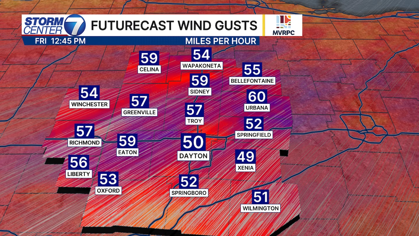
The strongest gusts are likely from late morning through mid afternoon. Winds will initially be from the southwest, which can make for driving difficulties in spots where crosswinds may set up. Additionally, some power outages cannot be ruled out along with loose outdoor items being blown around or damaged.
Today would be a great time to secure loose items and ensure everything is secured before the higher winds arrive.
©2026 Cox Media Group


