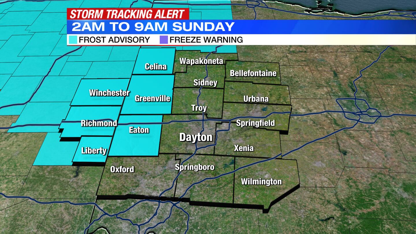
A Frost Advisory has been issued for counties in the Northern Miami Valley from 2 a.m. until 9 a.m. Sunday.
The following counites are under the advisory: Preble, Darke, Mercer, Wayne and Randolph
QUICK-LOOK FORECAST:
- Cloudy & Mild Evening
- Drier & Mild Sunday
- Seasonably Nice Monday
- Snow Showers Tuesday Night
>>TRACK THE CONDITIONS: Live Doppler 7 Radar
DETAILED FORECAST:
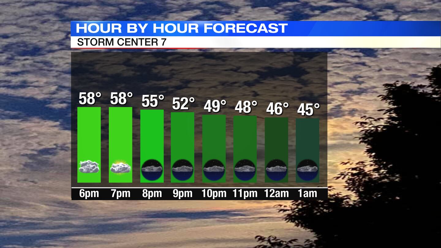
TODAY: Mostly cloudy with a few passing light scattered showers. Breezy at times with temps in the 50s early on and 40s late, said Storm Center 7 Meteorologist Dontae Jones.
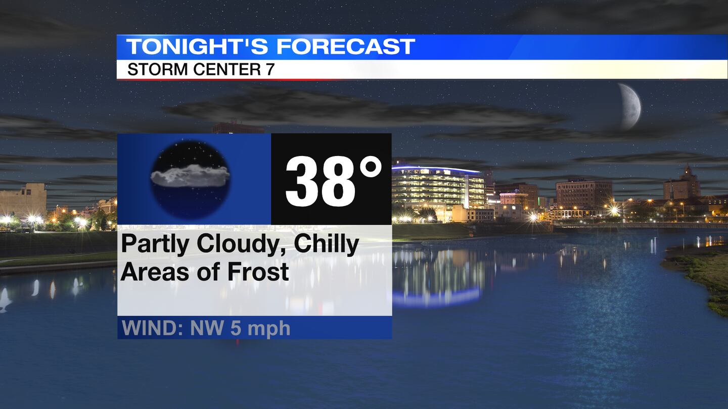
Overnight, some areas of frost, mainly north and west, temps drop into the upper 30s. Sensitive plants will need to be covered up or taken inside.

SUNDAY: After a chilly start to the morning. Partly cloudy through the day, a little more sunshine than Saturday. Slight chance of a passing shower but most are dry. Temps are a little milder, around 60.
MONDAY: A cold morning in the upper 30s. Sun and clouds through the day with highs in the lower 60s.
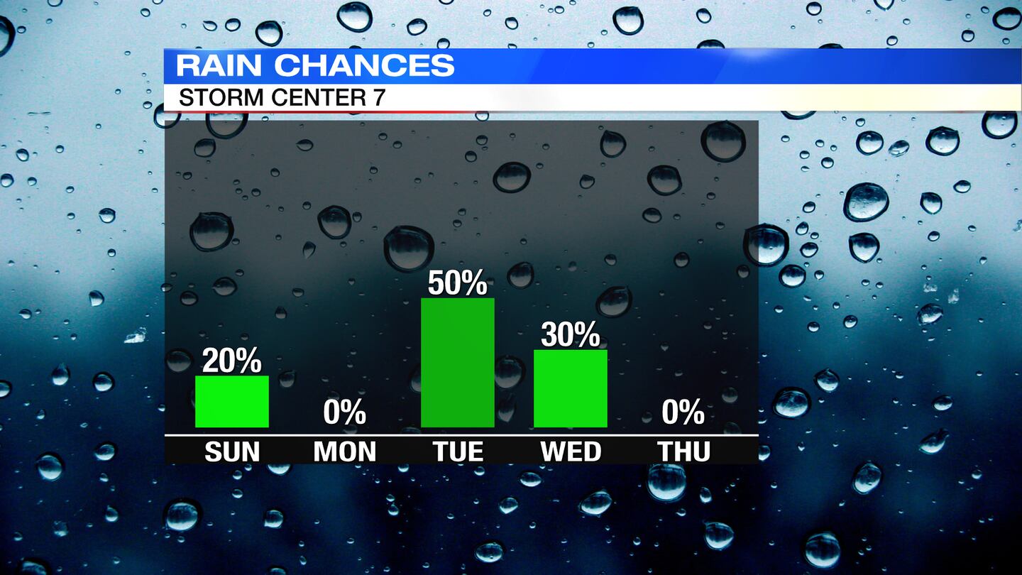
TUESDAY: A dry start to Tuesday, but a cold front will bring rain shower to the region by late day, and a wintry mix to snow into the night/overnight.
Highs in the lower 60s (midday)then dropping quickly into the 40s by late afternoon and 30s by evening.
Snow accumulations are about ½” north and west but nothing to a dusting everywhere else.
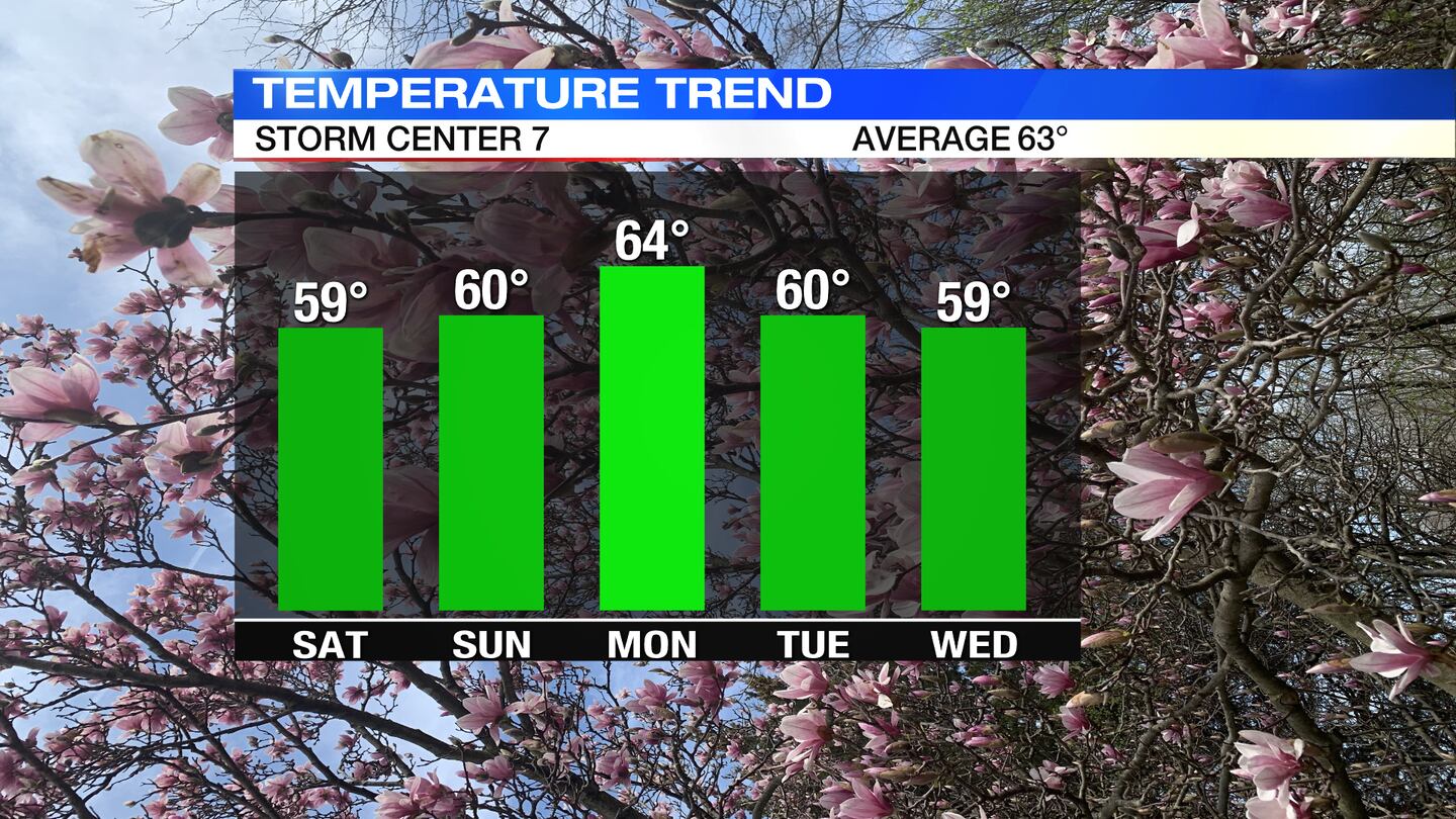
WEDNESDAY: Mostly cloudy with a passing rain or mix shower possible Wednesday. Highs in the mid 40s.
THURSDAY: Mostly sunny and breezy. Not as cold but still cooler than average with highs in the mid 50s.
FRIDAY: Partly to mostly cloudy, chance of evening showers, breezy with highs a little closer to seasonable, in the lower 60s.
Cox Media Group


