
DAYTON — Good evening to you on this Saturday. Meteorologist Nick Dunn here with you on what was a very nice day. Highs were in the 50s and 60s and it felt fantastic. I am tracking a very active weather pattern. So, let’s give you the latest.
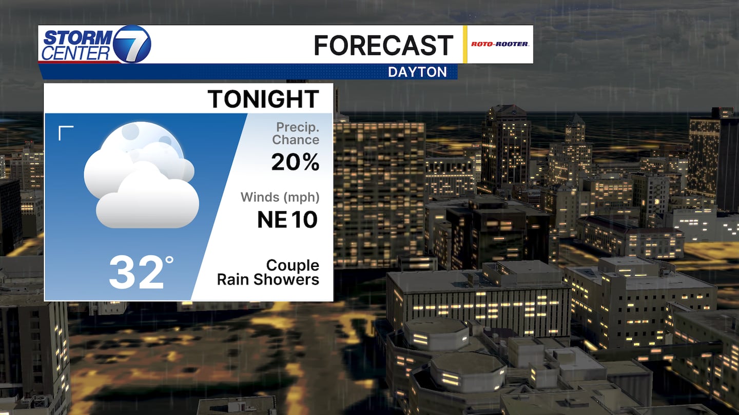
A cold front crossing the area tonight brings a few rain showers and a big drop in temperatures. This front will set the stage for a cooler second half of the weekend as highs on Sunday struggle to get to 40 degrees.
[DOWNLOAD: Free Storm Center 7 Weather app for alerts as news breaks]
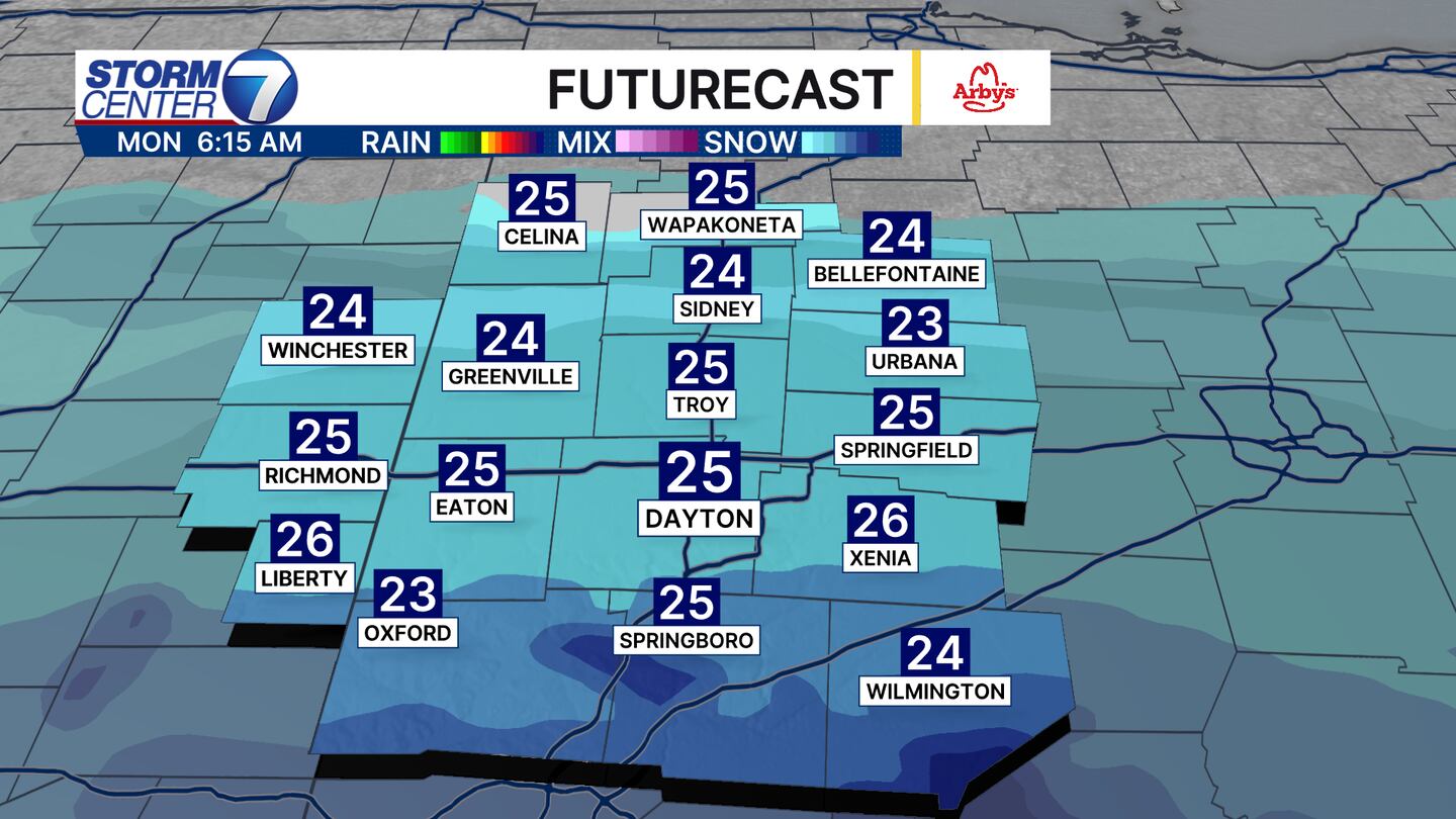
Monday has been a very complex forecast for a few days now, and some of our high-resolution guidance has snow Monday morning. The challenge here is how far north the snow would get. For now, I am calling for the best chances to be near and south of I-70. Any snow that sticks would be light (perhaps an inch or so).
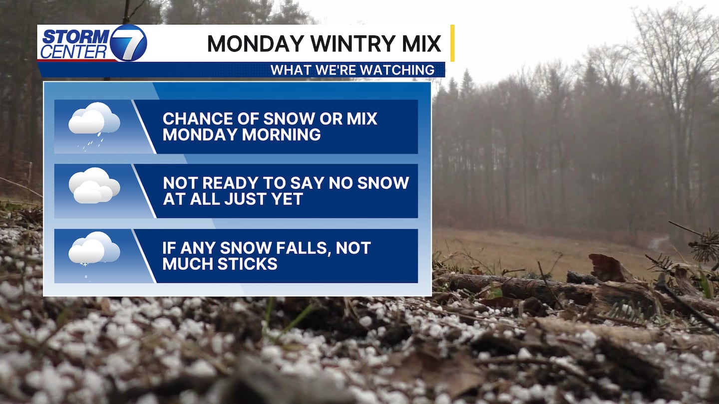
The key takeaway here is that we are not totally ready to rule out snow for Monday just yet. This is a tricky forecast as there remains a chance this totally misses us. Not easy to forecast, but the takeaway is watch the forecast close.
[WATCH Storm Center 7 Weather on the following devices]
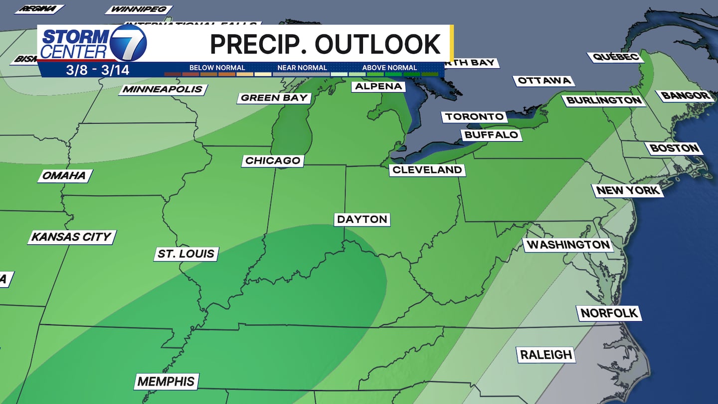
Trends suggest a very wet start to March in the form of waves of rain and even a few thunderstorms. Several inches of rain are possible, but specific amounts need to be ironed out. There is a high probability of at least two inches of rain. That would help those to the north with significant drought conditions.
©2026 Cox Media Group


