
DAYTON — Hello, and happy Friday to you! Meteorologist Nick Dunn here with an arctic forecast as we head into the weekend. We have had a plethora of cold weather alerts through the week, and that continues tonight!
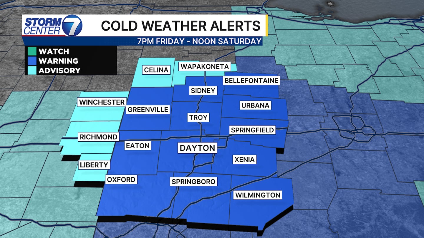
Most of us are under an Extreme Cold Warning that starts at 7PM Tonight and runs through Noon on Saturday. Others are under a Cold Weather Advisory. You may be asking what the difference is! Let me show you!
[DOWNLOAD: Free Storm Center 7 Weather app for alerts as news breaks]
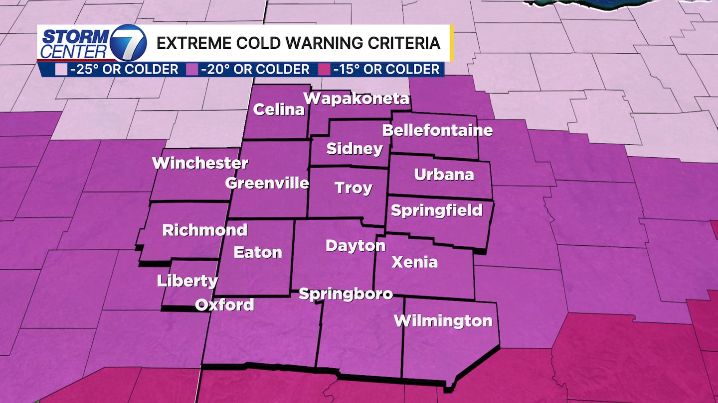
For an Extreme Cold Warning, wind chill temperatures of -20 degrees or colder are needed to trigger that alert. For the Cold Weather Advisory, the threshold is -10 degrees to -19 degrees.
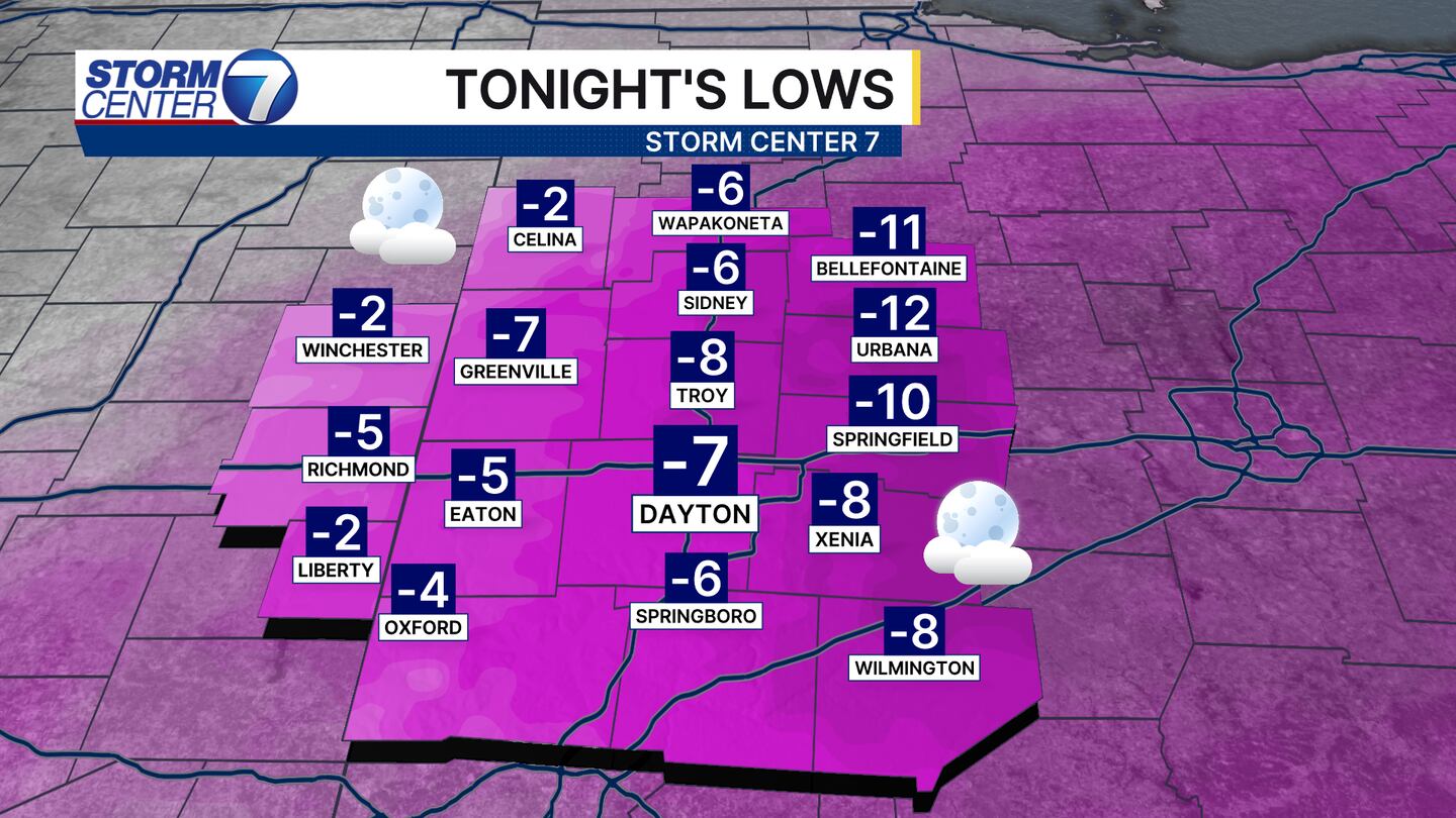
Tonight could become the coldest night of the year. Predicting overnight lows with snow pack and cloud cover is always tricky. However, wind may also keep some spots a touch “warmer” than it otherwise would be.
Last night, clouds did not prevail. Tonight could be a different story. Either way, air temperatures of -5 to -10 degrees will be common. A few spots may not get as cold, but the wind picks up a bit to drive wind chills to dangerous levels.
[WATCH Storm Center 7 Weather on the following devices]

Wind chills around or just below -20 are likely for Saturday morning, so if you must go outside you will need to dress in layers and limit the time spent outside. Frostnip and frostbite can set in quickly if exposed skin, especially the extremities, are not covered. Stay warm!
©2026 Cox Media Group


