
DAYTON — Good Friday afternoon to you. Meteorologist Nick Dunn here on what is a calmer, but much cooler, day. After the record high of 81 degrees was tied yesterday in Dayton, today was a definite reality check with 30s around at times today. The cool weather is here for a short visit as I am already tracking another warming trend.
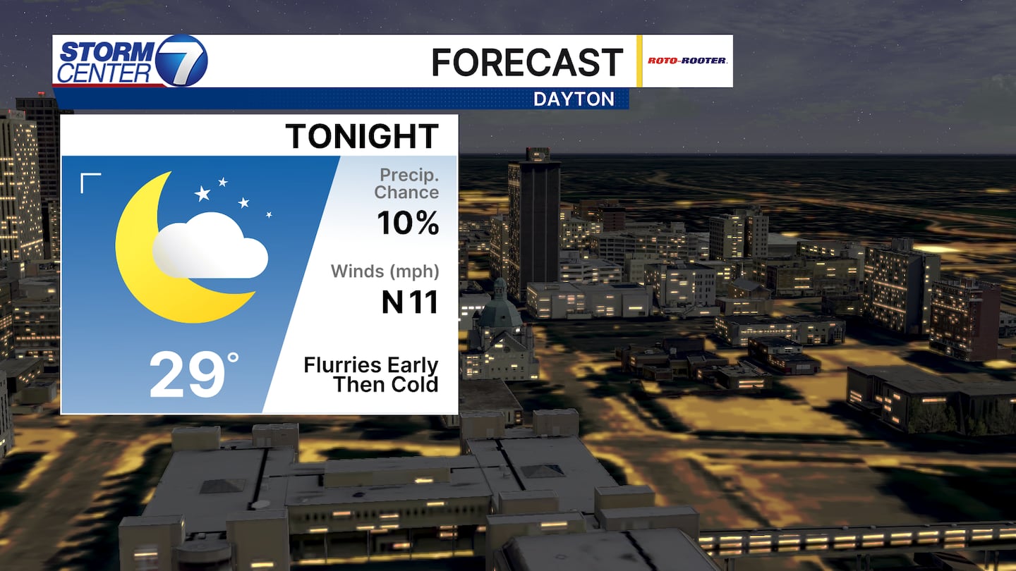
Tonight features lows in the upper 20s. A few snow flurries are possible this evening with a weak system crossing through. A clearing sky tonight will help us cool off nicely with below average temperatures area-wide.
[DOWNLOAD: Free Storm Center 7 Weather app for alerts as news breaks]
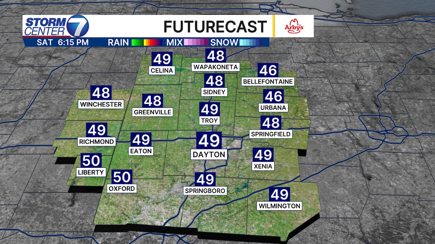
Into Saturday, highs are below average in the upper 40s. But, we have more sunshine through the day and we get a chance to dry out. Northerly winds will add a slight chill to the air, but still a very nice day overall.
[WATCH Storm Center 7 Weather on the following devices]

By Sunday, some more clouds are around. However, the trade off with the cloud cover is we find temperatures rebounding nicely into the upper 50s and lower 60s. We end the weekend dry as well with a midler air mass waiting in the wings to kick off next week.

The temperature trends show highs in the 70s return Monday and Tuesday. There may be some very low-end shower chances around but most look dry. SOme 80s for highs are possible again Tuesday. Another strong system arrives midweek next week with more rain and storm chances. Have a great weekend!
©2026 Cox Media Group


