
DAYTON — Good evening, everyone! Meteorologist Nick Dunn here to break down what I am calling the Great December Thaw into the upcoming week. After a snowy and cold start to the month we definitely will have a nice stretch of milder temperatures to offset things a bit!
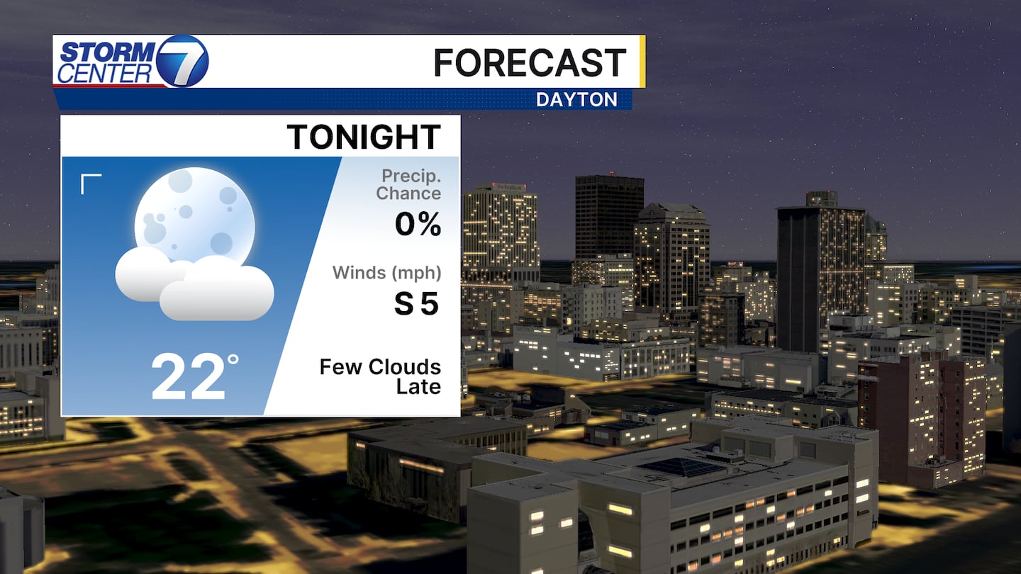
Ahead of that we still have a chilly night ahead tonight with lows in the lower 20s and a few clouds arriving towards dawn. We will stay dry through the day on Monday, but by nighttime we will be dodging light and scattered rain.
[DOWNLOAD: Free Storm Center 7 Weather app for alerts as news breaks]
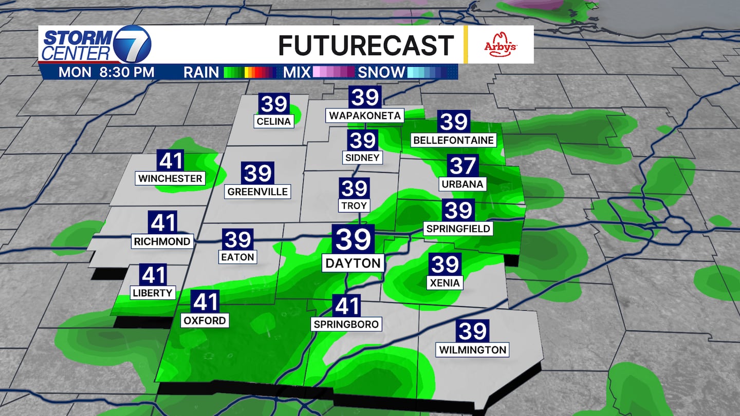
Futurecast has a great look at the intensity of the rain showers being light for Monday evening. Also, the coverage looks scattered and not a total washout. Rainfall amounts of 0.10″ or less are expected.
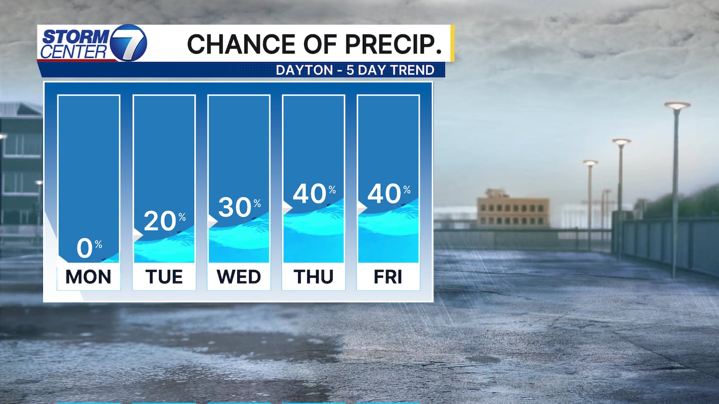
Rain chances persist at times this week. But, the positive here is the bulk of the rain chances are during the nighttime hours. That helps those traveling a bit as well with more daytime hours being dry.

The only exception I see to that is overnight Wednesday into Christmas Day on Thursday. Models disagree a bit on rain on Thursday, however, there will be a few showers passing by. The greatest coverage of rain should occur before Wednesday while many are sleeping. By Thursday, this would allow lighter rain to be possible at times. Highs will be near 60, which could tie the 5th warmest Christmas Day all-time in Dayton!
[WATCH Storm Center 7 Weather on the following devices]
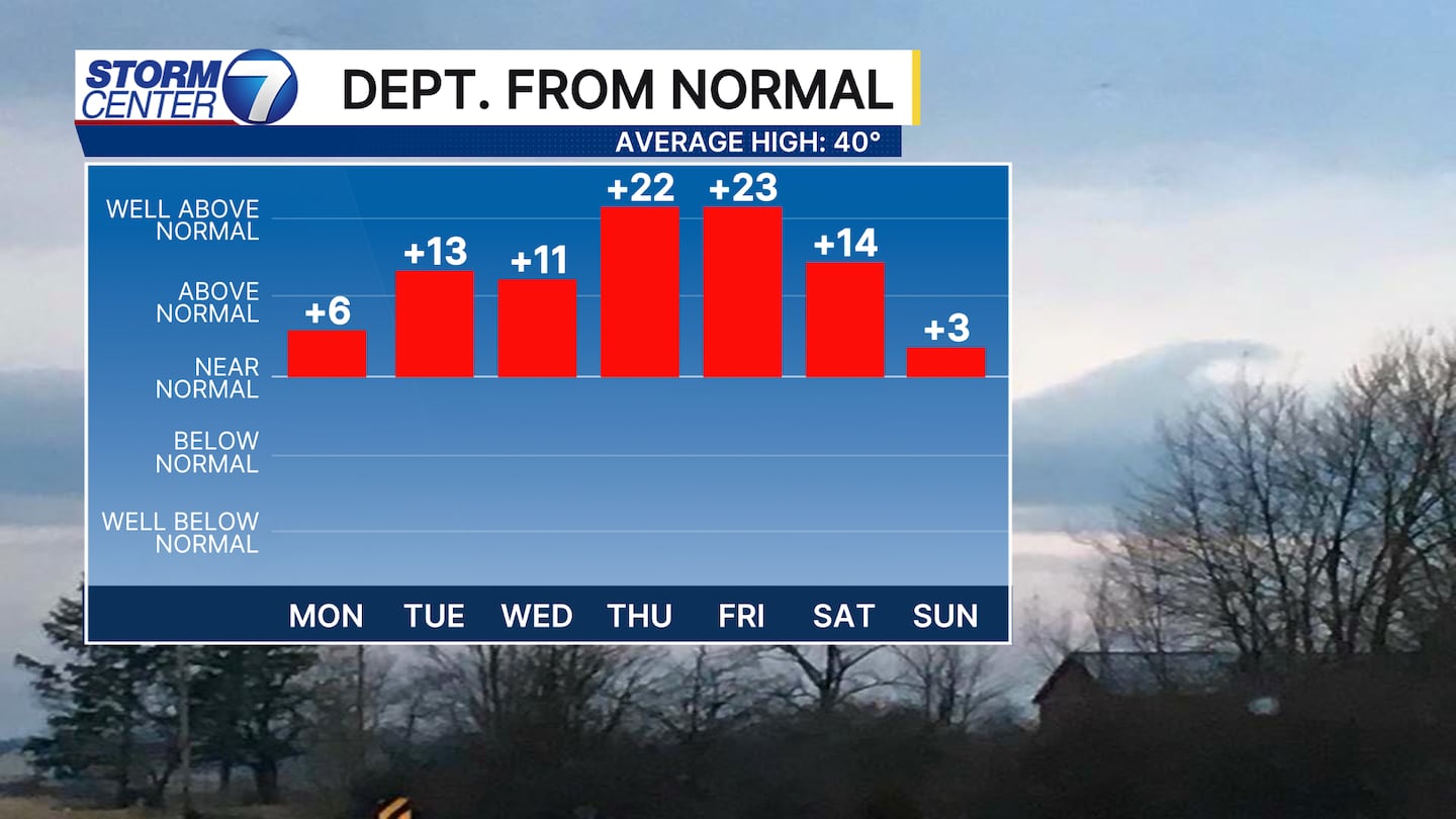
Current dats shows temperatures of 10-20 degrees (or more at times) above the typical highs for each respective day from Tuesday through Saturday. This means 50s and even some 60s are expected.
There is some minor disagreement showing on how warm we get for Christmas Day and Friday, however, not enough to say the warmth will not last.


