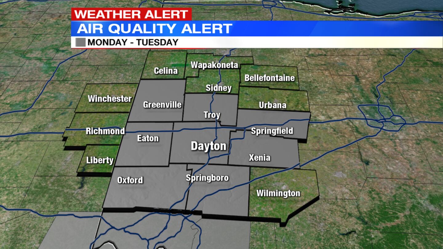
An Air Quality Alert for Butler and Warren counties continues through midnight.
The same alert continues until midnight Tuesday for Clark, Darke, Greene, Miami, Montgomery, and Preble counties.
QUICK-LOOK FORECAST:
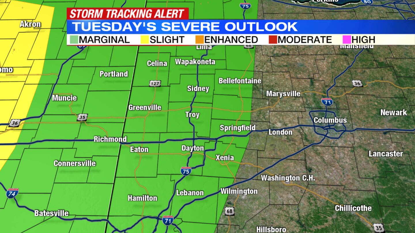
- Strong storms return Tuesday afternoon
- Damaging winds, brief spin-up possible
- Nice weather to end the week
>> STAY INFORMED: Download the WHIO Weather App
DETAILED FORECAST:
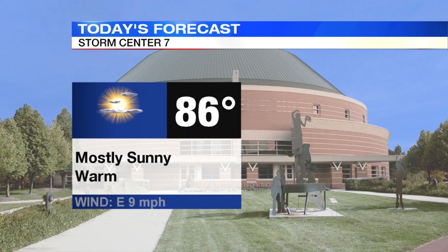
THIS EVENING - OVERNIGHT: Mainly clear and warm this evening with temperatures in the 80s, Storm Center 7 Chief Meteorologist McCall Vrydaghs said. A few more clouds around tonight, but remaining dry and still mild with lows in the middle 60s.
>> TRACK THE CONDITIONS: Live Doppler 7 Radar
TUESDAY: Dry start to the day, but as the remnants of Cristobal move north through the Midwest, a passing shower or storm will cross the area in the afternoon and evening.
An isolated severe storm is possible with damaging winds the primary threat. An isolated, brief tornado or two cannot be ruled out.
It will also be a hot and humid day with highs in the lower 90s. Heat indices expected in the middle 90s. An air quality alert will continue through parts of the Miami Valley until midnight. Increased ground level ozone may make it difficult for some to breath, especially individuals with respiratory issues, the young and elderly.
WEDNESDAY: Partly cloudy with a chance for a few showers or storms into the afternoon. A warm day, but not as hot with highs in the lower 80s. Windy at times with gusts up to 35 mph possible.
THURSDAY: Mostly sunny and nice for Thursday with lower humidity. Temperatures will still be warm with highs around 80 degrees.
FRIDAY: Mostly sunny and cooler. Slight chance of a shower as a cold front passes through. Highs climb into the upper 70s.
SATURDAY: Mostly sunny and pleasant. Highs in the lower 70s.
© 2020 Cox Media Group


