All eyes are on our next weather-maker set to hit the Miami Valley Monday.
A strong area of low pressure is developing along the west coast of the United States with a track taking it across the Rockies then toward the Miami Valley by Sunday.
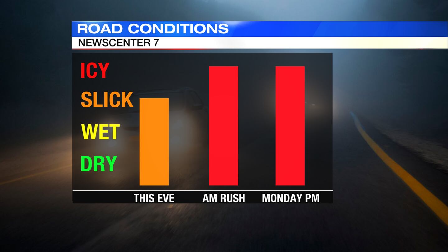
One of the most significant factors leading up to this storm system is the temperature. From now through Monday morning, temperatures will remain below freezing causing the ground temperature to stay cold as well. That means, whatever falls initially could freeze on contact leading to slick or icy spots. The concern for the Miami Valley Monday through early afternoon will be the slick and icy spots due to icy rain. Motorists are advised to take it slow and be extra cautious.
Warm air aloft will be pushing in initially and will spark the onset of the precipitation in the form of a light freezing rain or snow on Monday morning. As the warm air continues to surge north with the low, the precipitation will start as snow/wintry mix including light freezing rain mid Monday morning and will transition into all rain by mid Monday afternoon.
There may be some spots in the far northern Miami Valley, near Wapakoneta and Celina, that stay a wintry mix or snow throughout the day. This of course could change as we get closer to the event.
Winds will also increase Monday into Tuesday with some gusts up to 25-35mph. And, rain totals could range between a half inch to an inch and a half.
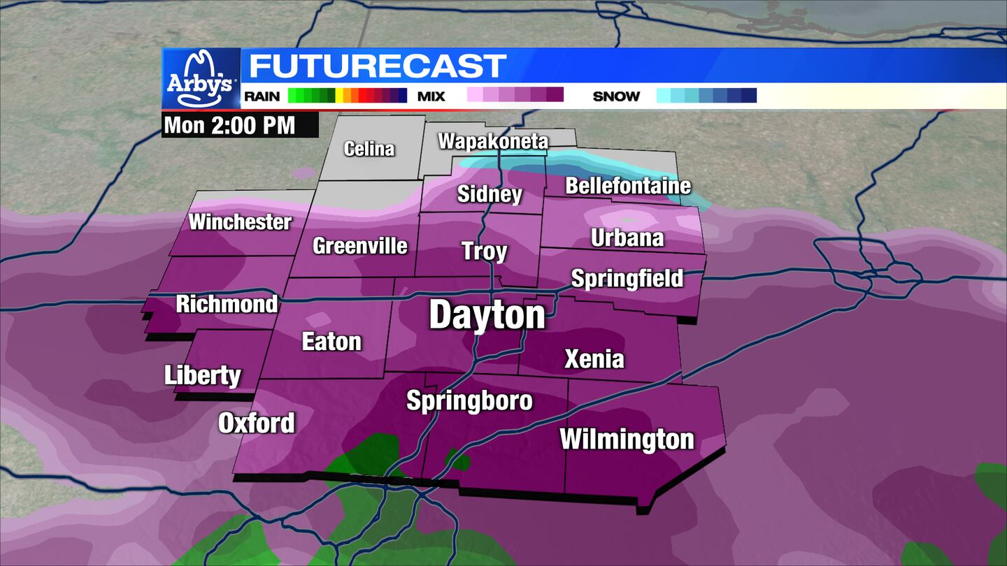
There may be some spots in the far northern Miami Valley, near Wapakoneta and Celina, that stay a wintry mix or snow throughout the day.
Winds will also increase Monday into Tuesday with some gusts up to 25-35mph. And, rain totals could range between a half inch to an inch and a half.
As always, stay tuned to WHIO for updates throughout the weekend as this is an evolving storm and any slight change in path could alter the forecast dramatically.
Cox Media Group


