QUICK-LOOK FORECAST:
- Unseasonably warm through Tuesday
- Temps return to near normal Thursday
- Some rain/snow mix showers Thursday and Friday
>>TRACK THE LATEST CONDITIONS: Live Doppler 7 Radar
DETAILED FORECAST:
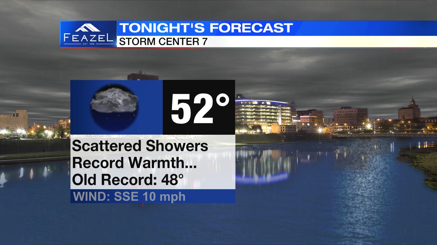
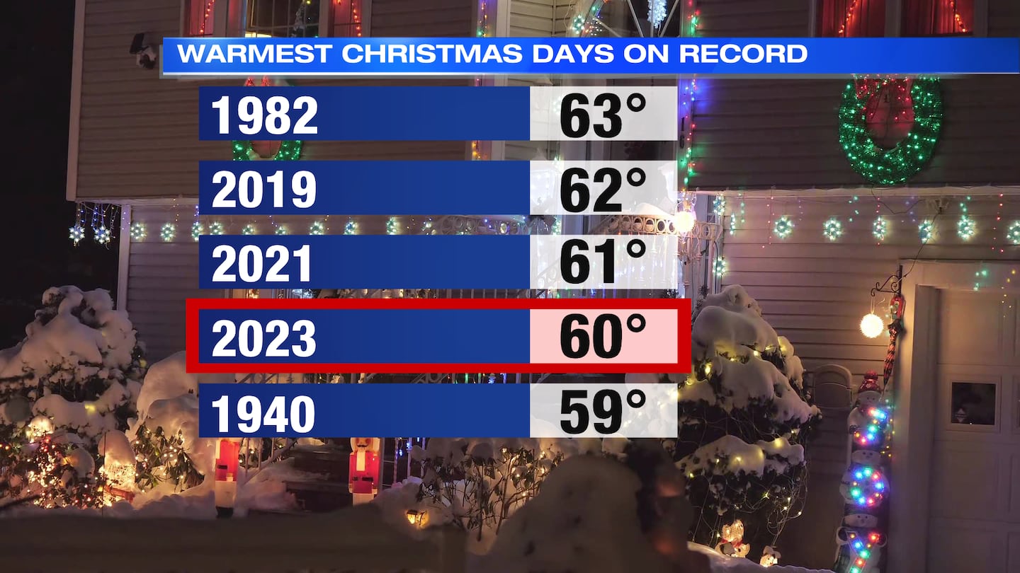
MONDAY: Rain this evening with scattered showers late tonight into Tuesday morning. It will likely be a record-warm morning Tuesday with lows in the lower 50s.
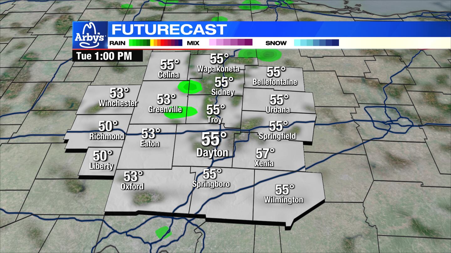
TUESDAY: A few showers still around on Tuesday. Plenty of dry time in between. Mostly cloudy. Mild with highs again in the upper 50s.
WEDNESDAY: Partly sunny, mainly dry for Wednesday. A bit cooler with highs in the upper 40s.
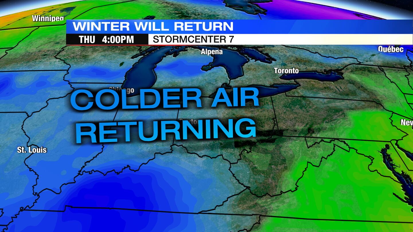
THURSDAY: A chance for rain showers on Thursday with highs in the low 40s. Considerable spread still exists among the models, there is the potential for some snow to mix in, especially by Thursday night.
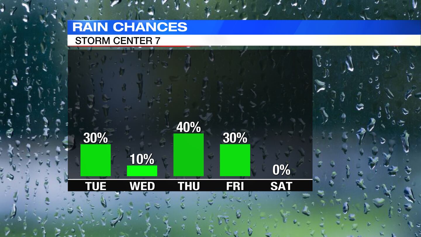
FRIDAY: A chance for rain or snow showers on Friday. Highs in the upper 30s to near 40.
SATURDAY: Partly cloudy and chilly with highs in near 40.
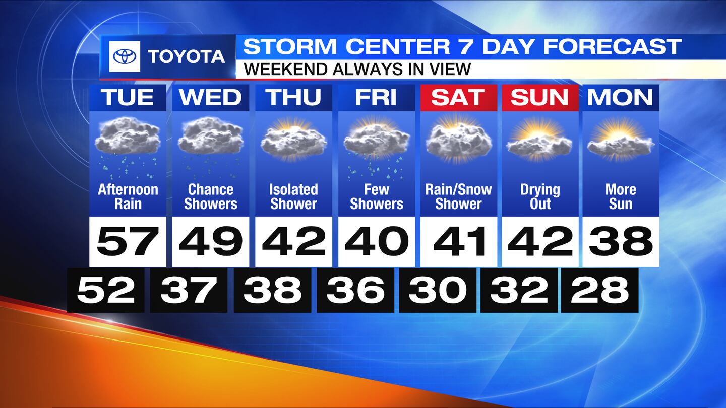
SUNDAY: Mostly cloudy and chilly with highs in the lower 40s.
MONDAY: Mostly cloudy and chilly with highs in the upper 30s.
©2023 Cox Media Group


