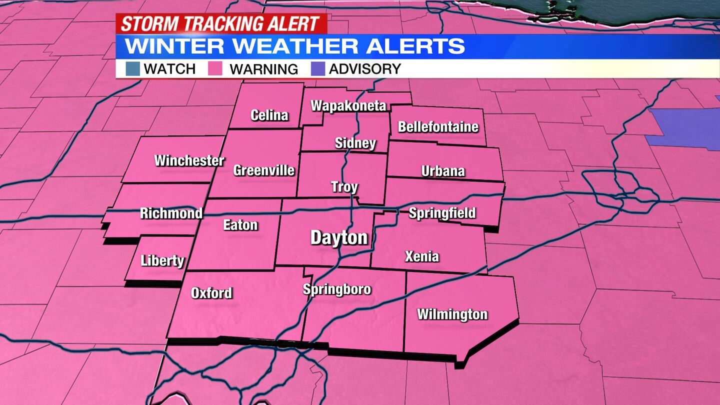
A Winter Storm Warning is in effect for the entire Miami Valley until 7 a.m. Friday.
Storm Center 7′s expanded Winter Storm Coverage continues today with a special edition at 4 p.m. — our meteorologists are tracking worsening conditions across the Miami Valley — plus, don’t miss live Storm Team Coverage updates at the top of every hour throughout the day.
>> Stay Alert: Download the free WHIO weather app
QUICK-LOOK FORECAST:
- Winter Storm Warning through Friday morning
- Snow showers ending Friday
- Very cold end to the week
>>TRACK THE CONDITIONS: Live Doppler 7 Radar
DETAILED FORECAST:
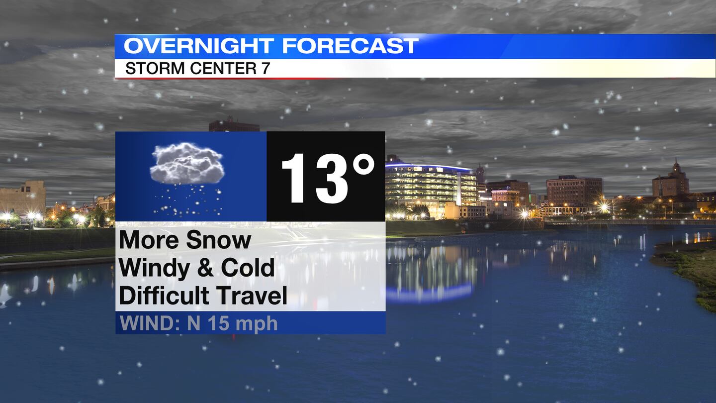
THURSDAY: Snow continues to fall tonight with some sleet that may mix in across the southern Miami Valley early. There will be a brief period of time when it tapers a bit then another push of moisture will bring more snow to the area overnight, according to Storm Center 7 Chief Meteorologist McCall Vrydaghs.
Winds remain gusty, so blowing and drifting will keep roads snow covered. Temperatures will fall into the teens overnight with wind chills in the single digits.
>> STAY INFORMED: Latest school closings and delays
Expected Ice accumulations:
- Up to .25″ south of Eaton, to Dayton, to Springfield
- Up to .5″ south of Hamilton, to Springboro, to Wilmington
Expected Snow totals:
- Winchester to Bellefontaine northward: 8-12″
- Eaton to Urbana: 6-10″
- Hamilton to Xenia: 3-6″
- Springboro to Wilmington: 1-3″
>> Local counties issue snow emergencies; What does it mean?
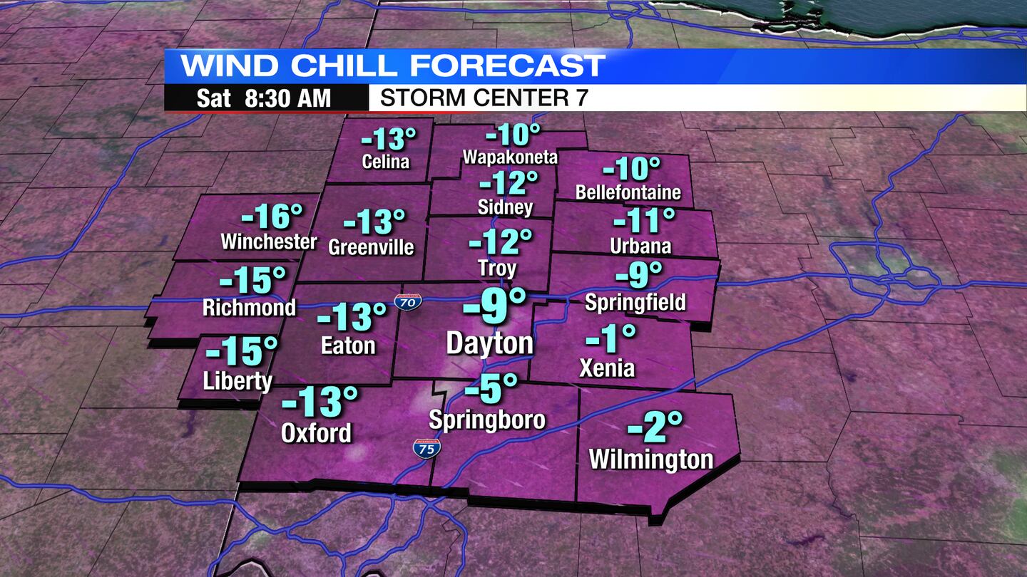
FRIDAY: Light snow showers linger to start Friday, especially across the southern Miami Valley. Snow will come to an end in the afternoon. It will be a blustery and cold day with highs in the teens and wind chills in the single digits. Clouds decrease into Friday night and temperatures drop fast. Overnight lows dip below zero with wind chills near -10 to -15 possible.
SATURDAY: A very cold morning, with temperatures below zero to start. Even with sunny skies, temperatures will top out in upper teens to lower 20s.
SUNDAY: Sun and a few clouds around on Sunday. A chilly day, but not as cold with highs in the lower 30s.
MONDAY: Partly sunny and cold. Highs in the upper 20s.
TUESDAY: A chilly day, but mostly sunny with highs in the lower 30s.
WEDNESDAY: Sun and a few clouds for Wednesday. Highs closer to normal in the upper 30s.
THURSDAY: Partly sunny and a bit cooler. Highs in the middle 30s.
©2022 Cox Media Group


