QUICK-LOOK FORECAST:
- Very cold Thursday and Friday
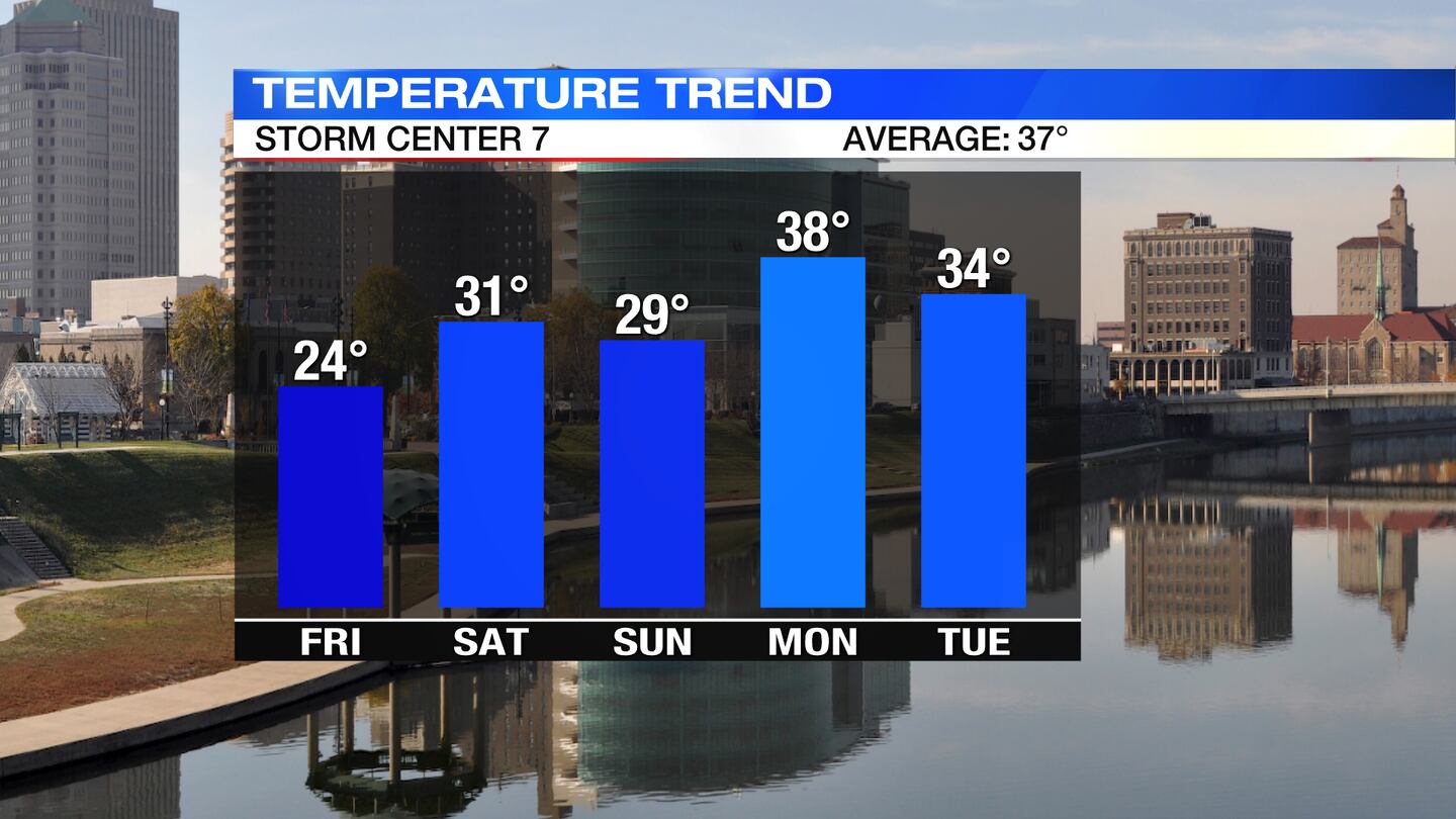
- Below freezing through Sunday
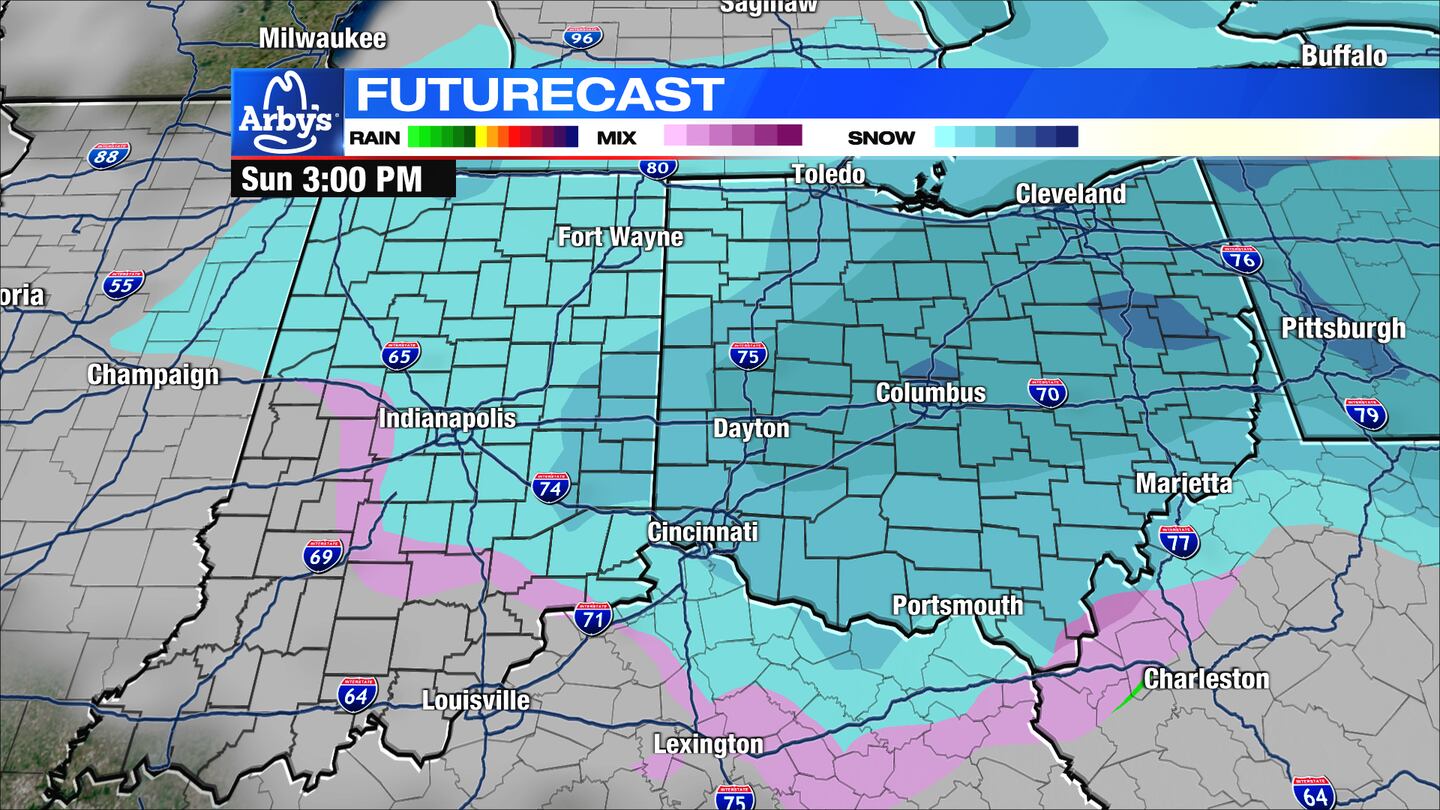
- Chance flurries or snow showers on Sunday
>>TRACK THE CONDITIONS: Live Doppler 7 Radar
DETAILED FORECAST:
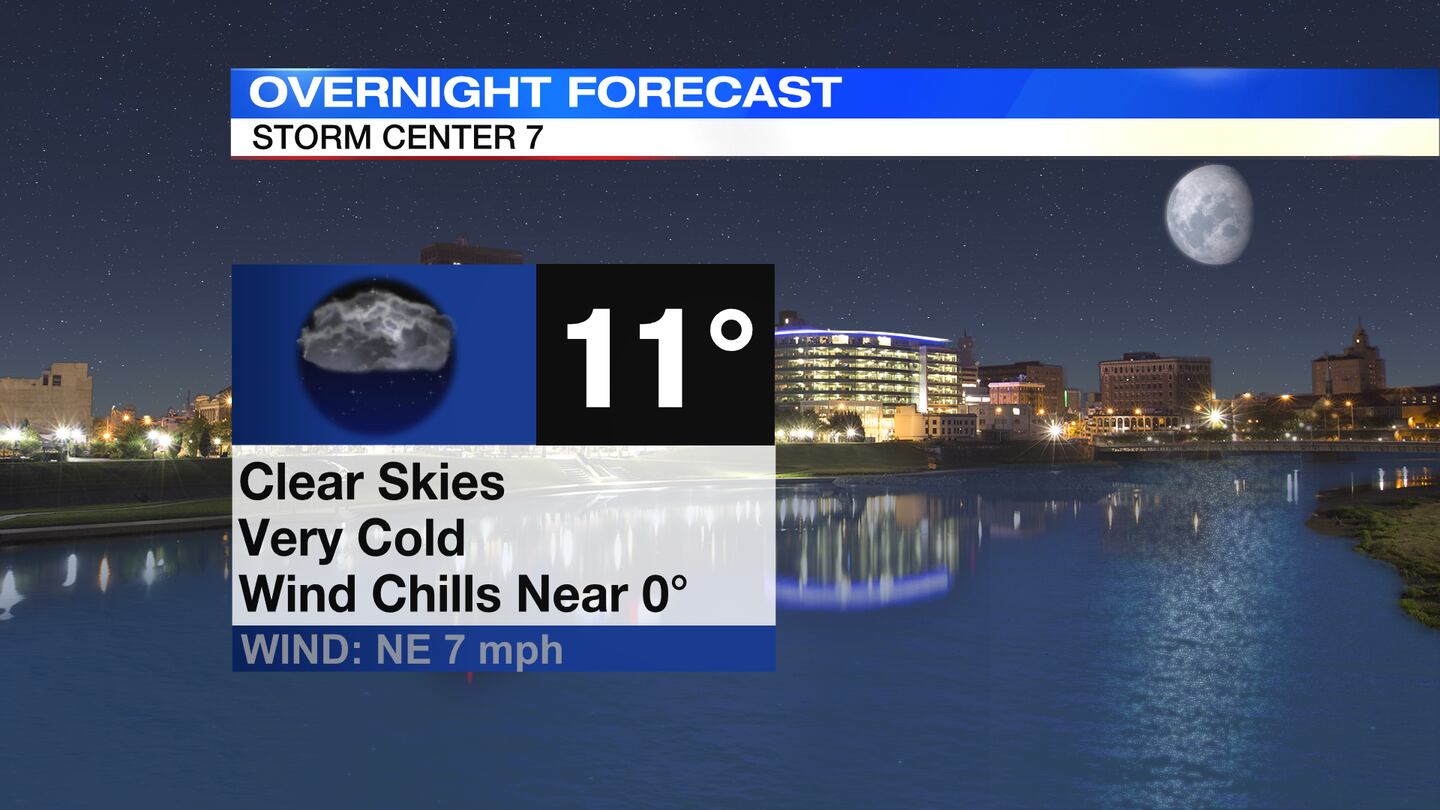
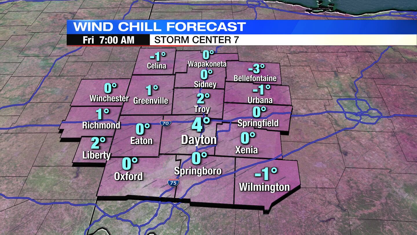
TODAY: Mainly clear and cold tonight with a low in the lower teens to upper single digits. Wind chills near zero overnight, according to Storm Center 7′s Chief Meteorologist McCall Vrydaghs.
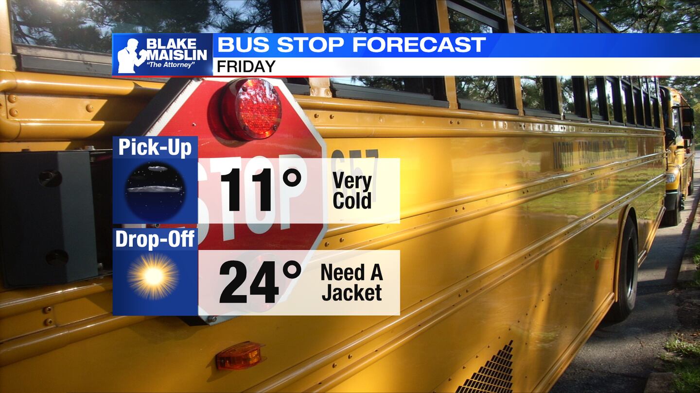
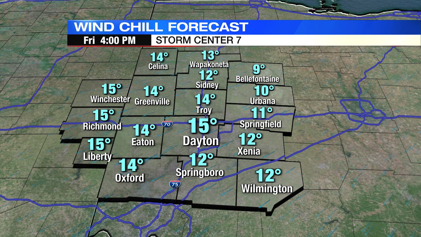
FRIDAY: Mostly sunny skies for Friday. Highs in the middle 20s. Mainly clear and very cold again Friday night. Lows near the single digits.
SATURDAY: Partly sunny skies expected Saturday. More clouds arrive by the evening. Cold with a high near 30 degrees.
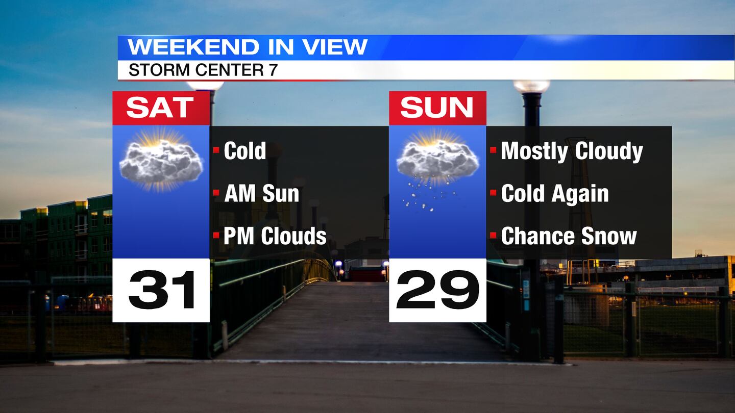
SUNDAY: Mostly cloudy and cold again. Highs near 30 degrees. A chance for flurries or snow showers comes in by Sunday evening.
MONDAY: Mostly cloudy and closer to normal. Chance of a few flurries. Highs in the upper 30s.
TUESDAY: Cloudy skies with a chance of rain or snow showers. Highs in the lower to middle 30s.
WEDNESDAY: Mostly sunny and colder. Highs in the middle 20s.
THURSDAY: Partly cloudy and cold again. Highs in the upper 20s.
©2022 Cox Media Group