QUICK-LOOK FORECAST:
- Some sun is possible Christmas Eve
- Warm, rainy, windy Christmas Day
- Prolonged cold stretch looming
>>TRACK THE LATEST CONDITIONS: Live Doppler 7 Radar
DETAILED FORECAST:
DENSE FOG ADVISORY UNTIL 11AM - Montgomery, Preble, Butler, Miami, Darke, Shelby, Mercer, Auglaize, Wayne and Randolph
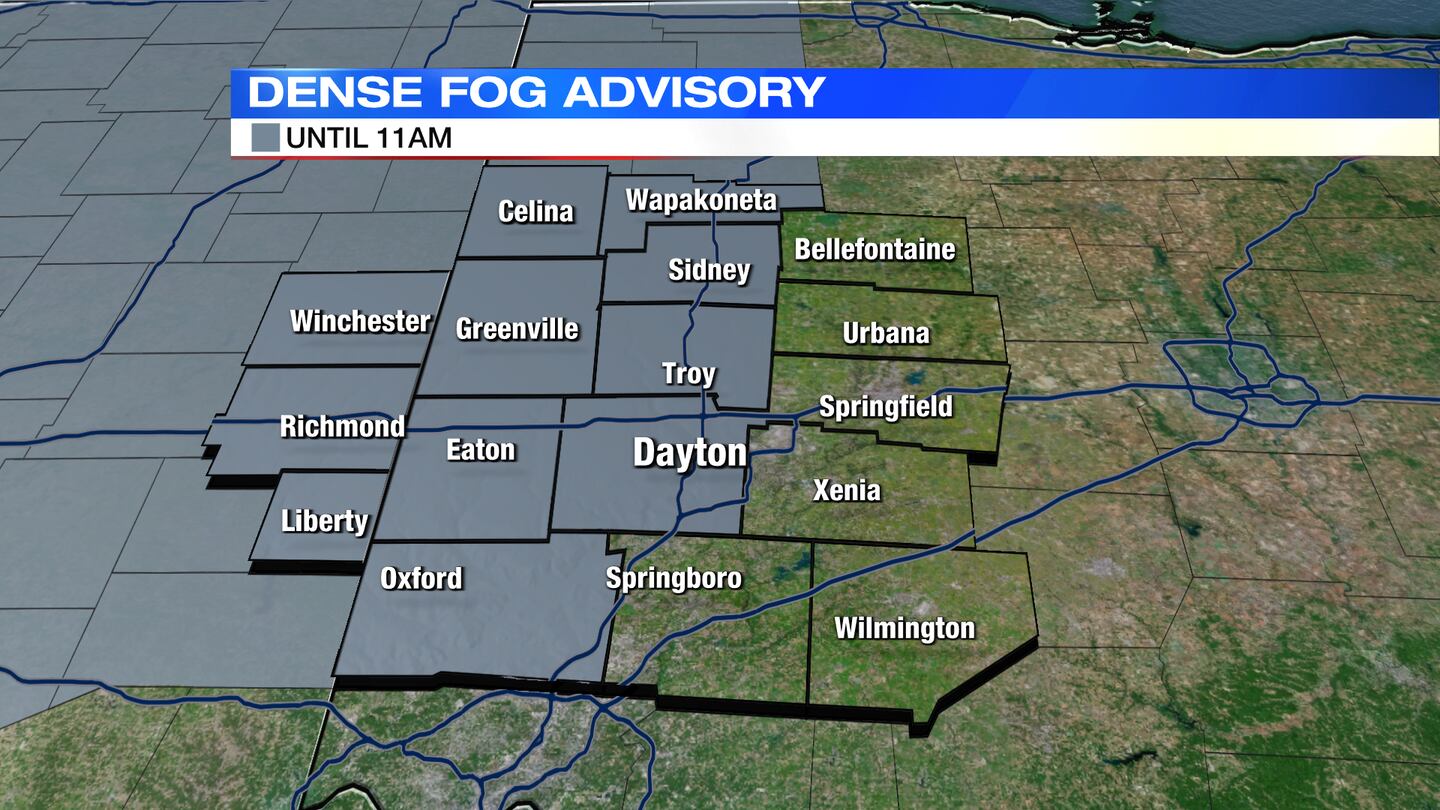
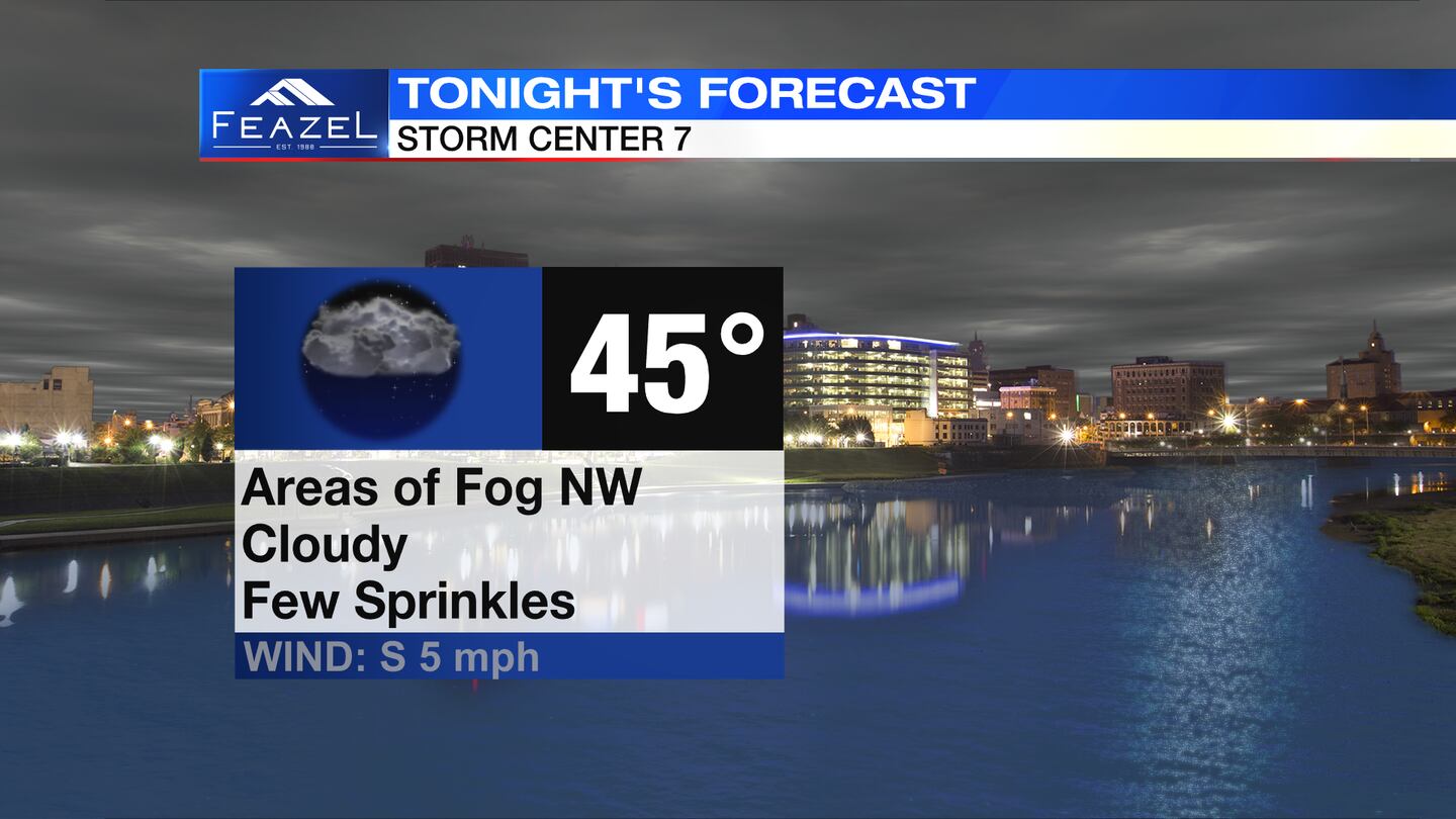
SATURDAY: Areas of fog tonight. Fog may be dense in spots with visibility down below ¼ mile. Fog should begin to improve by mid to late morning on Sunday. Lows tonight in the mid-40s, according to Storm Center 7′s Chief Meteorologist Austin Chaney.
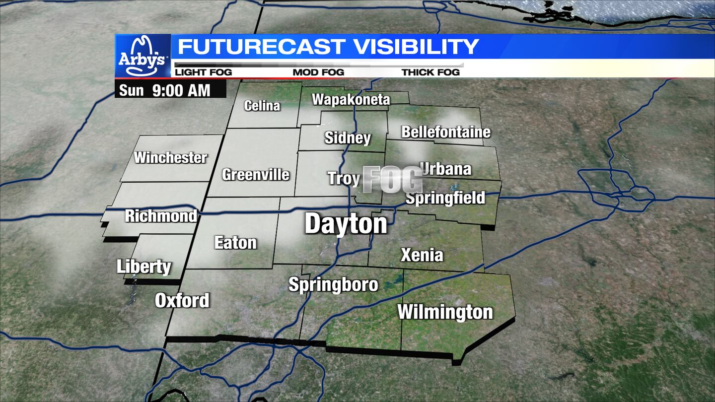
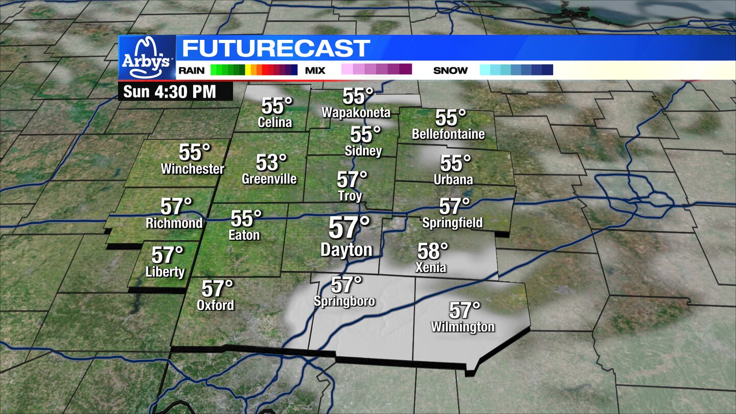
SUNDAY: Cloudy with a stray shower possibly early. Some sun may try to come out during the afternoon. Very mild for this time of year with highs in the upper 50s.
MONDAY: Cloudy with rain arriving during the afternoon for Christmas day. Breezy with some gusts to 25MPH. Another very mild day with highs in the mid to upper 50s. The current forecast of 58 degrees in Dayton would make it the 4th warmest Christmas ever since record-keeping began at the airport in 1935.

TUESDAY: Scattered showers continue on Tuesday. Staying mild with highs in the mid-50s. Morning lows around 50 could mark a record-warm morning low. The record is 48 set back in 1940.
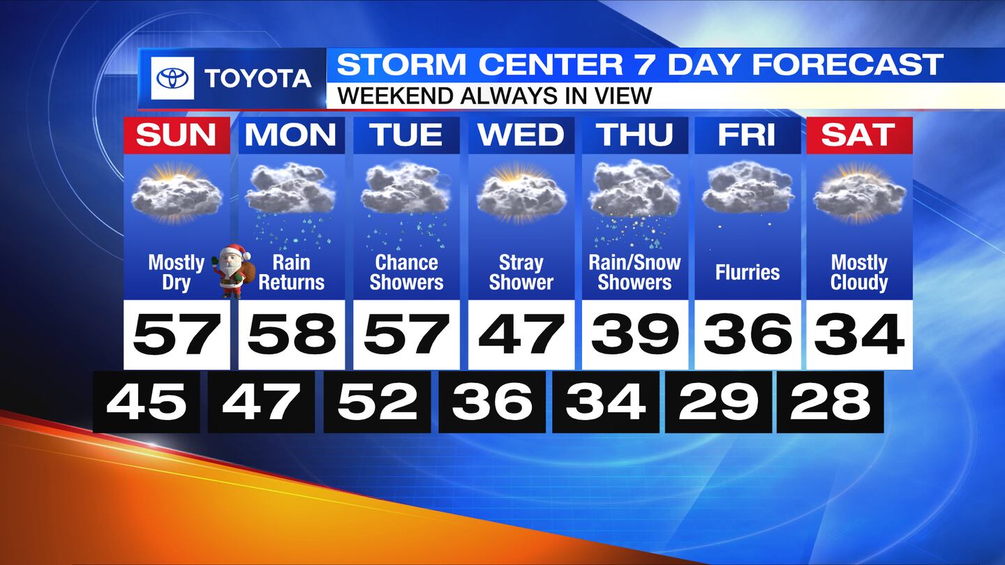
WEDNESDAY: Not as wet Wednesday. A little more sunshine is possible too. A cooling trend begins with highs back in the 40s.
THURSDAY: A few showers around on Thursday. With colder air in place, some snowflakes may mix in. Highs in the lower 40s.
FRIDAY: Cloudy, cold. A few flurries or light snow showers are possible, but confidence is a bit low right now. Highs in the mid-30s.

SATURDAY: Mostly cloudy and cold with highs in the mid-30s. A stray flurry is possible.
©2023 Cox Media Group


