log in to manage your profile and account
- Create your account
- Receive up-to-date newsletters
- Set up text alerts
Published: Friday, November 03, 2017 @ 7:12 AM
— Strong storms are possible to end the weekend, as temperatures will feel more like spring than the first weekend of November.
>>Latest conditions: Track them in your neighborhood with live WHIO Doppler 7 Interactive Radar
In the late afternoon Saturday, some showers will be possible as a warm front moves through. Temperatures will sit in the 60s and likely not drop much overnight. Temperatures, which should be in the upper 50s for this time of year, will be more than 10 degrees warmer than normal this weekend.
RELATED: Weekend Touchdown 7 weather forecast
With a warm front to our north and a strong cold front to our west, winds from the southwest will push temperatures well into the 70s for Sunday.
Most of the afternoon on Sunday looks dry, but a strong cold front will approach Sunday night. The cold front looks to move in from the northwest to the southeast Sunday evening.
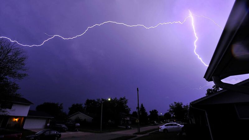
The timing of the front, combined with the warm, moist air and other favorable conditions, there will be a threat for thunderstorms into the night.
Areas northwest of Dayton have an "Enhanced Risk" for severe storms Sunday, with the rest of the Miami Valley under a "Slight Risk."
Your Storm Center 7 team predicts as the storms arrive across the northwest, there is a higher chance they will be strong. Damaging winds and flash flooding will be the main threats.
Published: Thursday, April 19, 2018 @ 6:13 AM
— Dry and pleasant weather returns just in time for the Lyrid Meteor Shower this weekend, said Storm Center 7 Meteorologist Kirstie Zontini.
RELATED: Tips for viewing a meteor shower
The meteor shower peaks before dawn April 22. The waxing crescent moon will have sets around 2:30 a.m. Sunday morning, meaning the sky will be darker to watch for meteors. Grab a blanket and go outside Saturday night/Sunday morning!
RELATED: SkyWitness7
The Lyrids usually produce 10 to 20 meteors per hour, but can have outbursts which produce around 100. The radiant point, which is the point where the meteors look to come from of the Lyrid shower, is the constellation Lyra.
Published: Thursday, April 19, 2018 @ 3:21 AM
Updated: Thursday, April 19, 2018 @ 3:38 AM
— A Freeze Warning will go into effect at 2 a.m. Friday for Montgomery, Greene, Warren, Preble and Butler Counties.
>> Live Doppler 7 Interactive Radar
QUICK-LOOK FORECAST
DETAILED FORECAST
Today: Road temperatures are warm, so the rain/snow mix is not expected to cause widespread slick spots. Snow may try to stick to elevated surfaces briefly. Highs will return to the upper 40s with clouds breaking for sun in the afternoon. It will be breezy and still cool. It will be mostly clear tonight. Temperatures will drop below freezing, so any outdoor vegetation will need protection.
Friday: Temperatures will be below freezing, making for a chilly morning. There will be plenty of sunshine through the afternoon and temperatures will finally get closer to normal, reaching the upper 50s.
Saturday: Skies will be sunny with highs around 60, making for a beautiful start to the weekend.
Sunday: It will be another nice day with highs in the low 60s, which is back to normal. We’ll see sunshine through the afternoon.
Published: Thursday, April 19, 2018 @ 12:20 AM
— WRIGHT PATTERSON AIR FORCE BASE—A quick blast of wintry weather will start the day with a chance for snow showers, according to Storm Center 7 Chief Meteorologist Eric Elwell.
RELATED: 5-Day Forecast
Little, if any snow accumulation is expected. After starting in the 30s, clearing skies this afternoon will allow temperatures to rebound into the upper 40s. It will be blustery through the day.
RELATED: County-by-County Weather
A steady warming trend will get underway Friday with sunny skies. Highs will rebound into the 50s. Dry weather will stick around through the weekend with highs reaching up to 60 degrees by Sunday.
Published: Wednesday, April 18, 2018 @ 3:36 AM
Updated: Wednesday, April 18, 2018 @ 7:00 PM
It will be blustery and turn colder overnight, Storm Center 7 Chief Meteorologist Eric Elwell said. Passing rain or snow showers are possible before daybreak, with little, if any, snow accumulation. Temperatures will fall into the middle 30s.
QUICK-LOOK FORECAST
• Colder air moving in overnight
• Chance for rain/snow showers again by morning
• Calmer, milder weather this weekend
DETAILED FORECAST
Thursday: Expect a mix of rain or snow showers in the morning. A coating of snow will be possible on grassy and elevated surfaces in the morning, mainly north. Skies will clear in the afternoon with blustery, cool conditions. Temperatures will hold in the upper 40s.
Friday: Sunshine returns to end the week with milder temperatures in the middle 50s.
Saturday: Partly cloudy skies will start the weekend with temperatures reaching back into the middle to upper 50s.
Sunday: Dry weather will end the weekend with some high clouds and sunshine. Highs will top out in the lower 60s.
Monday: A bit more cloud cover is expected with highs reaching into the middle 60s.