QUICK-LOOK FORECAST:
- Fall-like Monday
- Cranking up the heat mid to late week
- Slim rain chances
>>TRACK THE LATEST CONDITIONS: Live Doppler 7 Radar
DETAILED FORECAST:
SUNDAY: Variable clouds tonight and turning a bit less breezy. Overnight lows falling into the middle 50s, according to Storm Center 7 Weather Specialist Nick Dunn.
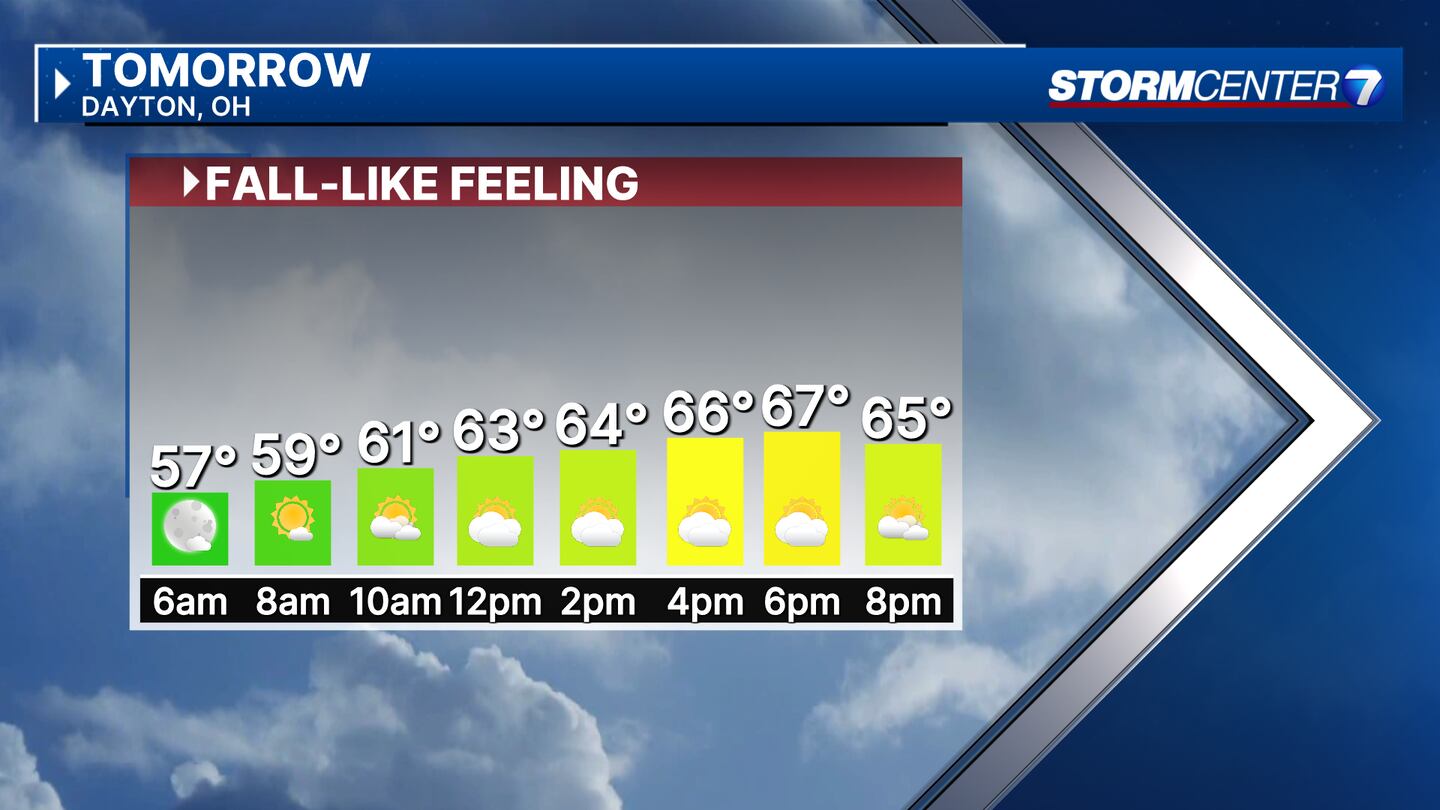
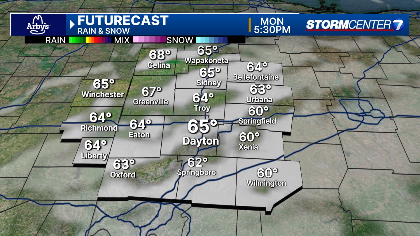
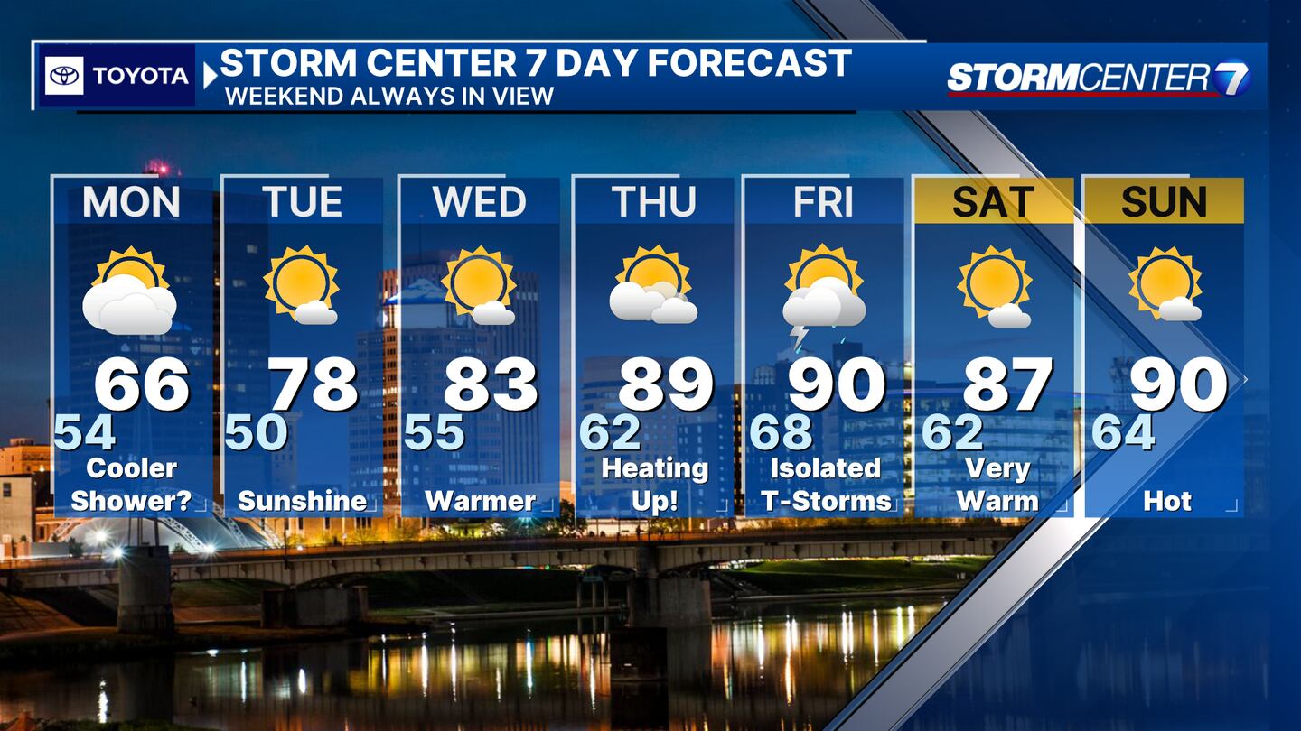
MONDAY: Mostly cloudy and much cooler. A bit breezy with gusts to 20mph and a stray shower is possible. Afternoon highs are generally in the middle 60s.
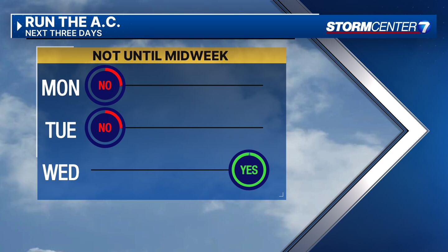
TUESDAY: Mostly sunny and more seasonable with highs in the upper 70s.
WEDNESDAY: Mostly sunny and warming up with highs in the middle 80s.
THURSDAY: Mostly sunny. Heat continues to build with highs climbing into the upper 80s to near 90.
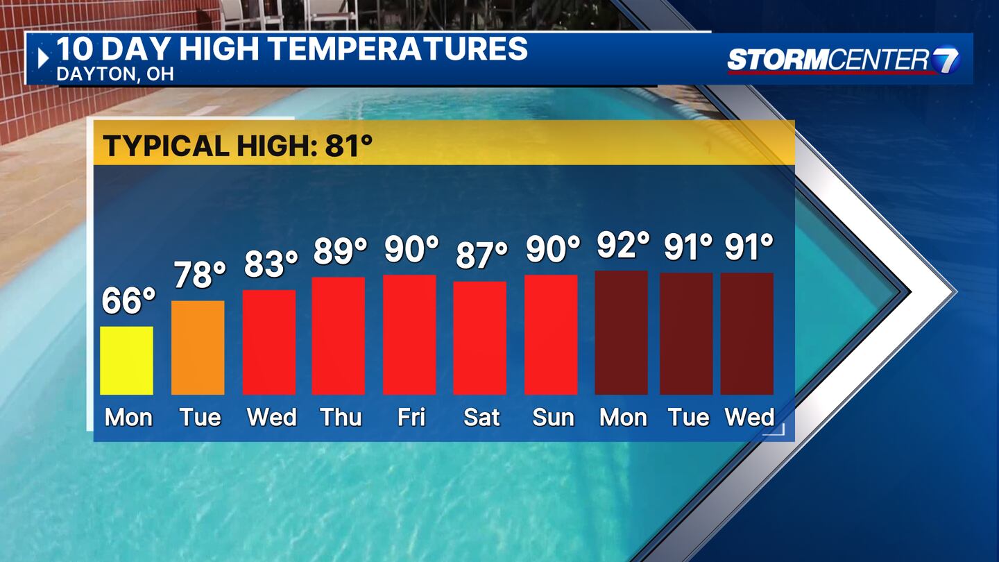
FRIDAY: Mostly sunny and hot. Highs around 90. A couple of thunderstorms may pop up in the afternoon and evening, but the chance of rain is not the greatest right now.
SATURDAY: Sunshine and a few clouds. Staying very warm with highs in the upper 80s.
SUNDAY: Plenty of sunshine and a few clouds. Hot with highs around 90.
©2024 Cox Media Group