QUICK-LOOK FORECAST:
- A soggy Thursday expected
- Briefly colder Saturday
- Warmer with chances for rain and storms next week
>> TRACK THE LATEST CONDITIONS: Live Doppler 7 Radar
DETAILED FORECAST:
WEDNESDAY: Clouds increase this evening eventually giving way to a chance for showers overnight, according to Storm Center 7 Chief Meteorologist Austin Chaney. Mild for this time of year with overnight lows in the mid to upper 40s.

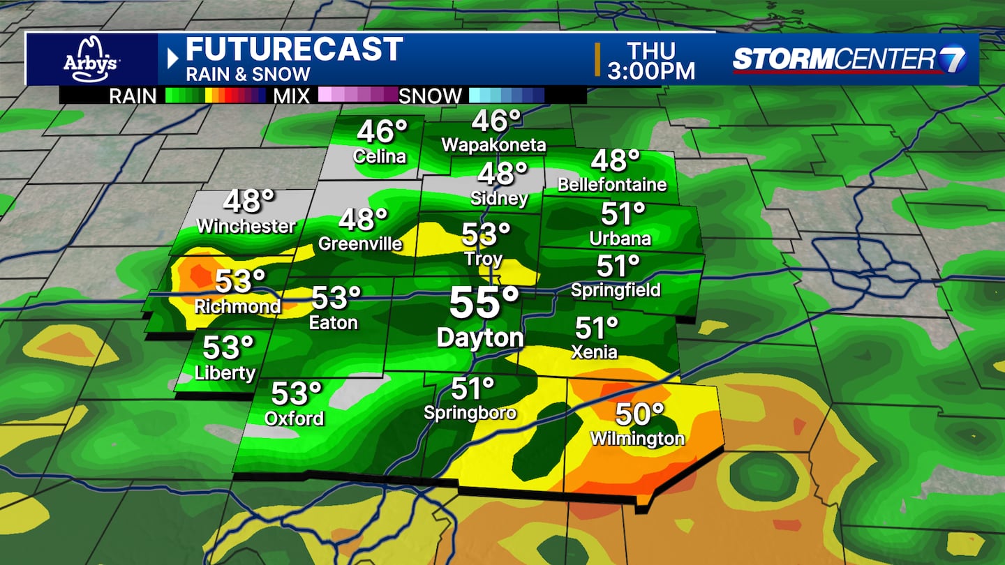
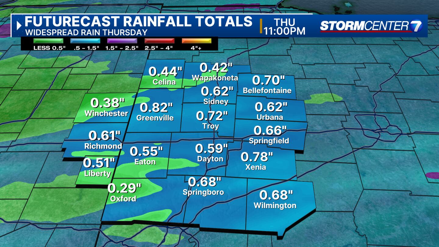
THURSDAY: Rounds of rain expected on Thursday. The rain could be heavy in spots, and an isolated thunderstorm can’t be ruled out. Rainfall totals up to an inch which will make things quite muddy after the recent snowmelt. Runoff and ponding of water on roads is also possible. Mild temperatures with highs in the mid-50s.
FRIDAY: Overall a mostly cloudy day on Friday as we are between systems. Dry and cooler with highs in the upper 40s. A reinforcing shot of colder air arrives Friday night. This may squeeze out some snow flurries overnight but no accumulation would occur from this.
SATURDAY: Mostly sunny but chilly on Saturday. Highs only reach the mid to upper 30s.
SUNDAY: Sunshine and rather mild again with highs quickly rebounding to the upper 50s.
MONDAY: Even milder with a mix of clouds and sunshine. Highs in the low to middle 60s.
TUESDAY: Cloudy with a chance for showers and thunderstorms. Very warm for this time of year with highs in the mid-60s.
WEDNESDAY: Cloudy with a chance for showers and storms. Breezy. Mild again with highs around 60 degrees.
©2024 Cox Media Group