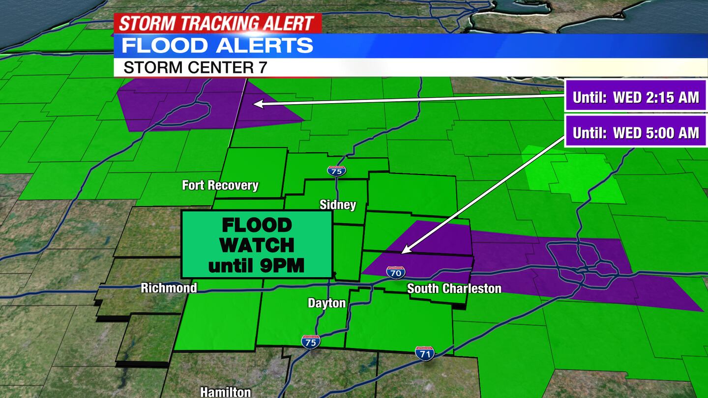
A Flash Flood Warning has been issued for Champaign and Clark counties until 5 a.m.
A Flood Watch has been issued for Auglaize, Champaign, Clark, Darke, Greene, Mercer, Miami, Preble, and Shelby counties until 9 p.m.
QUICK-LOOK FORECAST:
- More storms possible overnight into Wednesday
- Hot, humid, occasionally stormy through Thursday
- Cooler with lower humidity by Saturday
>>TRACK THE LATEST CONDITIONS: Live Doppler 7 Radar
DETAILED FORECAST:
TUESDAY: Partly cloudy skies through this evening with temperatures in the 80s. Showers and thunderstorms could begin to redevelop after 7-8PM this evening with more possible overnight. A few storms may get strong. Heavy rainfall and damaging wind gusts are the main threats.
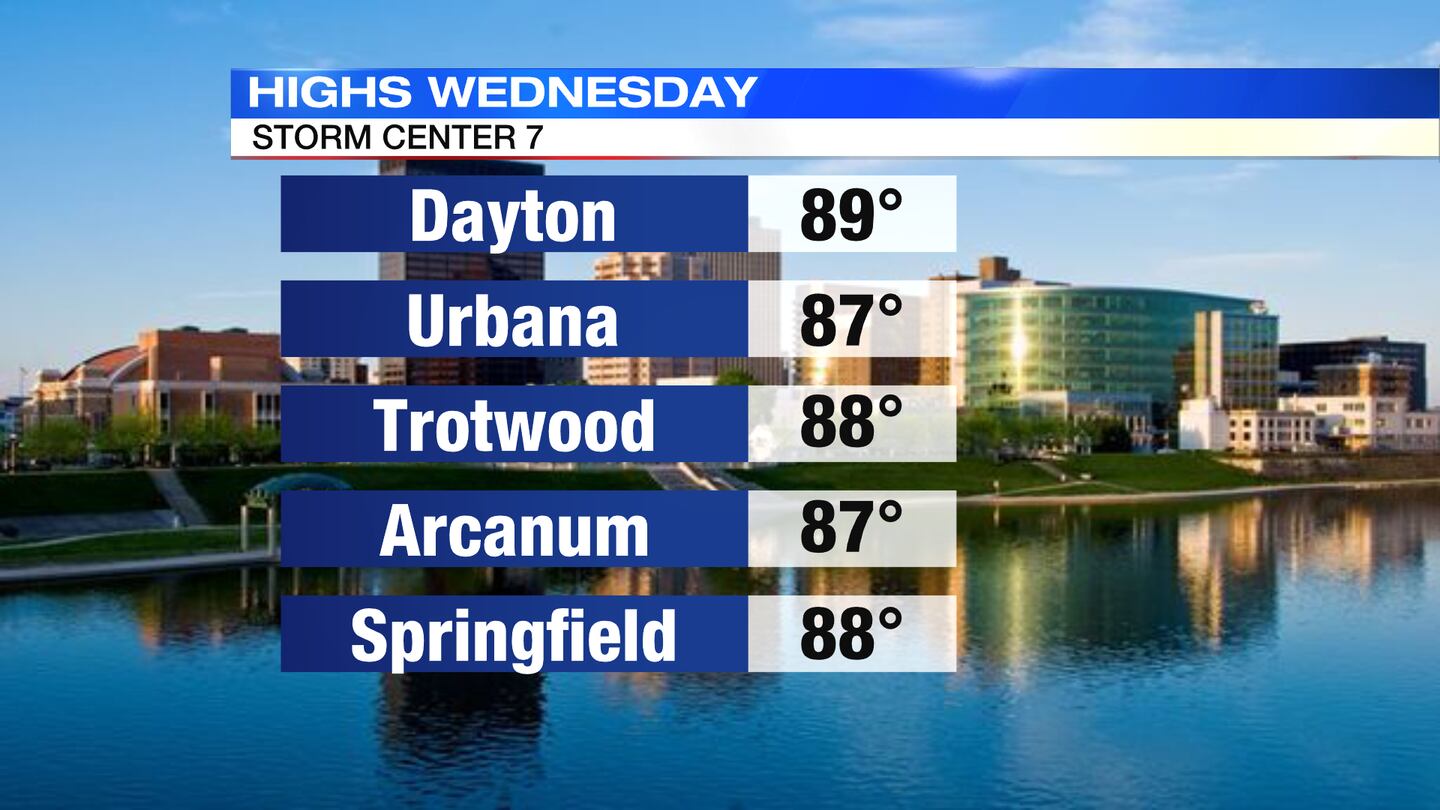
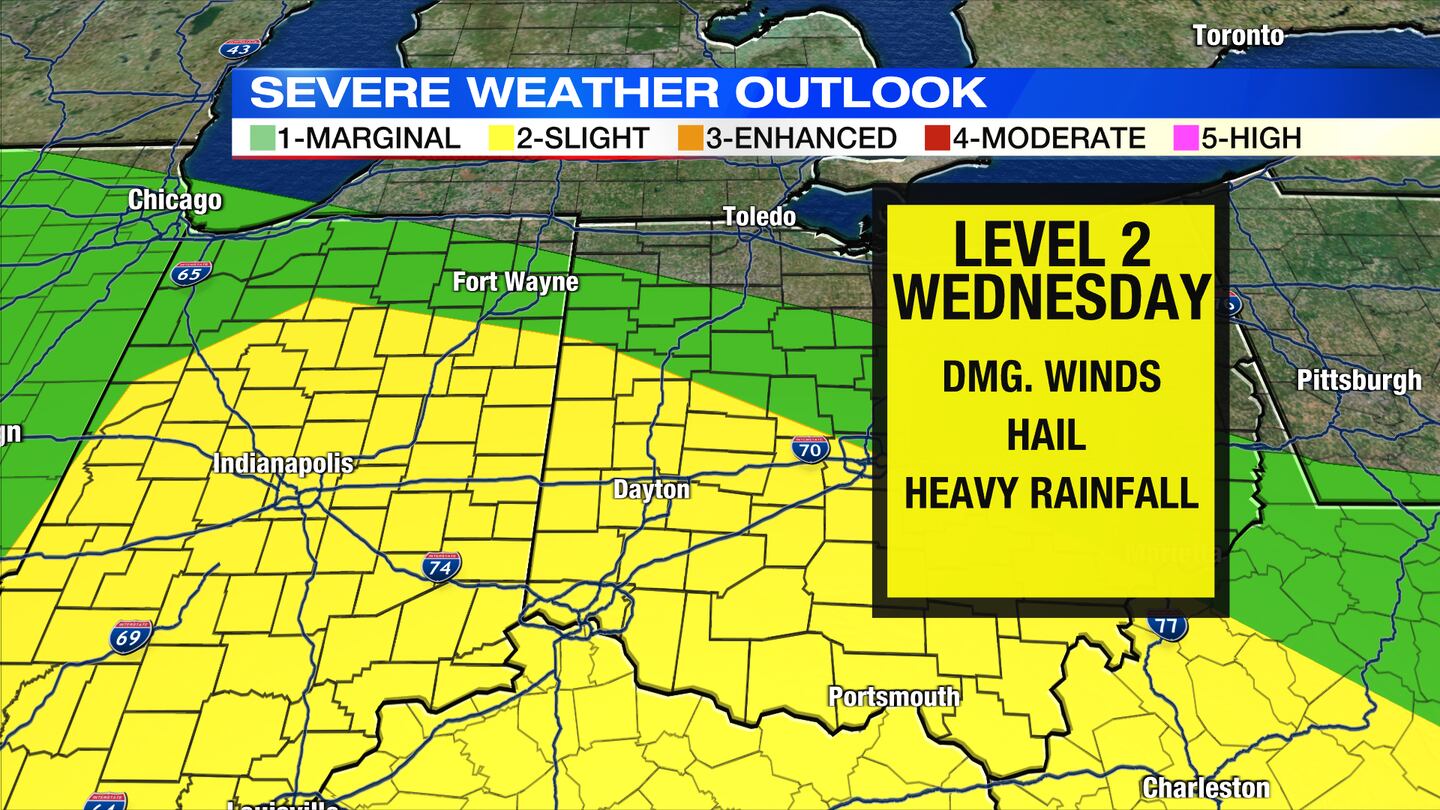
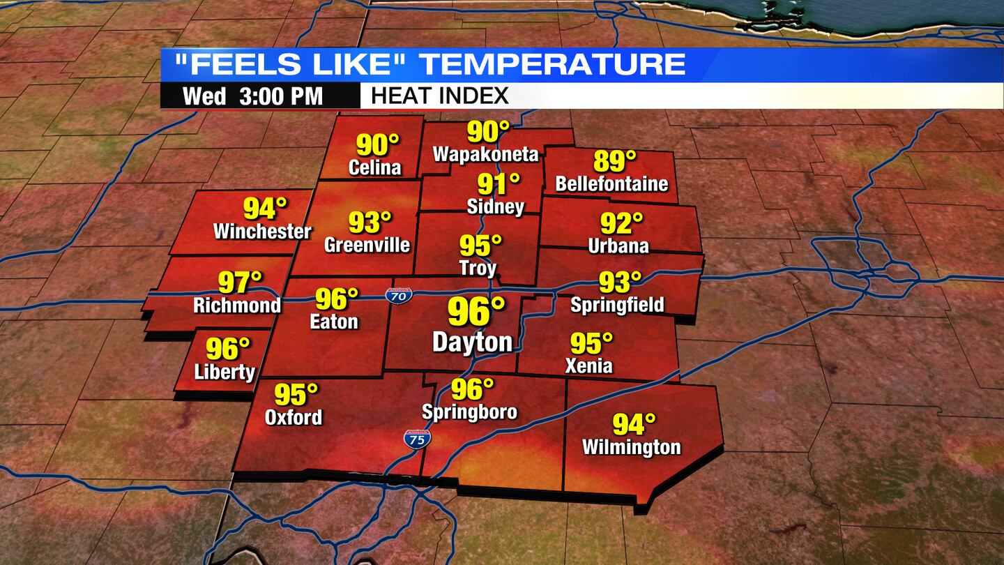
WEDNESDAY: Storm Tracking Alert Wednesday. A round of showers and storms possible in the morning with more redeveloping during the afternoon. Some storms may be strong. Damaging wind gusts and heavy rainfall continue to be the main threats. Hot and humid with highs around 90 and heat index values around 100.
THURSDAY: Warm and muggy with highs in the mid 80s. Another chance for showers and thunderstorms.
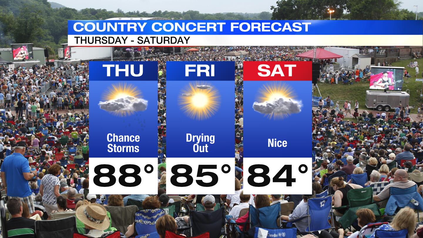
FRIDAY: Partly sunny with highs in the mid 80s. A few showers and storms possible early, but drying out as we head into the afternoon.
SATURDAY: Partly sunny skies with some cooler temperatures and lower humidity. Highs in the low 80s.
SUNDAY: Mostly sunny. Highs in the mid 80s.
MONDAY: Mostly sunny and warmer with highs in the upper 80s.
TUESDAY: Partly sunny and hot with highs in the upper 80s to 90 degrees. A chance for showers and thunderstorms arrives by afternoon.
©2022 Cox Media Group


