QUICK-LOOK FORECAST:
- Snow ends southeast early evening
- Below zero wind chills Friday morning
- Rain arrives Saturday night
>>TRACK THE CONDITIONS: Live Doppler 7 Radar
DETAILED FORECAST:
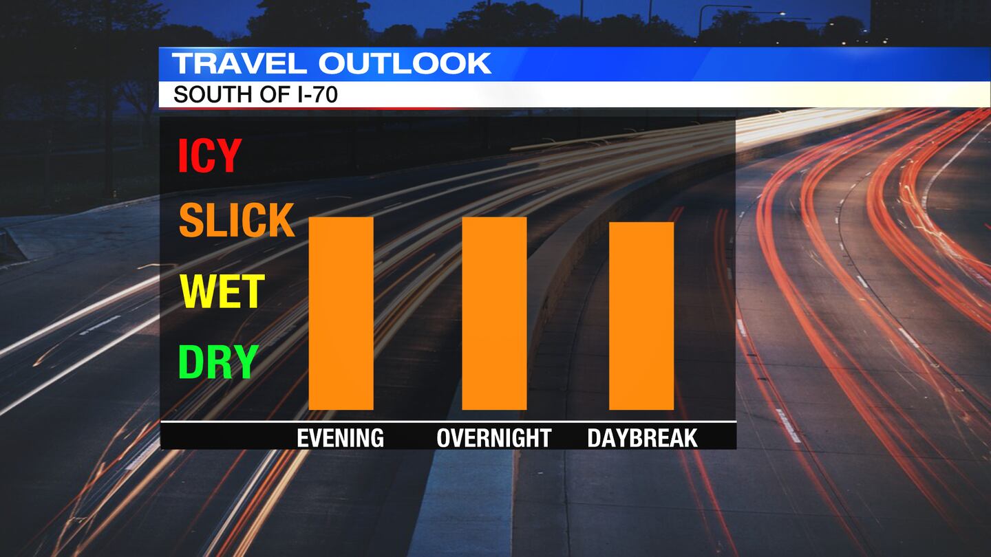
TODAY: A few lingering flurries or light snow showers will pass through the southeastern Miami Valley early in the evening, according to Storm Center 7 Chief Meteorologist McCall Vrydaghs. A light coating of snow may lead to slick spots on some roadways. Use caution driving, especially if your travels take you south of the Miami Valley tonight.
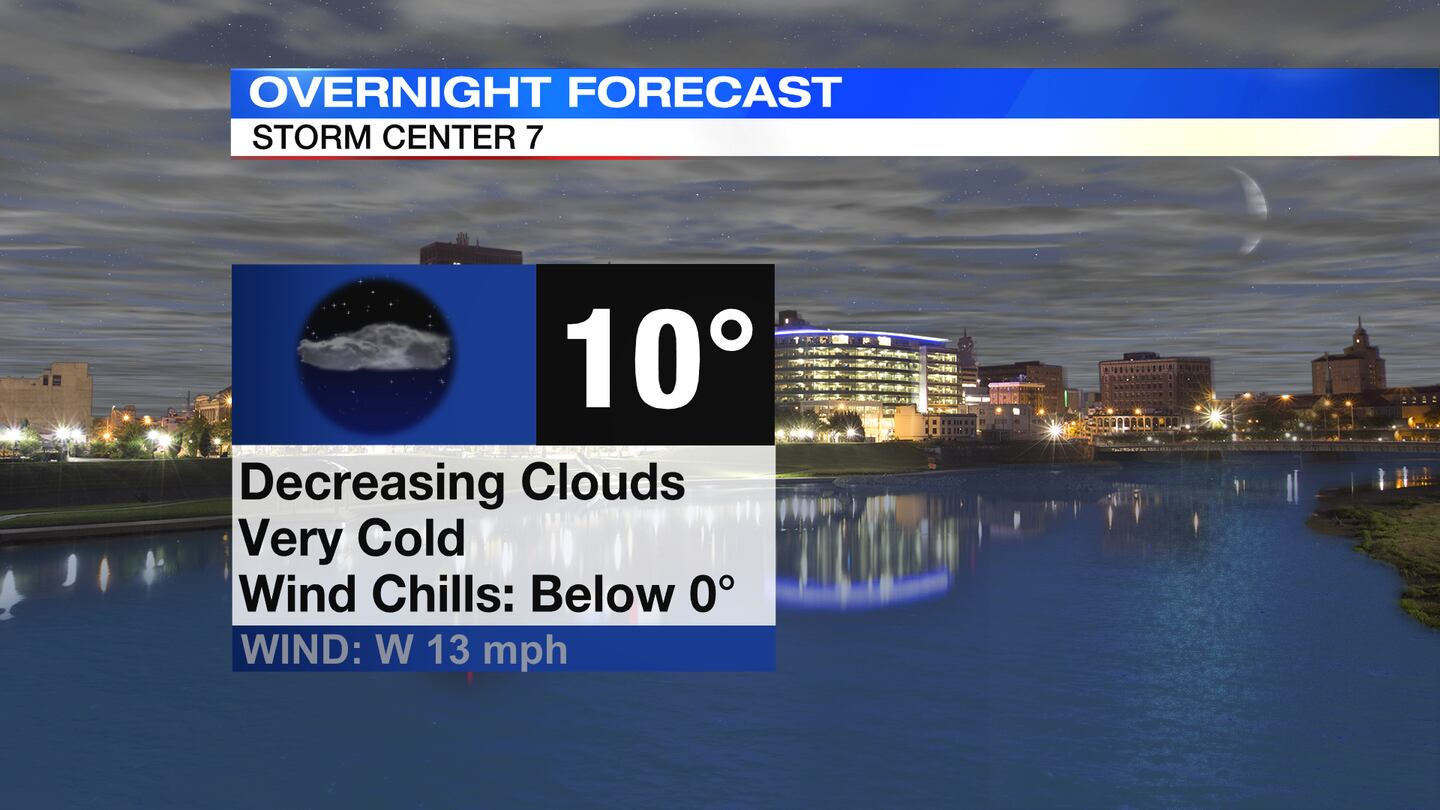
Clouds skies remain for the night with temperatures dropping into the upper single digits to lower teens. Wind chills by morning will be near or below zero.
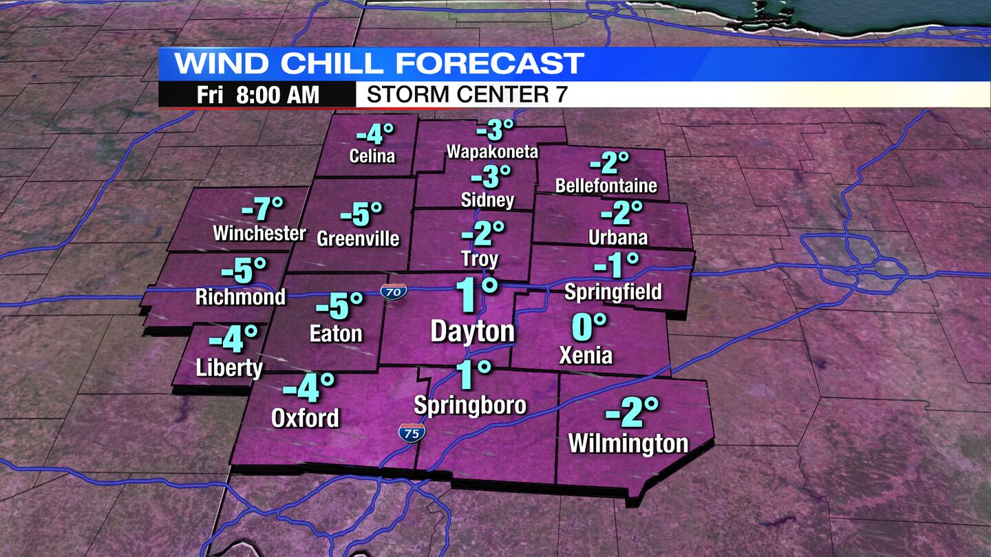
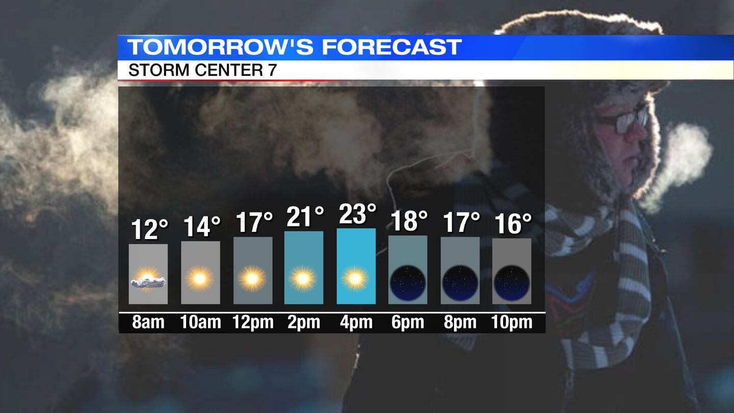
FRIDAY: A very cold start to the day with wind chills around or below zero early then only feeling like the teens for the afternoon. It will be a drier day with decreasing clouds. Skies clear into Friday night and temperatures fall back to the lower teens by Saturday morning.
SATURDAY: Another very cold start with readings in the lower teens for the morning then temperatures rebound nicely with seasonable highs in the upper 30s for the afternoon. It will be a dry day with mostly sunny to partly cloudy skies. Clouds increase Saturday night with rain arriving in the Miami Valley.
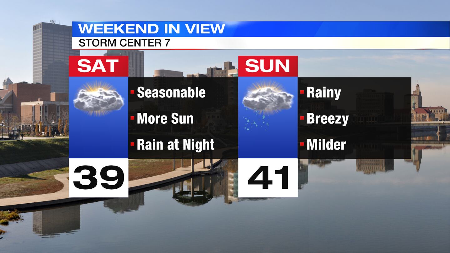
SUNDAY: Cloudy to mostly cloudy skies, windy and cool. Scattered light showers around early then drying out later in the afternoon. Temperatures will reach a high in the lower to middle 40s before the passage of a cold front then drop quickly.
MONDAY: Partly cloudy and much colder. Breezy at times, too. Highs in the middle 20s. Chills in the single digits and teens.
TUESDAY: Mostly sunny, breezy, and cold again. Highs in the upper 20s.
WEDNESDAY: Another dry day with sun and a few clouds. Highs around 40 degrees.
THURSDAY: Partly sunny and still milder than normal with highs in the lower 40s.
©2022 Cox Media Group


