
The National Weather Service has issued a Flood Advisory for Champaign and Clark counties until 3:30 a.m. this morning.
QUICK-LOOK FORECAST:
- Showers, storms likely overnight
- Rain chances persist into early next week
- Cooler temperatures briefly midweek
>>TRACK THE LATEST CONDITIONS: Live Doppler 7 Radar
DETAILED FORECAST:
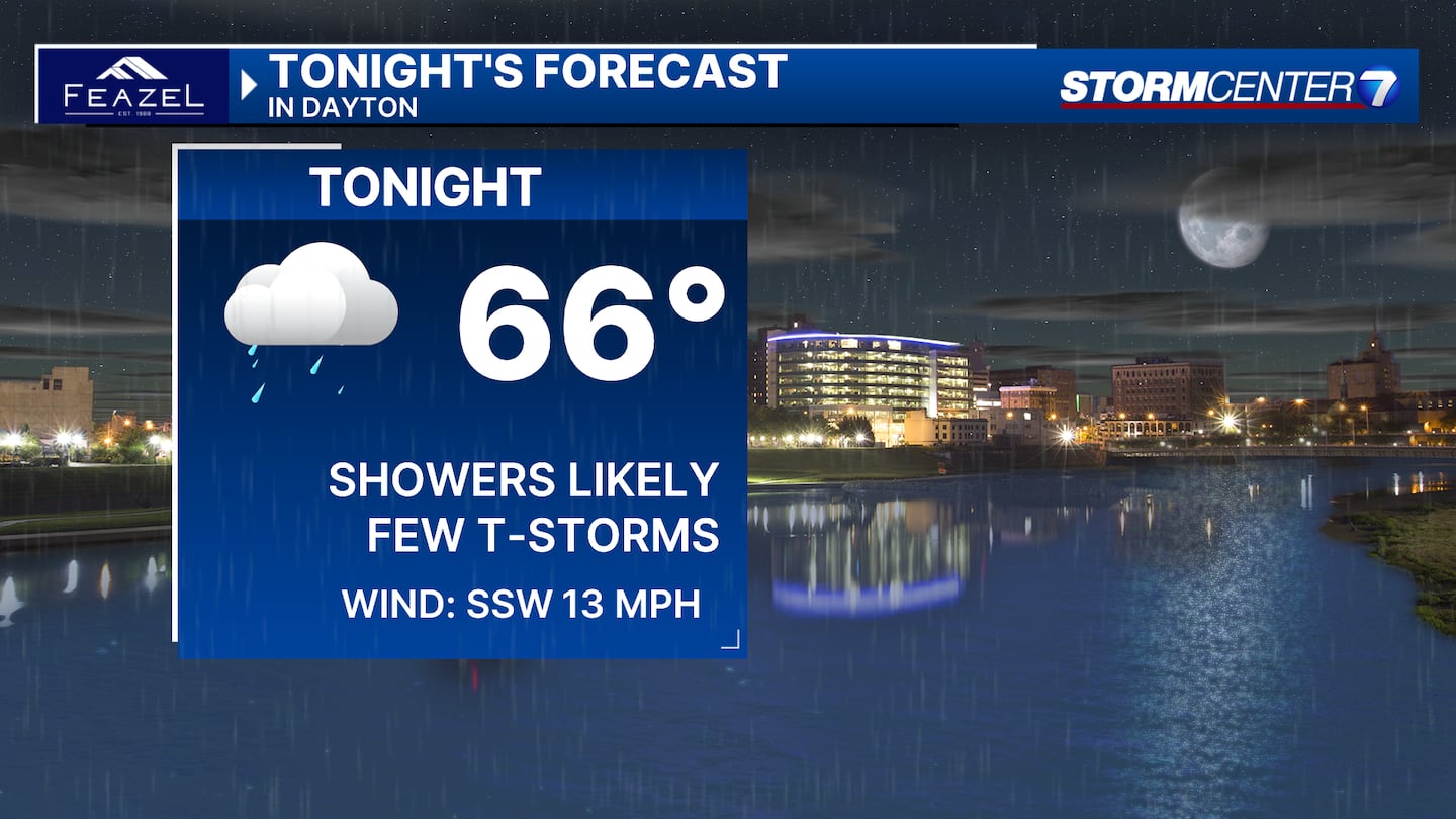
OVERNIGHT: Chance of showers and storms overnight, according to Storm Center 7 Weather Specialist Nick Dunn.
At this time, it seems unlikely that widespread severe weather will occur. An isolated strong storm with gusty winds can not be ruled out. Lows in the lower to middle 60s.
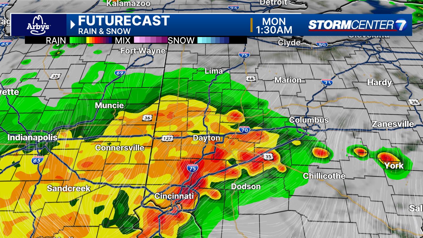
SPC maintains a Level 2 (Slight) risk for damaging winds tonight as of now, but I expect most storms with severe levels will stay mainly south of the area.
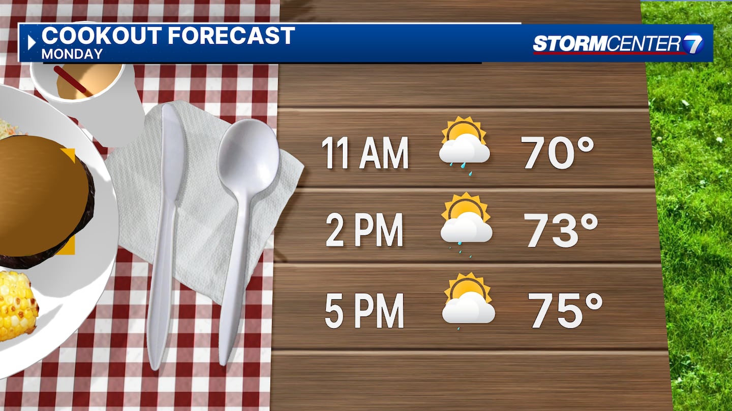
MONDAY (MEMORIAL DAY): Partly cloudy with a chance for showers. An isolated thunderstorm is also possible. Highs in the middle 70s.
TUESDAY: Partly cloudy with another chance for a few showers. Highs in the middle 70s.
WEDNESDAY: Partly cloudy. Cooler with highs around 70. Cool night with lows in the 40s.
THURSDAY: Sunny and comfortable weather with highs in the lower 70s. Another cool night with lows in the 40s.
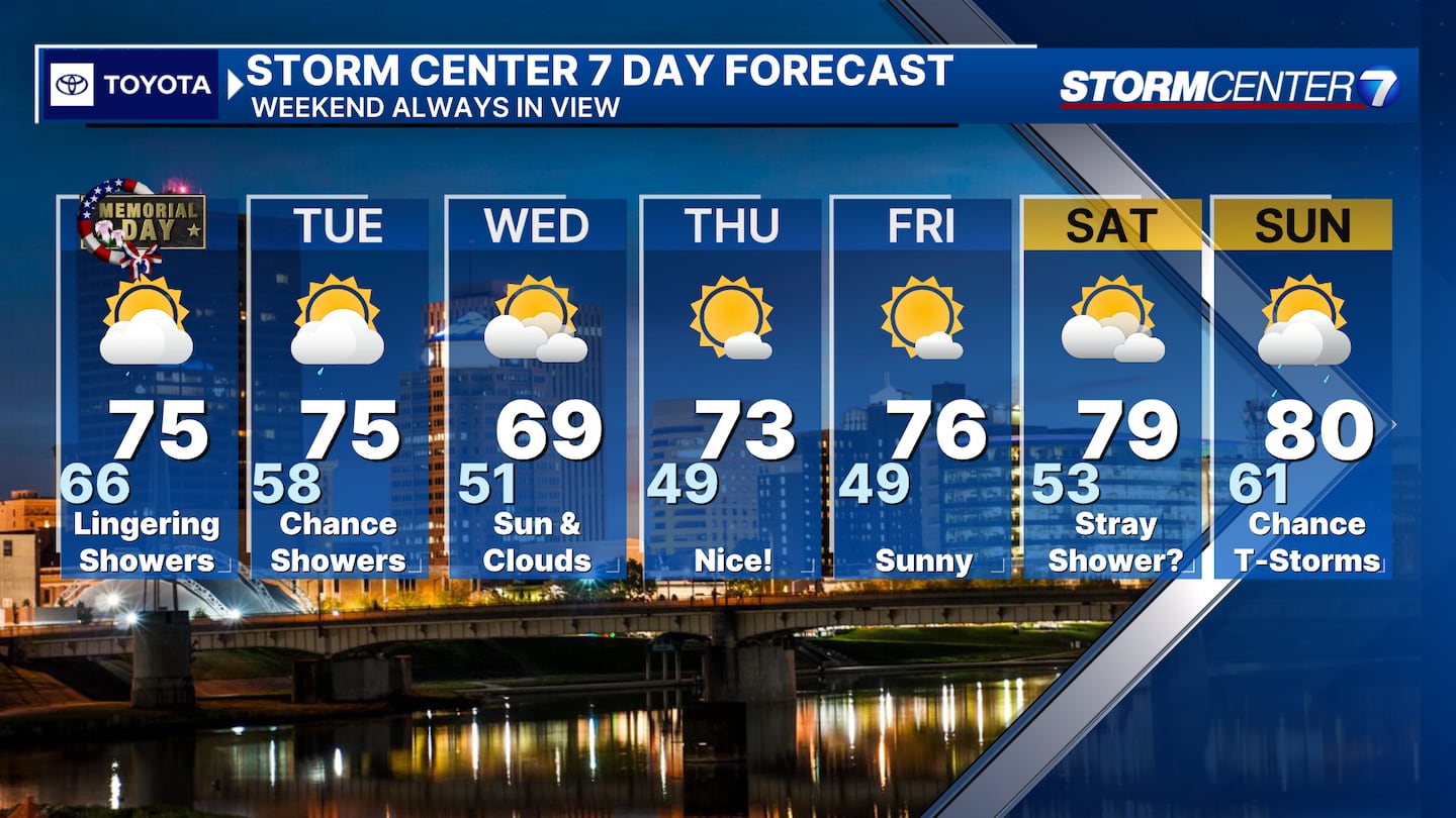
FRIDAY: Sunny. A great day with highs in the mid 70s.
SATURDAY: Partly cloudy to mostly sunny skies. Warmer as highs climb back to 80 degrees. Stray P.M. Shower Possible.
SUNDAY: Partly cloudy with an isolated thunderstorm or two possible. Highs near 80.
©2024 Cox Media Group


