- Heat wave to last into Tuesday
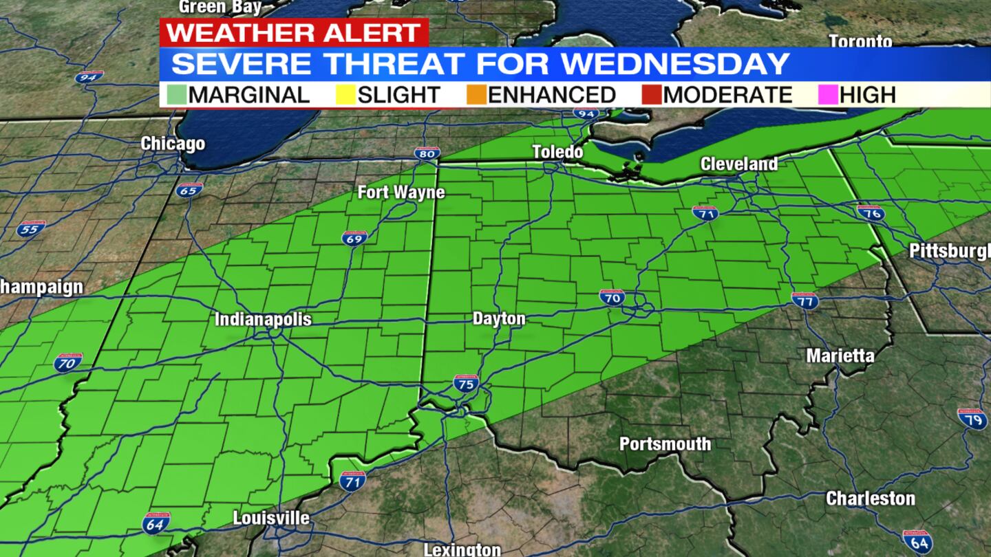
- Threat for strong storms arrives midweek
- Brief late-week cool down
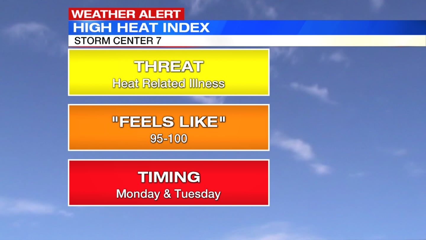
>> Dayton expected to hit its 3rd heat wave of the summer this week
Tonight: Skies will be mostly clear with warm, muggy conditions. Temperatures will hold in the lower 70s.
>>LISTEN: Cloudy with a Chance of Podcast: A Podcast for weather fans
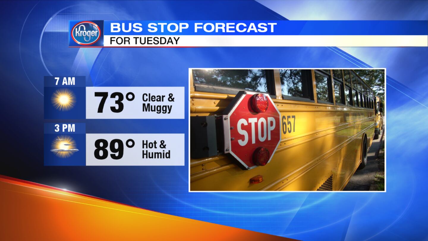
Tuesday: Another very warm and muggy day is expected with mostly sunny skies. Highs will top out near 90 degrees with the heat index in the upper 90s at times.

Wednesday: It will remain warm and muggy with increasing clouds. It also will be breezy at times. Scattered storms will develop by late in the day or early evening. A few strong storms will be possible. Highs will be in the middle to upper 80s.
Thursday: There is a chance for a shower in the morning, mainly south with decreasing clouds in the afternoon. It will be cooler and less humid with highs in the upper 70s.
Friday: Expect lots of sunshine and seasonably warm temperatures in the lower 80s.


