QUICK-LOOK FORECAST:
- Rain, storms return tonight
- Staying stormy through Tuesday
- Cooler later this upcoming week

>> TRACK THE LATEST CONDITIONS: Live Doppler 7 Radar
FULL DETAILS:
OVERNIGHT: Clouds increase with showers and storms returning to the area. An isolated strong to severe storm is possible with lows in the middle 50s. Heavy rain and hail are the main threats, along with frequent lightning.

MONDAY: Showers and thunderstorms looking likely early with a bit of a break before more chances return later in the day.
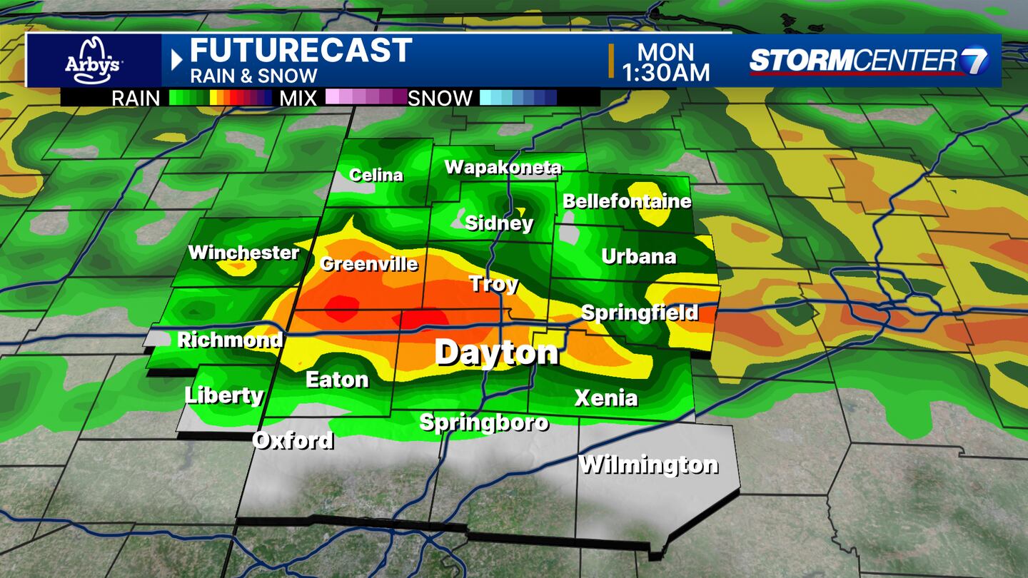
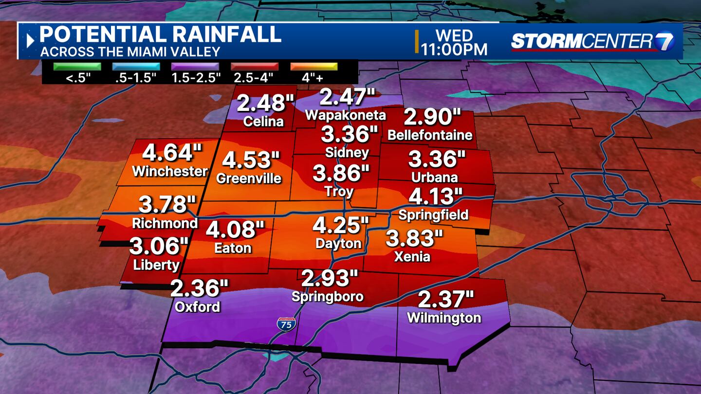
Repeated rounds of heavy rain and the potential for strong storms are on our radar to watch. Highs in the middle 60s.

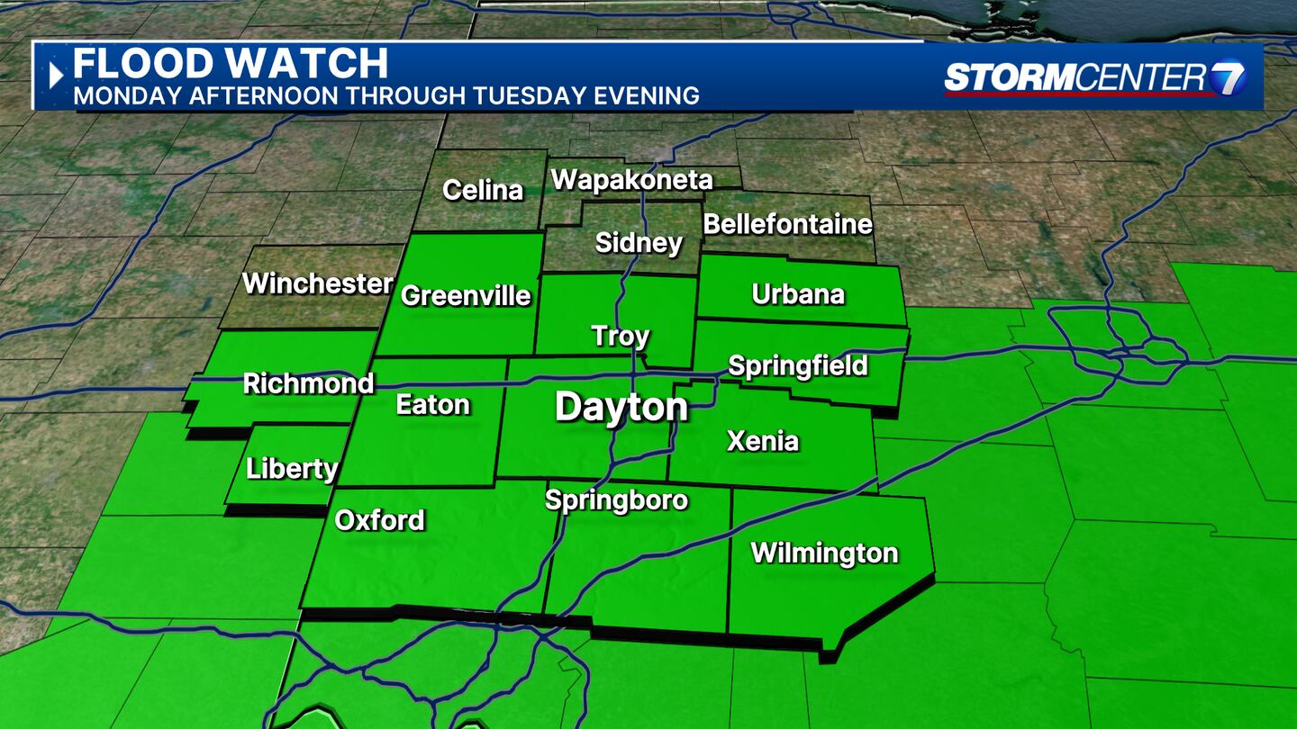
There will be a wide temperature gradient so some may stay in the 50s north and some may hit 70 south. We will have to watch for flooding concerns here with repeated rounds of heavy rain
TUESDAY: Showers and a few thunderstorms could continue into Tuesday morning. Additional thunderstorm activity looks likely later in the day with more chances for heavy rain or strong storms. Best chance of severe weather exists here as of now.

Certainly need to keep an eye on this as we move closer. Highs a bit cooler in the lower to middle 60s. High water issues may linger into Tuesday with more rain.
WEDNESDAY: Windy and much colder with rain showers mixing with snow showers by the afternoon. Highs in the middle 40s.
THURSDAY: Lingering rain or snow showers, mainly early. Staying cloudy. Cool with highs in the mid-40s.
FRIDAY: Sunshine returns gradually with clouds and still cool with highs near 50.

SATURDAY: Sunshine and a bit milder with higher in the middle 50s.
SUNDAY: Sunshine and a bit milder with highs in the upper 50s. There will be a few clouds as well.
©2024 Cox Media Group


